Hamilton County goes back to original plan for redistricting

Friday, January 1, 1904
 Hamilton County Redistricting
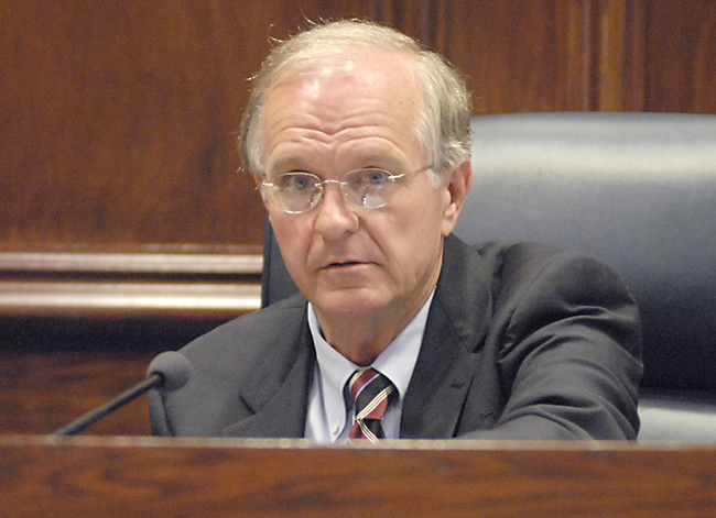 Hamilton County Commissioner Larry Henry
A second attempt to redraw Hamilton County voting districts failed to gain support, so commissioners are going back to their original plan.
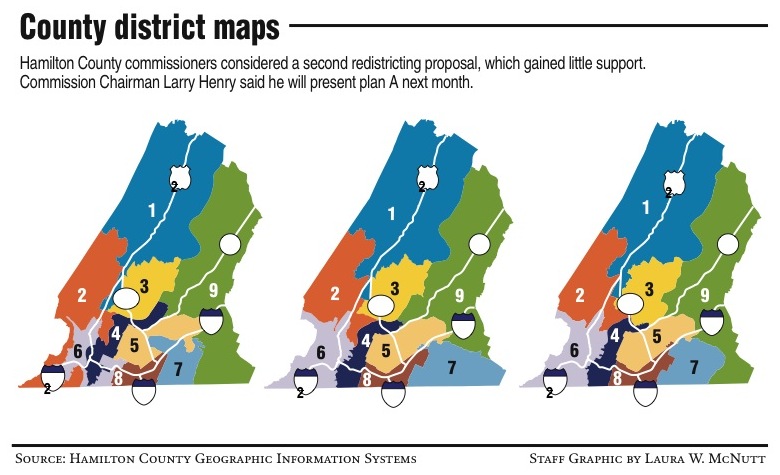
A new map of proposed district lines circulated among commissioners but will likely never be voted on, according to Chairman Larry Henry.
The new map, Map B, would stretch Commissioner Mitch McClure's 3rd District across the Tennessee River to State Highway 58. It would move Henry's 7th District eastward, leaving Commissioner Chester Bankston's 9th District stretching from north to south in the eastern edge of the county. The map would also pull Bess T. Shepherd Elementary School in Tyner into a district with East Ridge.
"This is really just a map we put together," Henry said of the alternative map. "Honestly, after that map came back to us, it wasn't something that would have been practical to use."
McClure's district would lose some of its northern neighborhoods and stretch eastward across the Chickamauga Dam.
"I will serve whoever I'm assigned," McClure said. "I'm not necessarily happy with having to go across the river because it is not contiguous with my district."
Every 10 years the county must draw new districts based on U.S. census figures to maintain population densities and protect minority voting strength.
During Wednesday's County Commission meeting, Joe Rowe, first vice president of the local chapter of the NAACP, publicly encouraged commissioners to vote quickly on the first redistricting proposal. The first mention of a new map came during his exchange with the commission.
The first redistricting effort, Map A, was presented in July. But Henry said Aug. 3 that he would defer a vote, citing concerns about the population difference between the largest and smallest districts. The new map created by the county's Geographic Information System team reduced the size of the three districts about which Henry expressed concern.
Though Map B would move various district boundaries, the total population deviation between largest and smallest districts would be less than 7 percent. Commissioners have said they want districts to have less than 10 percent deviation.
Rowe, who had not seen Map B when he spoke Wednesday, said he would support "whichever one is most consistent with the Voting Rights Act."
Both maps would maintain at least 60 percent minority populations in districts 4 and 5. Rowe said he would want to make sure those percentages counted only voting age population.
Rowe said he would like to see the commission finish redistricting to avoid a controversy like the 2000 redistricting, where as many as four or five maps were circulated.
"It was a very difficult process," Rowe said. "Partisan politics was involved."
Commissioner Joe Graham, some of whose constituents expressed concerns about Map A, said he liked the deviation numbers of Map B but that he would have to further study the lines.
"It's a lot better than our current districts we were elected in," Graham said. "As long as it's fair and legal, I can represent anybody."
Henry said he will probably present Map A to the commission soon.
"It's not got the gerrymandering in it," he said.
The commission will hold its next agenda session Sept. 1. A redistricting proposal is due to the state by Jan. 1.