Chattanooga: Proposed toll bridge sited just south of Sequoyah

Tuesday, July 19, 2011
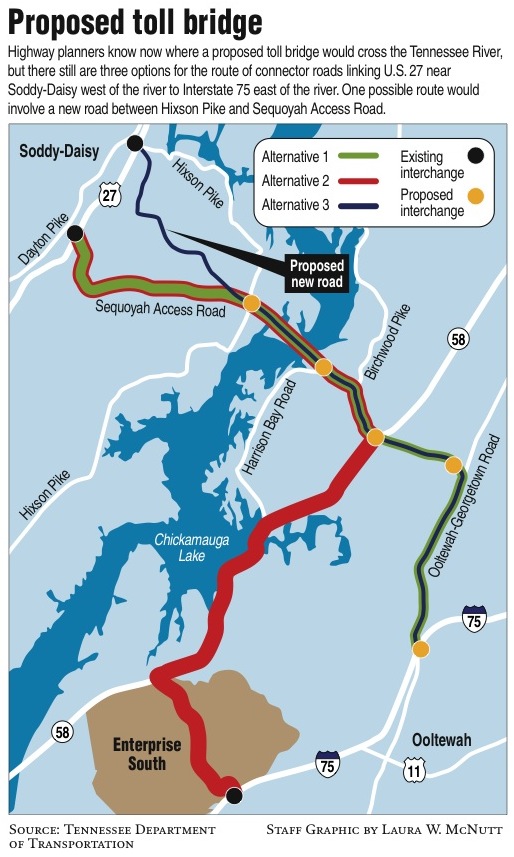 The bridge - a $5 toll bridge - would cross the river just south of Sequoyah Nuclear Plant to link U.S. Highway 27 with Interstate 75.
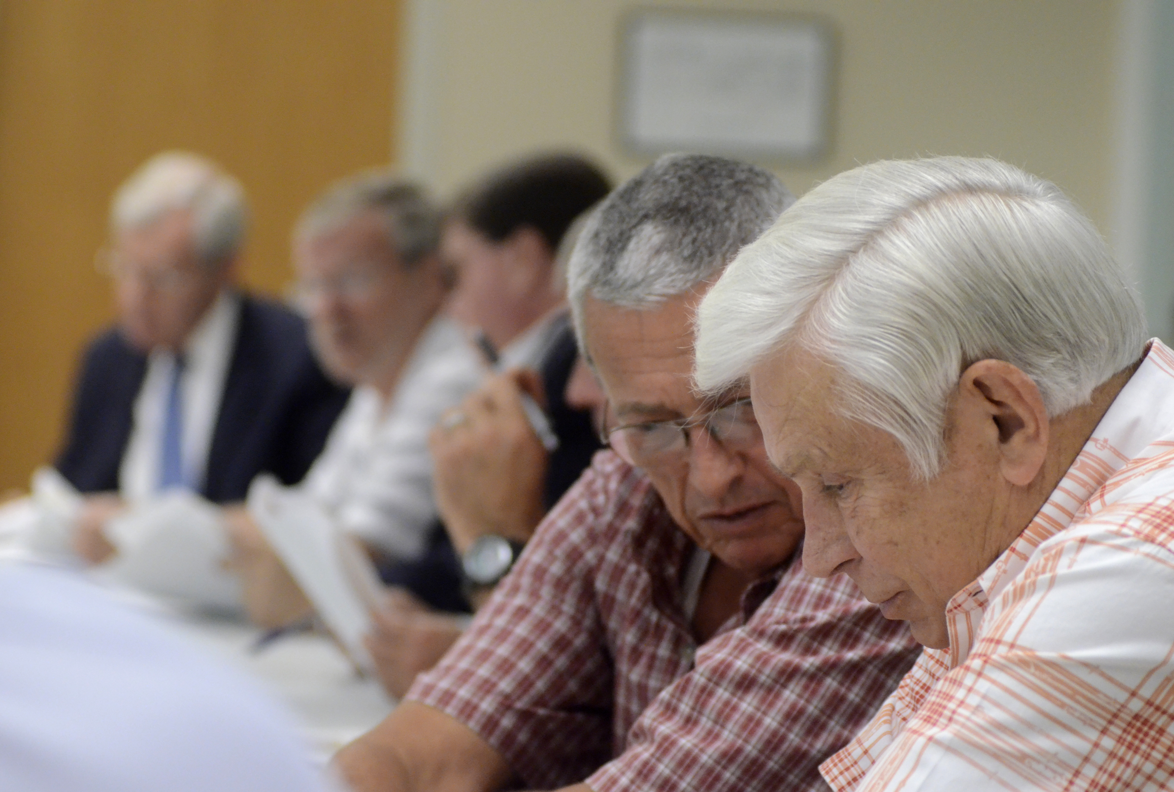 Soddy-Daisy City Manager Hardie Stulce speaks to Soddy-Daisy Mayor Jim Adams, right, as members of various local government groups meet Monday to discuss a feasibility study about a toll bridge in the north end of Hamilton County.
Highway planners have zeroed in on the location of a proposed toll bridge across the Tennessee River in the northern end of Hamilton County.
The bridge - a $5 toll bridge - would cross the river just south of Sequoyah Nuclear Plant to link U.S. Highway 27 with Interstate 75.
What remains in play is what maze of roads might be designated as the bridge's connector roads.
To the west of the river, possibilities are Sequoyah Road or a new road beginning a few miles north on U.S. 27 and ending at Sequoyah Road near the river.
To the east of the river, the bridge would pick up Harrison Bay Road and Birchwood Pike to Highway 58 South through Enterprise South industrial park to I-75. Or it would pick up Harrison Bay Road to Birchwood Pike to Mahan Gap Road to Ooltewah-Georgetown Road to the interstate.
The route through Enterprise South is the least expensive at about $235.6 million. The most expensive is the one that includes a new road from U.S. 27 to Ooltewah-Georgetown Road to I-75 at $433 million. Estimated cost for the remaining option is about $305 million. All estimates include the bridge and toll systems.
Some politicians and planners say growth is driving the options for what would be Tennessee's first toll bridge.
"These are projected growth areas of the county," said Tennessee Department of Transportation planner Jean Stevens.
TDOT consultants in December told local elected officials that a new bridge in northern Hamilton County is feasible in their view to offer a quicker and more direct route between Collegedale and Soddy-Daisy - the fastest-growing municipalities in the region.
Jim Adams, the mayor of Soddy-Daisy who stands to lose a much-touted rails-to-trails greenway to the proposed bridge's eastern-most access point, said politics have more to do with it.
"They want the road to go through Enterprise South," Adams said. "I think a better option would be [a bridge] farther north. Come off U.S. 11 and Corridor J and connect to I-75 near Cleveland. That makes more sense. There's more open land there."
He asked planners about that option Monday at a Chattanooga meeting that Rebecca Brooks, a consultant with TDOT contractor Wilbur Smith Associates, called a "consensus building workshop."
Highway officials said Adams' alternative was not among the options considered in narrowing the bridge's location.
"There was not enough interest in that one to even put it on the table," said Tennessee Rep. Jim Cobb, R-Spring City.
Looking ahead
Planners have said it could take 10 years for the proposed bridge to go through planning and environmental studies as well as design and right-of-way phases. Construction would take about two more years.
Supporters said the $5 toll to pay for the bridge and its connecting roads may not seem so high by the time everything is complete in 2018 or later. They said the bridge would save time and fuel for drivers who would shorten their current 50-mile trips to somewhere between 16 and 21 miles.
The next bridge north and upriver of the city is 57 miles from Chattanooga at Highway 60, connecting Bradley County with its cross-river neighbor Rhea County.
Brooks said a study has estimated 6,700 to 7,600 cars and trucks would cross the northern Hamilton County bridge every day, even with a $5 toll.
Already there are five vehicle bridges over the river in Hamilton County, but they are all near downtown Chattanooga. The Olgiati Bridge, the Market Street Bridge, Veterans Bridge, C.B. Robinson Bridge and Thrasher Bridge over the Chickamauga Dam are all within 10 miles of downtown.
The next bridge downriver from Chattanooga is about 20 miles to the west in Marion County near Jasper, Tenn.
Brooks told workshop attendees Monday that planners will have draft reports on the proposed bridge plan in mid-December, and final reports should be complete in the first quarter of 2012.
Contact Pam Sohn at psohn@timesfreepress.com or 423-757-6346.