Parts of region listed as 'abnormally dry'
Friday, June 10, 2011
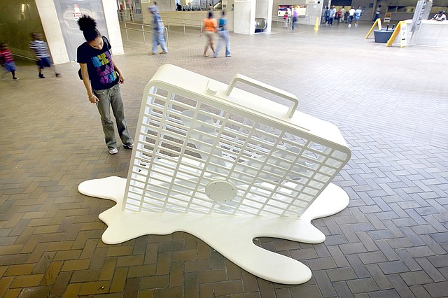
 An art installation of a melting fan sits on display in a subway station Thursday in Atlanta. Sweltering temperatures across half the country had people doing what they could to stay cool Thursday. The South is forecast to stay hotter than usual at least through the end of the week.
(AP Photo/David Goldman)
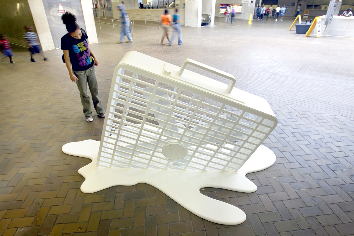
An art installation of a melting fan sits on display in a subway station Thursday in Atlanta. Sweltering temperatures across half the country had people doing what they could to stay cool Thursday. The South is forecast to stay hotter than usual at least through the end of the week.
(AP Photo/David Goldman)CHATTANOOGA FORECASTToday: A 20 percent chance of showers and thunderstorms after 2 p.m. Mostly sunny and hot, with a high near 95.Tonight: A 20 percent chance of showers and thunderstorms before 2 a.m. Partly cloudy, with a low around 69.Saturday: A 30 percent chance of showers and thunderstorms, mainly after 2 p.m. High near 93.Sunday: A 30 percent chance of showers and thunderstorms. Mostly sunny and hot, with a high near 92.
If Thursday's rain showers seemed a bit unfamiliar, there's a reason.
Before the afternoon storms, Chattanooga had seen rain on only five days since April 28, a span of 43 days.
"It's been abnormally dry there over the last few weeks," said Luigi Romolo, a climatologist with the Southern Regional Climate Center in Baton Rouge, La. "(Rain) basically turned off around mid-May."
And a fresh report from the U.S. Drought Monitor shows the impact of the cloudless days: Dry conditions have returned to Southeast Tennessee and Northwest Georgia.
Parts of Bradley, Polk and McMinn counties in Tennessee were added to the "abnormally dry" classification in Thursday's report. In Georgia, portions of Catoosa, Walker, Dade, Chattooga, Murray, Whitfield and Gordon counties were also added to the classification, which Romolo called a "yellow flashing light" indicating that drought could soon follow.
Stream flow meters in Chattooga and Dade counties recorded below-normal flows before Thursday afternoon's showers. Meters in Murray, Whitfield and Gordon counties showed creeks were "much below normal."
In Tennessee, meters in Marion and McMinn counties showed normal flows, but the Hiwassee River near Charleston showed low flows.
"We're getting into the drier time of the year," said Paul Barys, meteorologist with WRCB-Channel 3. "I don't see anything huge changing around here."
Farmers such as Dade County's Roy Hartline don't need charts to see the drying trend. He said he's seen worse in recent years, but the dry spell isn't helping his crops.
"It's dry, you can say that," Hartline said. "We need some water."
Romolo and others say the Chattanooga area would be in much worse shape were it not for rain earlier this year.
"When the dryness started, the soil was full of water," Romolo explained.
Much of the tri-state region was under dry or drought conditions in January, before a rainy spring brought things back to normal. April was unusually rainy for the city, with nearly 9 inches recorded. But while the city came into May more than 6 inches ahead of the norm, that margin had been cut in half by Wednesday.
"We haven't had a lot of rain lately, but we had quite a bit earlier in the year," said Sam Roberts, a meteorologist with the National Weather Service in Morristown, Tenn.
Roberts said Knoxville, Chattanooga and the Tri-Cities region in Northeast Tennessee are all above year-to-date norms, but that may not last long if the clouds don't return. He said the top level of soil is dry, but subterranean supplies are still strong.
"We're still OK now, but it's definitely something to keep an eye out for," he said.
Forecasters give the region a chance of brief afternoon showers over the next several days, but Roberts said they won't be anything like the soaking rains caused by frontal systems that blew through in spring.