
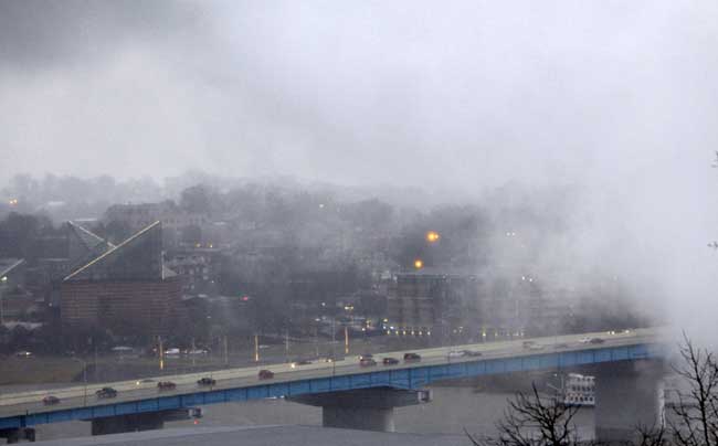
 Motorists commute to work on Highway 27 as steady rains hit the Chattanooga area today.
Since 4 p.m. Tuesday, the Chattanooga has received 2.18 inches of rain, according to the National Weather Service, forcing at least one area creek into flood stage.
One of the most swollen creeks in the area this morning is Lookout Creek in Dade County, which went over flood stage at 8:45 a.m.
Emergency officials said they have closed Sells Lane around the creek in the Piney community.
A 911 dispatcher said she expects to have to close several more road closings as the creek rise.
The U.S. Geological Survey meters on Lookout Creek near New England was at 13 feet around 9:30 a.m. Flood stage at the meter is 12 feet. Forecasts call for the creek to crest at 15 feet later today.
Elsewhere in Northwest Georgia, the USGS classified the Chattooga River near Trion as "much above normal," while meters on the Conasauga, Coosawattee and Oostanaula Rivers are all reporting "above normal" flows.
In Southeast Tennessee, the Sequatchie River in Whitwell and the Elk River in Pelham are listed as much above normal.
In East Ridge, Camp Jordan Parkway was closed due to high water around 8:30 a.m., according to police spokesman Eric Hopkins.
Chickamauaga Creek was still in its banks this morning, but officials were not sure how long that would last. For East Ridge, he said, it's the hours after the rain that are dangerous as water pours into the creek from feeder streams.
"The next 24 to 48 hours will be critical for us," Hopkins said.
Catoosa County dispatchers said there was high water everywhere , but no
reports of flooding or closed roads.
In Trion, which was hit hard by floods in September 2009, EMA Director Eddie Henderson said the Chattooga River was within its banks for now.
"I'm looking for it to come out at some point today," he said around 9 a.m.
The same line of storms dumping water on Chattanooga spawned spawned three tornadoes today in the New Orleans area and dumped as much seven inches of rain in parts of Mississippi. It's also blamed for damage in Greeneville, Tenn.
The Louisiana tornadoes touched down early in the morning on the heels of the Mardi Gras season, which ended Tuesday night.
Forecaster Mike Shields said one tornado touched down about 10 miles southwest of Bush in St. Tammany Parish around 5:20 a.m., injuring one person, damaging a house, destroying a trailer and knocking down trees.
Emergency officials said the woman suffered a cut on her head.
Firefighters in Lacombe reported a twister that took the roof off a house just before 5 a.m. And the weather service said a meteorologist reported a tornado on the north side of Kenner near Lake Pontchartrain shortly after 6 a.m. No damage was reported.
Strong winds accompanying thunderstorms in eastern Tennessee ripped part of
the roof off a school. A section of roof was torn from Camp Creek Elementary School on Wednesday morning, The Greeneville Sun reported. No injuries were reported and there were no children at the school yet.
In Mississippi, reports of damage were sporadic but no deaths or injuries
were immediately reported Wednesday by the Highway Patrol or emergency
officials.
Daniel Lamb, a meteorologist with the National Weather Service in Jackson, Miss.,
said there had been reports of tornadoes around the state. He said weather service storm survey teams would be out later Wednesday to assess the damage.
Forecasters were also expecting a day of rough weather in Alabama. The
National Weather Service said winds gusting to 50 mph were possible across a
wide section of the state along with torrential rains. Morning commuters
struggled to open doors in Montgomery as whistling winds buffeted the area.
The Associated Press contributed to this report.
See tomorrow's Chattanooga Times Free Press for complete coverage.