 An unidentified motorist damages his right front tire while driving around a barricade on South Hickory Street. The street was closed due to flooding.
Rain and possible flash flooding should be hitting the Tennessee Valley today and Monday thanks to a low air-pressure system coming from the Mississippi Valley.
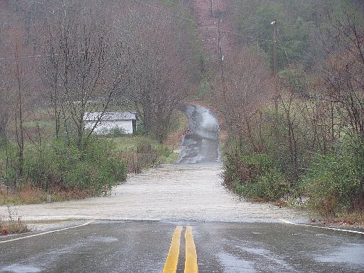
Southeast Tennessee is expected to receive 2 to 5 inches of rain from today through Tuesday morning, according to Derek Eisentrout, a National Weather Service forecaster in Morristown, Tenn.
Once the rain eases off Tuesday, the temperatures should drop. The high in the mid-40s during the day will fall to the low 30s at night with a slight chance of snow flurries.
In Northwest Georgia, West and South Chicka-mauga creeks, the Conesauga River and Lookout Creek could have minor flooding, according to Kent Frantz, a hydrologist with the National Weather Service in Peachtree City, Ga.
Streets also may have more flooding because of backed-up drainage systems, Frantz said.
"Whenever we have these rainfall events in November and December, we see that there's more flooding because the leaves back up the drains," he said.
In the last 30 days, the area received 2 to 4 inches of rain. Normally, the area receives 4 to 6 inches of rain, Frantz said.