Longest US trail seeks link to Appalachian Trail
Monday, June 25, 2012
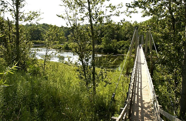
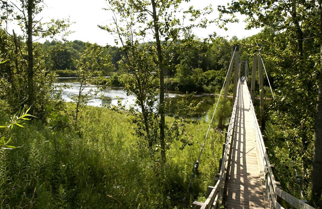 This July 27, 2003, file photo, shows a suspension bridge over the Manistee River southeast of Mesick, Mich., where the North Country Scenic Trail follows the river for miles. The North Country National Scenic Trail runs 4,600 miles from North Dakota to New York's eastern border. From there, it's about 40 miles across Vermont fields and mountains to the Appalachian Trail. Closing the 40-mile gap is a priority for the Michigan-based North Country Trail Association, the group responsible for the trail. (AP Photo/John L. Russell, File)
WEYBRIDGE, Vt. (AP) - The longest hiking trail in the United States stops 40 miles short of its most famous cousin, but a group is trying to bridge that gap.
The North Country National Scenic Trail runs 4,600 miles from North Dakota to New York's eastern border. From there, it's about 40 miles across Vermont fields and mountains to the Appalachian Trail, the famous 2,170-mile hiking trail that runs from Georgia to Maine.
Bringing them together now are a push from the organization that runs the North Country Trail; a changed attitude from officials in Vermont, where the connection was blocked decades ago; and a growing movement to connect the nation's longest hiking trails.
"This 40-mile gap is a gap in the system," said Bruce Matthews, executive director of the Michigan-based North Country Trail Association, which is working with the National Park Service, Vermont's Green Mountain Club and others to build the new connecting trail. "There's no logical reason for it."
Despite being the longest hiking trail in the country, the North Country Trail isn't as well-known as others, partly because it's still a work in progress and partly because it has no defining feature, like the mountain range the Appalachian Trail is named for.
"With the North Country, it's more of an immersion in the people and how they have eked a living out of the hardships of the North Country than it is climbing from mountaintop to mountaintop," Matthews said.
The North Country Trail was one of 11 National Scenic Trails planned for decades and finally approved by Congress in 1980. On the map the trail is about 4,600 miles, but only about half is traditional hiking trail through rural areas. Much of it runs along roads. In many sections there aren't camping areas where hikers can use a lean-to or easily pitch a tent.
Thousands have hiked the entire Appalachian Trial. Just 11 people have completed the North Country Trail.
Still, for those who know it, the trail and its paths that meander through farmland, the hills of New York's Finger Lakes region and canal towpaths is one to be admired.
"All the criticism that this trail gets really are some of its strengths. It doesn't follow a particular geographic feature. It's not associated with one state. It's not associated with one ecosystem," said Joan Young, 64, of Scottville, Mich., who completed the trail in 2010. "Its strongest feature is the diversity of the experiences."
The North Country Trail is unlike many of the more traditional trails, said Matthews.
"In New England and the Appalachian region there's a hiking culture there, there's an expectation that people hike it and do know about it," Matthews said.
"The further into the Midwest you get, there's more of a love affair with the internal combustion engine."
The route to extend the trail through Vermont hasn't been chosen, but it's expected to be about a 40-mile path that will hook up with the state's Long Trail, which is the same path as the Appalachian Trail at that point.
It could be years before the shield-shaped markers used by the North Country Trail start sprouting in the fields of Vermont's agricultural heartland.
In the mid-1970s when the North Country Trail was being planned, Vermont officials objected to it coming into the state over concerns additional hiker traffic could overwhelm the state's 273-mile Long Trail, which runs from Massachusetts to Canada. So the North Country Trail ended on the shore of Lake Champlain at the base of the bridge between Crown Point and West Addison.
The National Park Service is doing a feasibility study, which must be completed before the plan can be presented to Congress. Matthews said he was hopeful the Park Service approval can be finished this summer.
"It's one of those labors of love," Matthews said. "It's a simple foot path, yet it connects all the peoples of the north country and their combined experiences. You set foot on the trail in New York, you're connected with somebody in Minnesota."