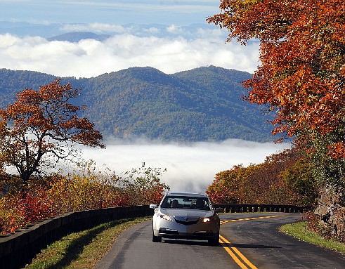
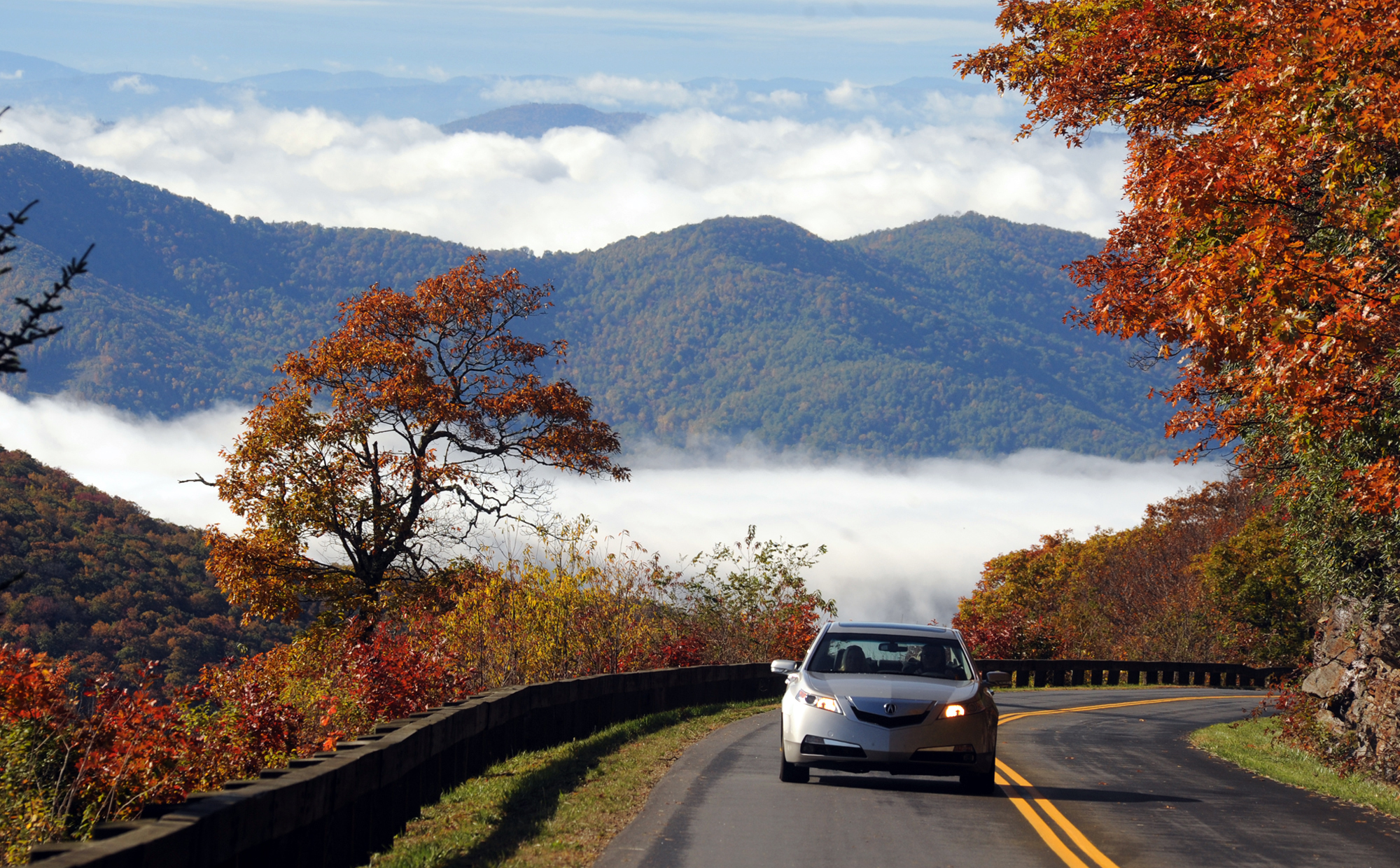
 Pockets of fall colors appear to be peaking along the Blue Ridge Parkway at Craggy Gardens, north of Asheville.
GLIMPSE OF THE FUTUREFor more tips that will help you find the best things to do in the Chattanooga region, pick up a copy of Glimpse, a travel guide that will be inserted into your newspaper on Aug. 30. Glimpse covers the hottest activities and best-kept secrets in nearly 100 cities across Tennessee, Georgia, Alabama and North Carolina and will be accessible online from TimesFreePress.com.
Don't you just hate the annual frenzy over the gorgeous orange, red and yellow blanket that drapes the region's mountains each fall?
No?
Then you've come to the right place. The exhibit of autumn color in the hills and valleys around the Chattanooga region rivals any New Englander's boast. And you don't have to lug along earmuffs and anoraks to enjoy the view.
Still, visitors who take to the high roads of Tennessee, Georgia, Alabama and North Carolina only in September or October are missing a good part of Mother Nature's show. The same astounding variety of colors and shapes is on display from early spring through late summer in the region's native wildflowers and shrubs.
THE EARLY SHOW
The bold display of early spring's redbud, maple and dogwood trees can go toe to toe with fall's flaming maples and golden hickories.
• More than 100 trees, shrubs and flowering species show off blossoms and foliage between February and the fall frost.
• Many native plants are shy, not showy, hiding small, delicately colored petals in shadows or among larger species.
• Plants' popular or folk names often reflect their appearance or their uses in folk medicine, such as Heal All (prunella vulgaris), Nodding Lady Tresses (spiranthus cernua) and Witch Hobble (viburnum alnifolium).
• American Indians in the area and European settlers later used species such as black cohosh, bloodroot, echinacea and goldenseal for health and healing.
Source: www.uswildflowers.com
THE FINALE
Fall's palette is ever-changing as each species turns out in its brightest colors.
• The annual fall color display comes from depletion of green chlorophyll as the tree goes dormant for winter.
• More than 70 species of trees, from ash to white pine, flourish in the region's lowlands, its flat plateaus, its mountain coves and soaring peaks.
• Just among the oaks, more than 20 varieties grow in the region, from water-loving pin oaks to the post oaks that top dry ridges.
• The mountain hardwoods - maples and cherries, hickories and hackberries, sycamores and dozens more - were logged and shipped out of the area for industry elsewhere in the late 19th and early 20th centuries and also formed the backbone of Western North Carolina's furniture industry.
Source: University of Tennessee Extension Service, East Tennessee State University
HIT THE HIGHWAY
Spring or fall, visitors can enjoy spectacular on highways and parks throughout the four-state region.
The Cherohala Skyway
• A National Scenic Byway, it runs between Tellico Plains, Tenn., and Robbinsville, N.C.
• The skyway cost more than $100 million when it was opened and dedicated in 1996.
• The 40-mile highway is named for the two national forests it crosses: the Cherokee in Tennessee and the Nantahala in North Carolina.
• The two-lane road's elevation ranges from 900 feet above sea level at the Tellico River to 5,400 feet at Haw Knob on the Tennessee-North Carolina line.
Source: www.cherohala.org
Brasstown Bald
• Located near Blairsville, Ga., in the Chattahoochee-Oconee National Forest.
• Georgia's highest mountain, at 3,784 feet above sea level.
• From the top, look down on Georgia's only "cloud forest," where lichen-covered yellow birch and fields of wildflowers are usually dripping wet from cloud moisture.
• Visitors can see four states - Georgia, Tennessee, North Carolina and South Carolina - from the top.
• Steep, 0.6-mile paved trail goes up the Bald from the visitors center. Shuttles are available.
• The name doesn't refer to a nearby town. It came about because settlers confused the Cherokee word itse-yi ("place of fresh green") with untsaiyi ("brass.")
Sources: U.S. Forest Service,www.fs.usda.gov/conf, and www.geology.com
Little River Canyon National Preserve
• Little River mostly flows through a gorge atop Lookout Mountain near Fort Payne, Ala.
• The former state park was brought into the National Park System in 1992.
• A winding, 11-mile drive on Alabama Highway 176 travels along the canyon rim through forest highlands, with regular stops to gaze at waterfalls and rock formations.
Source: National Park Service, www.nps.gov/liri/index.htm
Blue Ridge Parkway
• The Blue Ridge Parkway is the most visited unit in the National Park System because of its fabulous vistas of mountains, forests and long, long landscapes, views that are available in any season.
• The lead designer for "America's favorite drive," Stanley Abbott, was a landscape architect rather than an engineer.
• The 469-mile highway connects the Great Smoky Mountains National Park in North Carolina to the Shenandoah National Park in Virginia.
• Construction began in 1935, but the last section - around Grandfather Mountain - didn't open until 1987.
• The parkway's seasonal wildflower and fall color line is 828-298-0398, press option 7.
Source: Blue Ridge Parkway, www.blueridgeparkway.org