ATLANTA (AP) - The latest on severe weather in the southern U.S. (all times central):
8:20 p.m.
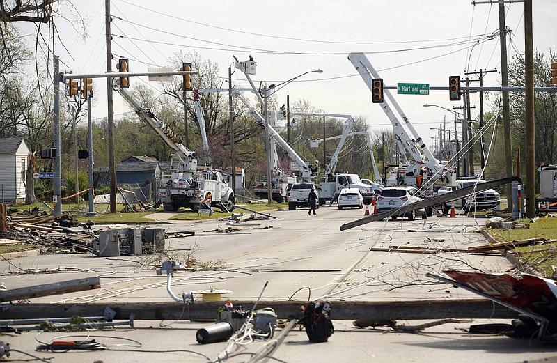
An emergency management director in central Alabama says another tornado has touched down in the state.
Walker County Emergency Management assistant director Harry Markham says a tornado struck Eldridge, Alabama, around 8 p.m. He says there were no immediate reports on damage or any injuries.
It is the second tornado authorities say has hit the ground in Alabama since one touched down in northern part of the state in Ardmore around 7:07 p.m.
___
8 p.m.
Authorities say a teen driver in Mississippi has lost his life amid the severe weather outbreak in the South.
The Daily Corinthian (http://bit.ly/21Vie2U ) reports that William Luca McMahan of Iuka apparently lost control of a Chevrolet Blazer SUV around 7 a.m. Thursday, sliding off a rain-slick highway and into a ditch.
Authorities say the 18-year-old's vehicle rolled over and landed upside down in Indian Creek. McMahan, a senior whom classmates say was on the way to school, was reportedly pinned inside the vehicle.
___
7:45 p.m.
An emergency management director says a tornado touched down in northern Alabama.
Limestone County Emergency Management director Rita White says that a tornado touched down in Ardmore, Alabama, around 7:07 p.m. Thursday. She says there were no reports of damage.
National Weather Service meteorologist Curt Weber says tornado warnings have been issued in Limestone and Madison counties along with a separate warning in Hazel Green, a rural community near the Alabama and Tennessee line. He says the warnings in Limestone and Madison will be in effect until 8 p.m. and 7:45 p.m. in Hazel Green.
The weather service says tornado warnings have also been issued in areas of central Alabama including Carbon Hill, Nauvoo and Kansas.
___
7:30 p.m.
An apparent tornado has damaged homes and downed trees near Columbus, Mississippi.
Lowndes County Emergency Management director Cindy Lawrence says reports indicate at least a dozen homes have been damaged near New Hope, between Columbus and the Alabama state line.
Lawrence says it's unclear whether anyone has been injured. She says emergency workers are responding by foot in some places because so many trees are blocking roads.
Eric Carpenter, a meteorologist with the National Weather Service in Pearl, Mississippi, says radar detected a tornado debris signature beginning around 6:22 p.m. The storm crossed into Alabama and wind damage was also reported around the Millport area there.
More than 2,000 power outages in the area were reported by 4-County Electric Power Association.
___
6:30 p.m.
The National Weather Service says a tornado warning has been issued in south Alabama.
Meteorologist Jason Beaman says the warnings are issued for Clarke and Choctaw counties on Thursday evening. He says a storm was rushing toward both counties with very strong signs of a tornado.
Beamen says the warning would last until 7 p.m. and might be extended in about hour depending on the strength of the storm. He says the tornado could be "large and very dangerous" that "considerable" damage is certainly possible.
Beamen warns people in those areas should get into an interior room or the lowest point of their home.
___
4:45 p.m.
The National Weather Service has confirmed two tornadoes touched down in southeast Louisiana, bringing down trees and power lines but causing no injuries.
Meteorologist Frank Revitte says an eastward-moving storm spawned two weak tornadoes, both rated EF-1, early Thursday. One hit east of Greensburg in St. Helena Parish; the other struck near the village of Tangipahoa in Tangipahoa Parish.
Revitte says showers remain in the forecast through Friday, keeping the area under a flash flood watch.
___
Noon
Heavy rain in the Mississippi Delta has caused widespread flooding and prompted some evacuations.
Forecaster Latrice Maxie says 3 to 5 inches of rain fell late Wednesday night and early Thursday morning causing some evacuations and closing several highways. Maxie said the heaviest rain was along the U.S. Highway 82 corridor between Washington and Montgomery counties.
Sunflower County Emergency Manager Ben Grant says about two dozen homes in Moorhead were evacuated.
Mayor George Holland said he went into one flooded house and was standing in 10 inches of water.
Holland said most of those evacuated have returned to their homes to begin repairs or moved in with relatives.
___
11 a.m.
Forecasters say storms moving toward Alabama could produce hail, damaging winds and tornadoes throughout the state.
A tornado watch issued by the National Weather Service in southwest Alabama is in effect until 2 p.m. Thursday.
Officials say there's a moderate chance for tornadoes and large hail in the Mobile area and throughout north and central Alabama, where meteorologists expect winds of up to 70 mph.
They say an elevated threat area covers Birmingham, Gadsden, Tuscaloosa and other parts of central and west Alabama.
The National Weather Service says storms in central Alabama are expected to strengthen after 3 p.m. and could continue through 3 a.m. Forecasters in Huntsville say severe weather in north Alabama is likely to taper off after midnight.
___
9:35 a.m.
The National Weather Service office in Jackson, Mississippi, says a possible tornado touched down Thursday morning in Lamar County.
Meteorologist Joanne Culin says trees are down in two areas of Purvis and one crashed into a house.
There were no reports of injuries.
Culin said radar picked up rotation in a storm moving over Purvis at the time of the reported damage.
She says a team will be sent out in the coming days to survey the damage and determine if it was caused by a tornado.
Culin says the afternoon heat is expected to fire up a new round of storms Thursday. The area north of Interstate 20 may see strong tornadoes and baseball size hail.
___
8:25 a.m.
Forecasters have issued a flash flood watch covering much of Georgia through Friday evening as a system of severe storms moves across the South.
The National Weather Service says up to 3.5 inches of rain is expected in parts of north and western Georgia on Thursday night through Friday, with some spots getting even higher amounts of rain.
Forecasters say they expect some of the heaviest rains - which could total more than 4 inches - in an area south and southwest of Macon.
The weather service says isolated flash flooding will be possible if multiple storms move over the same areas.
Forecasters say that in Georgia, the northwest corner of the state will be at highest risk for tornadoes Thursday.
___
7:30 a.m.
Forecasters are warning of possible tornadoes in parts of Mississippi and Alabama on Thursday.
Meteorologists at the National Weather Service's Storm Prediction Center released a weather update Thursday morning, saying the greatest threat of tornadoes and large hail will be in northern Mississippi and Alabama, along with parts of Tennessee and southern Kentucky.
Severe thunderstorms are already moving across the lower Mississippi River Valley, bringing hail and damaging winds. The National Weather Service says the heavy rain may produce flash flooding in some areas.
Forecasters say more than 8 million people will be at an "enhanced" risk of severe weather in parts of Mississippi, Alabama and Tennessee.
___
7:10 a.m.
More thunderstorms are in the forecast Thursday in Arkansas, a day after heavy rainfall inundated streets and roads statewide and flooded a lecture hall in a Little Rock art museum.
The National Weather Service says many areas received 4 inches or more of rain on Wednesday. A flash flood emergency was issued Wednesday night in Jonesboro after water inundated many city streets.
No injuries or deaths have been reported.
In Little Rock, heavy rains poured through the roof of the Arkansas Arts Center, flooding a lecture hall and knocking down ceiling tiles. Museum officials say none of the artwork was damaged except for a paper frame that surrounded a painting.
The museum in downtown Little Rock houses works by Claude Monet, Pablo Picasso, Jackson Pollock, Diego Rivera and Andy Warhol, among others.
___
6:55 a.m.
One injury has been reported after a suspected tornado hit the southeastern Arkansas town of Dermott.
The National Weather Service says heavy damage, including downed trees and power lines, was reported after severe weather swept through the town about 115 miles southeast of Little Rock late Wednesday.
There were no immediate details about the severity of the person's injury, which was reported to the National Weather Service in Jackson, Mississippi.
Earlier in the day, an American Airlines flight traveling from Dallas to Memphis, Tennessee, was forced to make an emergency landing in Little Rock because of the stormy weather. American Airlines says the plane landed safely, but two flight attendants suffered minor injuries and were taken to a Little Rock hospital.
No passengers were hurt.
___
6:30 a.m.
Severe thunderstorms are moving across the lower Mississippi River Valley, bringing hail, damaging winds and the threat of some tornadoes.
The National Weather Service says the heavy rain may produce flash flooding in some areas Thursday.
Forecaster Cynthia Palmer in Shreveport, Louisiana, says strong winds downed trees over a highway in Union and Bienville parishes Wednesday night.
Palmer says flash flooding in the same area closed several roads. She says the rain totaled between 4 to 6 inches.
In Wilkinson County, Mississippi, hail the size of golf balls was reported in two locations, while strong winds damaged trees about 9 miles west of Woodville.
Forecasters are predicting more of the same for Louisiana and Mississippi on Thursday.
___
4:55 a.m.
Authorities say at least seven people were injured after severe storms spawned multiple tornado touchdowns in northeastern Oklahoma.
National Weather Service meteorologist Amy Jankowski said a tornado touched down and lifted up numerous times Wednesday night as it swept through the northern Tulsa and Owasso areas.
Tulsa Fire Department spokesman Stan May says about a square mile of a mostly residential area sustained damage. He says one home was destroyed and other residences and businesses sustained roof and structural damage.
Emergency Medical Services Authority, an ambulance service provider, said it transported seven patients to a hospital. Spokeswoman Kelli Bruer said one was in critical condition and several were in serious condition.