
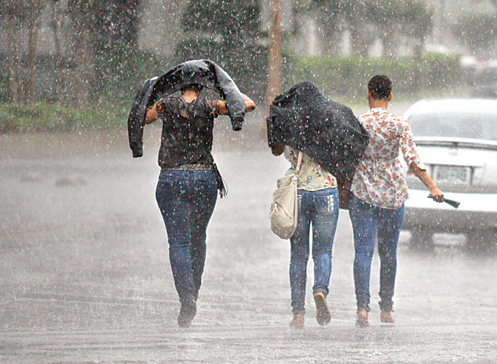
 Three people walk on Georgia Avenue in downtown Chattanooga during a driving rainstorm on Sunday. The city got about 2 inches of rain over the weekend, but parts of the tri-state area were drenched with several inches from thunderstorms that brought some scattered power outages and flooding.
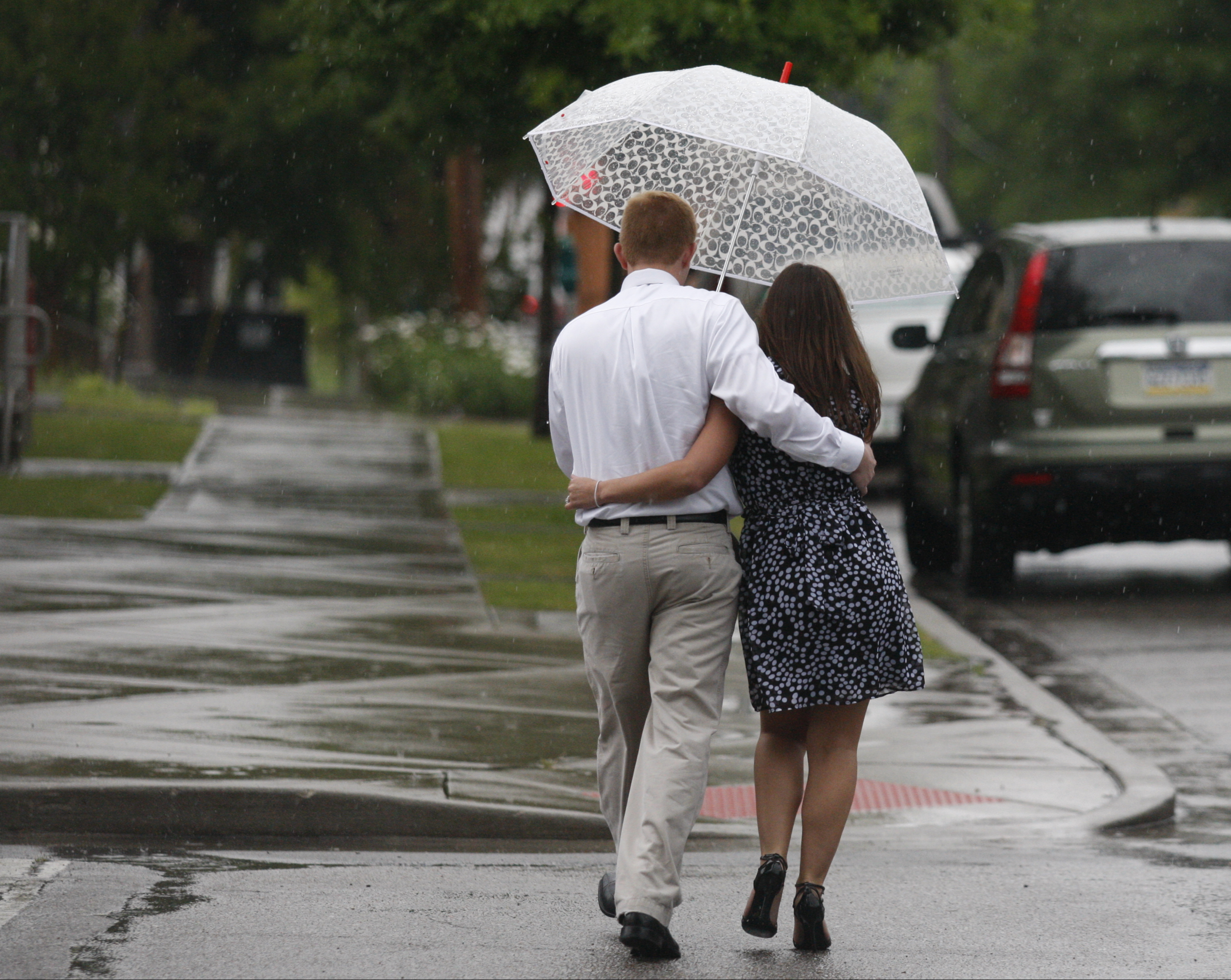 Jessica and Jason Stapp walk beneath an umbrella as they cross Oak Street during afternoon thunderstorms Sunday in Chattanooga. Thunderstorm and flood warnings were issued for the tri-state region and authorities reported flash floods and scattered power outages Sunday evening.
Read moreChattanooga area business and school closings
After a wet weekend, the sun is ready to come out, just in time for you to return to work.
WRCB-TV Channel 3 meteorologist Nick Austin said Chattanooga residents can expect a sunny afternoon with highs between 85-90 degrees. This comes after the city received about 2 inches of rain over the weekend.
"All this stuff is winding down," Austin said Sunday night. "[Today] is going to be pretty quiet. If anything pops up, it's not going to be anything like [Sunday] or [Saturday]."
But before the sun comes out, Chattanooga residents should prepare for low visibility on their way to work.
Austin said fog will coat the sky early this morning, with the weather clearing up about 9 a.m.
This comes a day after storms pulled down power lines, flooded streets and washed away mobile homes.
"I knew we were going to get some storms [Sunday]," Austin said. "And I knew it was going to be kind of severe. But it was definitely more energized than I expected."
The National Weather Service reported up to 2 inches of rain fell in an hour near Harrison and McDonald early Sunday afternoon. And Amy Maxwell with Hamilton County Emergency Services said flash flooding was reported near Sale Creek and some trees were down at a Sale Creek campground, but she had heard of no major problems.
Bledsoe County and counties in northwest Georgia were the areas hardest hit.
According to the National Weather Service, about 10 inches of rain fell in Bledsoe in a 24-hour span. A dispatcher in the area said Sunday afternoon that people living in mobile homes in the northern part of the county had been evacuated. Flooding water swept some homes away.
In Georgia, Dade and Walker counties received about 3 or 4 inches of rain between Saturday evening and Sunday, said Mike Leary, a meteorologist in the National Weather Service's Peachtree City, Ga., office.
There was widespread but mostly short-term flash flooding. Leary said the extent of the Sunday's damage was unknown as of Sunday night, but a few reports are telling.
Several roads in northern Dade County were still flooded Sunday night, as were the ones in eastern Bartow County. In Thomaston, Ga., lightning struck a house and caused a fire in one part of town, while power lines fell and became tangled in another part.
In Whitfield County, pea-sized hail pea fell those residents who failed to get inside on time. The hailstorm was intense but because it was so small, it didn't cause damage.
Marion County, Tenn., experienced a minor amount of flooding Sunday, said Jessica Winton, a National Weather Service meteorologist based out of Morristown, Tenn. Rivers and streams will continue to rise as the weekend's rainfall drains from mountains and plateaus.
As for next weekend, Austin said early reports indicate it will be sunny but, "I'll keep my fingers crossed."
Contact Tyler Jett at tjett@timesfreepress.com or 423-757-6476.