Isaac Holden and Daniel Rucker unstrapped kayaks from the tops of their cars and zipped up wetsuits, preparing for a trip Wednesday afternoon along Suck Creek Road, just a few hundred yards into Marion County.
The duo anticipated ideal whitewater conditions following Tuesday night's rain.
"Usually, the whole parking lot is packed after it rains," said Holden, a 22-year-old rafting guide.
The results of Tuesday night's mini-monsoon were not as great for everyone across the region after sunny, spring-like weather turned windy and wet in a hurry. The same storm system spawned tornadoes to the west when it arrived in the tri-state area.
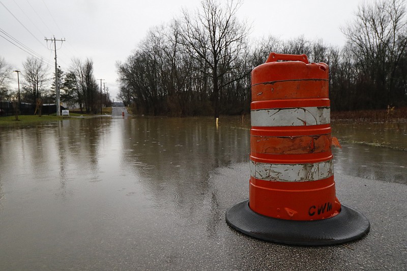
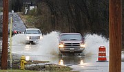
No weather-related injuries were reported, but several Hamilton County motorists drove into flooded portions of roads Wednesday morning before crews closed them off, officials said.
Ochs Highway was closed much of the day because of downed power wires, making the commute for Lookout Mountain residents longer. Even the underground waterfall attraction Ruby Falls shut down for the day because of flooding. The attraction's Twitter page said workers were trying to clear water from the cave.
In the valley, portions of East Brainerd, Standifer Gap and Hickory Valley roads were closed Wednesday.
The National Weather Service reported 2.75 inches of rain fell overnight at the Chattanooga Airport - more than half the area's February average of 4.88 inches.
Catoosa County emergency manager Doug Flury reported 3-3.5 inches near Fort Oglethorpe, and winds damaged the bingo hall in nearby Rossville. Contrary to some reports, Flury said no one was evacuated in Catoosa County, where two roads remained closed Wednesday afternoon.
Weather experts and emergency managers agreed the region was lucky to have escaped with little damage from the storm front that spawned tornadoes in Mississippi and Alabama.
"I was really nervous we would be getting some significant wind and weather-related problems," Hamilton County Emergency Services spokeswoman Amy Maxwell said.
Meteorologists said the Chattanooga area is in for a pleasant weekend after the wild burst, but what's coming after may prove Punxsutawney Phil's Groundhog Day prediction of an early spring to be misleading.
High temperatures are expected to hover in the low to mid-50s the rest of the week before winter returns.
Snow could be on its way early next week, WRCB-TV Chief Meteorologist Paul Barys said.
"It looks like the heaviest will be Monday night and early Tuesday," he said. "And there could be up to an inch of accumulation in the more elevated areas."
Sam Roberts, a meteorologist at the National Weather Service's bureau in Morristown, Tenn., agreed temperatures for the rest of the week should be average. But, he added lows could dip into the teens Wednesday night.
"That's a pretty big dropoff compared to the last few days," he said. "It'll be back to the old routine of bringing pets in and leaving the water running."
And it means the early spring predicted by the groundhog will have to wait a little while longer.
Contact staff writer David Cobb at dcobb@timesfree press.com or 423-757-6249.