
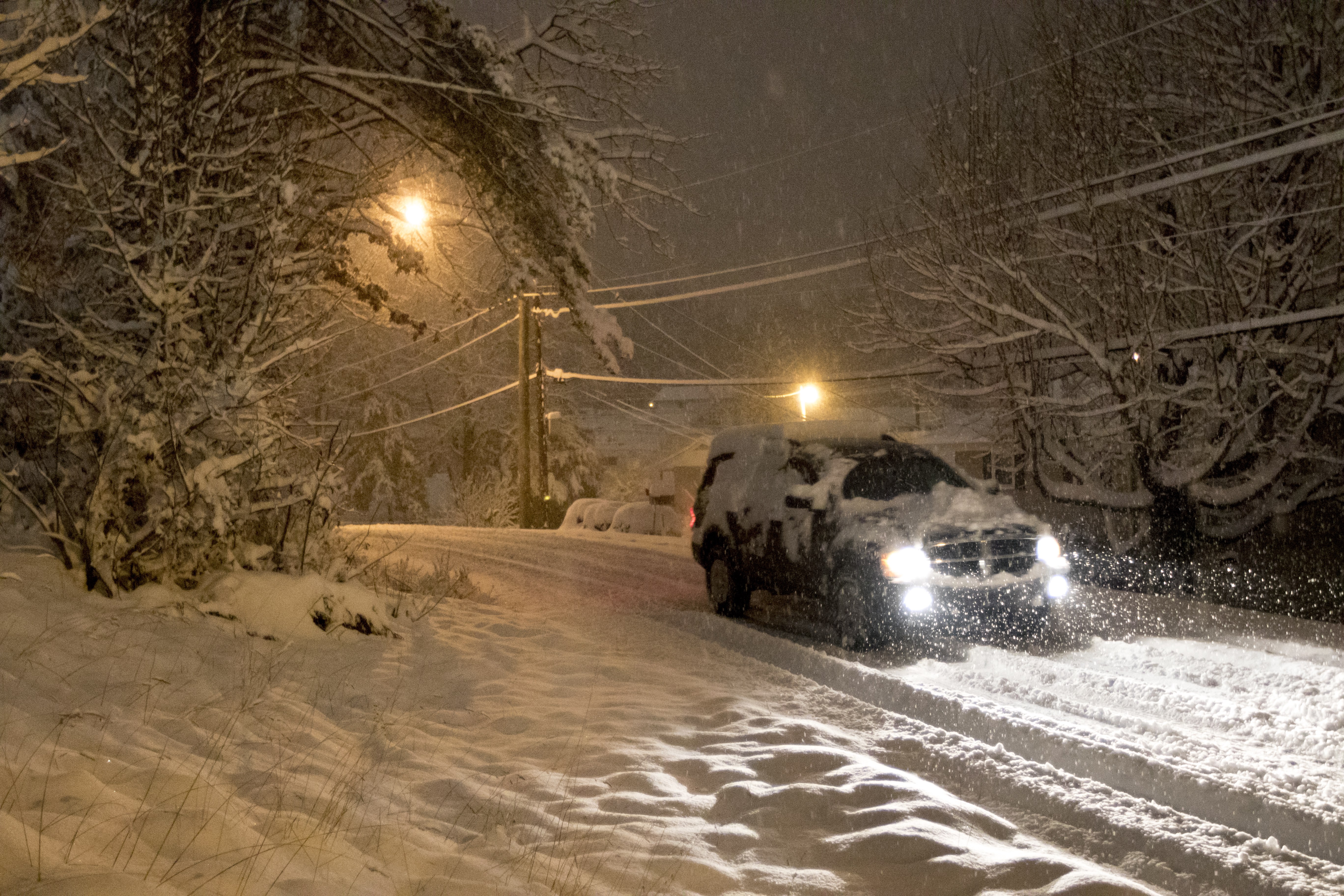
 A vehicle travels on Winding Way after heavy regional snowfall blanketed the area Wednesday, Feb. 25, 2015, in Chattanooga, Tenn.
Also read
* Canceled flights pile up as major storm threatens Eastern U.S. * Snow, freezing rain fall across much of Tennessee * Looming blizzard could rank near top 10 to hit Eastern U.S. * Frigid Friday: Tennessee could see more snow, ice today * Tennessee declares state of emergency ahead of 'blizzard-like conditions' * Approaching winter storm triggers warnings, watches for region * All Friday athletic events in Hamilton County have been postponed * Storm could bring freezing rain, high winds to north Georgia * Forecasters: Strong storms, snow possible in Alabama * At least 4 killed in snowstorm-related deaths
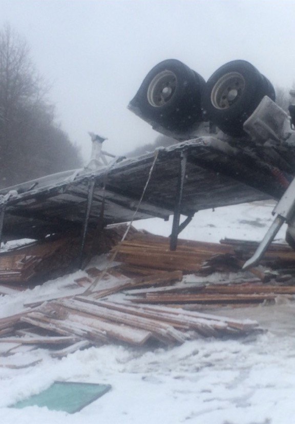 Tennessee Highway Patrol photo from Jackson, Tenn., area.
A winter storm that is threatening to cripple the East Coast may also have a serious impact on the Chattanooga area today, even though the Scenic City is only being clipped by the storm's edge.
Gov. Bill Haslam shut down all state offices across Tennessee today in preparation for the storm and the Tennessee Emergency Management Agency declared a state of emergency yesterday through tonight.
According to Jessica Winton, a meteorologist for the National Weather Service in Morristown, Tenn., the continued rain should transition into sleet between 2 and 3 p.m. and will then gradually turn into snow throughout the afternoon.
"As each hour goes by, it will become more snow, less sleet," she said.
Hamilton and Bradley County can only expect 1-2 inches of snow to accumulate this evening and through the night, but some higher elevations can expect more.
To the east, areas in Polk, McMinn, and Meigs Counties can all expect 2-3 inches while Bledsoe, Sequatchie and Marion may see as much as 5-6 inches.
Regardless of where you are, forecasters say that conditions are going to be horrible for travel.
"Once it starts changing from rain, just go home," Winton said. "I know it's Friday night and people like to stay out late, but that's not a good idea tonight."
As bad as conditions may get in the area, especially in mountainous areas that don't receive a great deal of road treatment, the Associated Press has reported that other cities in Tennessee are bearing the brunt of the storm.
Nashville is reportedly completely locked down after receiving 4.5 inches with another 1-2 expected.
Tennessee Highway Patrol Lt. Bill Miller said the interstates are "pure gridlock" and are "totally shut down."
He said that snow plows and salt trucks are out working as fast as they can, but they simply can't keep up with the weather.
Multiple crashes are being reported across the area this week, including one in which a vehicle plummeted down a 300-foot embankment on Wednesday night in Carter County.
The crash killed Stacy Sherill, the woman who was driving. Her husband was riding in the passenger seat and survived before climbing the embankment for several hours to report the accident.
The Knox County sheriff's department also reported that another fatal wreck occurred there due to speed and slick conditions. The driver was killed and the passenger was injured after a car slid off the roadway.
Further north, more than two feet of snow may accumulate in Washington, a foot to 18 inches in Philadelphia, and 8 inches to a foot in New York.
CLOSURES, EARLY DISMISSALS
* Sequatchie Cove Farm's presentation scheduled for Jan. 23.
* The Hamilton County Sheriff's Office has officially closed the W Road at the top of the mountain and at the base of the mountain temporarily. Residents utilizing this road should seek alternative routes
* The Hamilton County Sheriff's Office has officially closed Roberts Mill Road at the top of the mountain and at the base of the mountain temporarily. Residents utilizing this road should seek alternative routes.
* Hamilton County Schools will dismiss 1 hour and 45 minutes early beginning with the early start schools at 12:30 p.m. School Age Child Care will be closed this afternoon.
* Georgia Northwestern Technical College will close at noon.
* Bradley County Schools will dismiss today at 1:45 p.m.
* Chattanooga State is closing at 4 p.m. There will be no evening classes and they will be closed Saturday.
* Saturday's UTC men's basketball game against VMI has been postponed.
* UTC and McCallie have postponed administering Saturday's scheduled SAT tests on their sites until Feb. 20.
* The College Goal TN: Framing the Future conference that was to take place Saturday on the campus of UTC has been canceled.
* UTC is closing at 3 p.m. today and all day Saturday. All events closed.
* Virginia College will have no evening classes tonight and will be closed Saturday.
* All Hamilton County athletic events have been postponed.
* All Tennessee emissions testing stations are closed.
* All Tennessee state offices will be closed today.
* Whitfield County Schools will close early today because of the weather forecast. Elementary schools will close at 1 p.m. and middle and high school will close at 2 p.m. All school-related activities scheduled for Saturday are canceled for Whitfield County Schools.
* Calhoun City Schools are closing one hour early.
* Dalton Middle is closing at 12:30 p.m., all other Dalton Public Schools are closing at 1:30 p.m.
* Murray County Schools are closing two hours early.
* Chickamauga City Schools will have regular school hours today. All extracurricular activities this evening and Saturday are canceled. Aftercare will close at 4 p.m.
* The SAT exam scheduled for Saturday at Dalton High School is canceled.
* The Dalton-Whitfield Solid Waste Authority has announced that it's four facilities in Whitfield County will close early at 3 p.m. today due to inclement weather. Locations include the Old Dixie Landfill & Convenience Center, McGaughey Chapel Convenience Center in Cohutta, Westside Convenience Center in Rocky Face, and the M.L. King Blvd. Convenience Center in Dalton.
* The North Georgia Health District office in Dalton and Public Health Departments in Cherokee, Murray, Pickens and Whitfield counties will close today at noon -- this includes all WIC and Children's Health Services.
* Fannin County Public Health Department is closed today.
* Gilmer County Public Health Department is closed today.
PREPAREDNESS MEASURES
AT HOME Be sure you have adequate clothing and blankets to keep you warm. Have sufficient heating fuel for your home. Store a good supply of dry, seasoned wood for your fireplace or wood-burning stove. Bring pets and companion animals inside during winter weather. Move other animals or livestock to sheltered areas with non-frozen drinking water. If pipes freeze, remove any insulation or layers of newspapers and wrap pipes in rags. Completely open all faucets and pour hot water over the pipes, starting where they were most exposed to the cold (or where the cold was most likely to penetrate). Maintain ventilation when using kerosene heaters to avoid build-up of toxic fumes. Refuel kerosene heaters outside and keep them at least three feet from flammable objects. If you go outside, watch for signs of frostbite (loss of feeling and white or pale appearance in extremities) and hypothermia (uncontrollable shivering, memory loss, disorientation, incoherence, slurred speech, drowsiness, and apparent exhaustion). Seek warm shelter and medical treatment immediately for frostbite and hypothermia symptoms. ON THE ROAD Have a winter safety kit in your car with water, food, first aid supplies, blankets, gloves, heavy boots, food, flashlight, extra batteries, and warning lights or flares. Let someone know your destination, your route, and when you expect to arrive. If your car gets stuck along the way, help can be sent along your predetermined route. Call *THP (*847) if you get stranded to be connected to the closest Tennessee Highway Patrol dispatch location. Call 511 for traffic information from the Tennessee Department of Transportation. Monitor local radio and television broadcasts, and NOAA Weather Radio, for updates on weather forecasts and conditions. STAY INFORMED Listen to NOAA Weather Radio for winter weather watches and warnings. Monitor local radio and television stations for updates on weather and road conditions. Download the ReadyTN smartphone app to get weather, road conditions and emergency preparedness information on your smartphone.