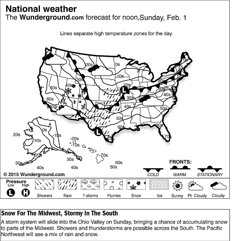
A storm gathering steam over the southern Rockies is expected to dump up to a foot of snow on parts of the Midwest and perhaps even more on Boston, which is still recovering from a winter walloping it received just a few days ago. It's also bad news for those planning to drive to Super Bowl parties.
Here's the outlook:
___
THE STORM
National Weather Service meteorologist Ricky Castro said the storm is expected to move into the Midwest on Saturday night and last through Sunday. He said it will be the most widespread storm of the season, thus far, dumping a significant amount of snow on swath of the country from Nebraska to Maine.
It's also forecast to be unusually slow-moving, meaning accumulations of between 5 to 12 inches are possible for parts of Iowa, northern Illinois, Indiana and northwest Ohio. Similar amounts of snow are expected for the Northeast on Monday with 10-14 inches forecast for Boston.
"This is going to be a very high-impact storm for a large swath of the eastern half of the country," Castro said.
___
SUPER BOWL PARTY SPOILER?
This storm could make road travel hazardous for those heading to and from Super Bowl parties. In the Midwest, especially, the most intense period of snow is forecast to hit right around game time on Sunday. Combine that with potential wind gusts of up to 40 mph and drivers could face terrible visibility and snarling snow drifts. The good news for those living near public transit is that the storm is not expected to be rough enough to shut down train traffic.
___
NOT AGAIN!
Parts of New England are still recovering from a blizzard that threw down a record 34.5 inches of snow in the central Massachusetts city of Worcester, where dump trucks and front-end loaders had to be brought in to move snow. The Monday and Tuesday storm hit Boston with 24 inches, and Providence, Rhode Island, had about 19 inches.
Another foot or so could spell particular trouble for snow-clearing operations in Boston's narrow streets.