LOS ANGELES (AP) - A powerful storm hit California with the first in a new series of rainstorms moving across the northern half of the state while the south awaited a rains that forecasters said could be the strongest in years if not decades.
Rain, accompanied by heavy winds, pelted the San Francisco Bay Area, where Marin and Napa counties logged up to an inch of precipitation. San Francisco recorded 1.67 inches for the day, according to the National Weather Service. In Northern California, officials monitoring the stricken Oroville Dam said they were confident the reservoir would handle runoff from the storms because releases have been lowering the lake's level since its spillways were damaged last week, prompting mass evacuations. People are now back in their home but warned to be ready to leave at a moment's notice.
Precipitation also moved down the Central Coast counties, but forecasters said it was only a light precursor to a dangerous atmospheric river taking aim at Southern California.
The plume of moisture stretching far out over the Pacific was expected to arrive early Friday and last through the day and into Saturday.
Flood warnings for the period were in effect for rivers and creeks up and down the state. High wind warnings were issued for mountains and valleys, which could see gusts to 70 mph.
"The storm looks to be the strongest storm to hit southwest California this season," the National Weather Service office for the Los Angeles region wrote. "It is likely the strongest within the last six years and possibly even as far back as December 2004 or January 1995."
Rainfall predictions ranged from 2 inches to 6 inches on the coast and from 5 inches to 10 inches in foothills and coastal mountain slopes.
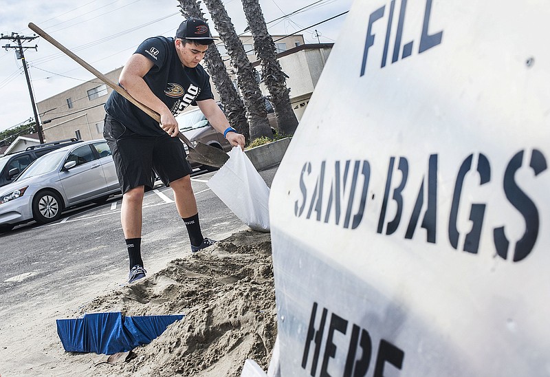
Jerry Rootlieb piled sandbags in front of the white wooden gate at his waterfront house in Seal Beach, saying it may not be enough to keep water from inside his house.
"I'm hoping it doesn't get that bad, but if we get 3 inches or more, it'll be higher than those sandbags," Rootlieb told KTTV-TV. "I'm concerned."
With soil already saturated from significant rains this winter, forecasters warned of potential for flash floods and debris flows, especially near areas left barren by wildfires.
The city of Duarte, in the foothills of the San Gabriel Mountains east of Los Angeles, ordered evacuation of 180 homes below a burn scar by 7 a.m. Friday.
Powerful winds capable of downing trees and powerlines were also expected, along with heavy snow in Southern California's mountains.
Cal Poly, the state university in San Luis Obispo, was keeping an eye on an unstable hillside near a dormitory housing 275 students. A protective barrier was set up and some trees have been removed but students were being told to be ready to evacuate.
Santa Anita Park near Pasadena canceled all its horse races for Friday, and golfers at the PGA tour's annual stop at Riviera Country Club were unlikely to get more than a few holes in amid the storm.
Pasadena cancelled Saturday's annual Black History Month parade, citing public safety concerns including possible lightning strikes.
In Northern California, officials monitoring the stricken Oroville Dam on the Feather River said Thursday they were confident the its reservoir would handle runoff from the storms because ongoing releases have been lowering the lake's level since its spillways were damaged last week.
The Sacramento weather office said models were trending stronger for a system arriving Sunday night and Monday in the northern part of the state due to a tap of deep moisture over the Eastern Pacific that could bring 24 to 30 hours of moderate to heavy precipitation.
Rainfall predictions in that region's foothills and mountains ranged from 3 inches to 10 inches.
"Needless to say, impacts from the increased runoff, wind and heavy snow will be considerable," the weather service said.