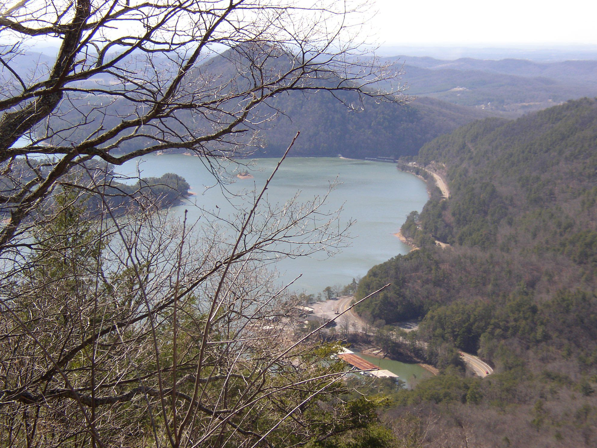
 Cherokee National Forest overlook on Chilhowee Mountain above Parksville Lake.
ABOUT THE MAPThe Cherokee National Forest Adventure Map sells for $4.95 and will be available at Walmart stores in the 10 counties that contain portions of the Cherokee National Forest -- Monroe, McMinn and Polk counties at the southern end of the forest; Sullivan, Johnson, Washington, Carter, Greene, Unicoi and Cocke counties at the northern end.
The waterfalls, roadside attractions and day hikes of the Cherokee National Forest are the focus of a new map designed to make it easier for visitors to enjoy Tennessee's largest tract of public land.
At 650,000 acres, the Cherokee National Forest actually covers more of East Tennessee than the Great Smoky Mountains National Park. With user-friendly graphics and a simple design, the new "Cherokee National Forest Adventure Map" takes this 10-county region of the Southern Appalachians and highlights the natural and historical features most likely to appeal to families and first-time visitors.
"This is a beginner's guide to the Cherokee National Forest," said Doug Byerly, recreation program manager for the Cherokee National Forest. "It's designed to lead people to features that are in a day's reach. I think it's our job to connect people to these places, and this map makes that easy."
The Cherokee National Forest Adventure Map sells for $4.95 -- about half the cost of conventional topographic maps.
Todd Clark, manager of Rock Creek Outfitters in Chattanooga, said the Cherokee National Forest is a popular destination for local folks.
"We get a lot of people coming in, headed over to that area," he said, noting the higher peaks are a draw. "Up there, you actually feel like you're hiking toward the top of something."
All proceeds from map sales go to Partners of the Cherokee National Forest, a nonprofit organization that advocates for the forest.
Clark said he'd consider stocking the map at Rock Creek Outfitters.
"We'd be willing to take a look at it, if it's something that gets people outdoors," he said.
The map was designed by User Friendly Maps of Knoxville. In addition to thumbnail descriptions of each site, it includes GPS coordinates as well as general background information on the Cherokee National Forest.
The idea of the map came from Cleveland, Tenn., Walmart employees, who for five years have volunteered on landscaping and cleanup projects in the Ocoee District of the forest.
One day, the employees asked if there was a map that highlights the forest's scenic and recreational points of interests, which led to the development of the new map.
Some of the money to print the maps came from Walmart stores located in the East Tennessee counties contained in the Cherokee National Forest.
Gary Schneider, president of Partners of the Cherokee National Forest, said the goal is to get the new maps in retail stores soon.
"The national forest spent a lot of time identifying the features the average family would enjoy," Schneider said. "The map should fit a niche and hopefully make a little money that will be reinvested back in the Cherokee National Forest."
Staff writer Tim Omarzu contributed to this story.