 Motorists on Interstate 40 pass over the rising Mississippi River as the sun set over downtown Memphis on Thursday. Flood waters are expect edto reach record levels by next week.
(AP Photo/The Commercial Appeal, Mark Weber)
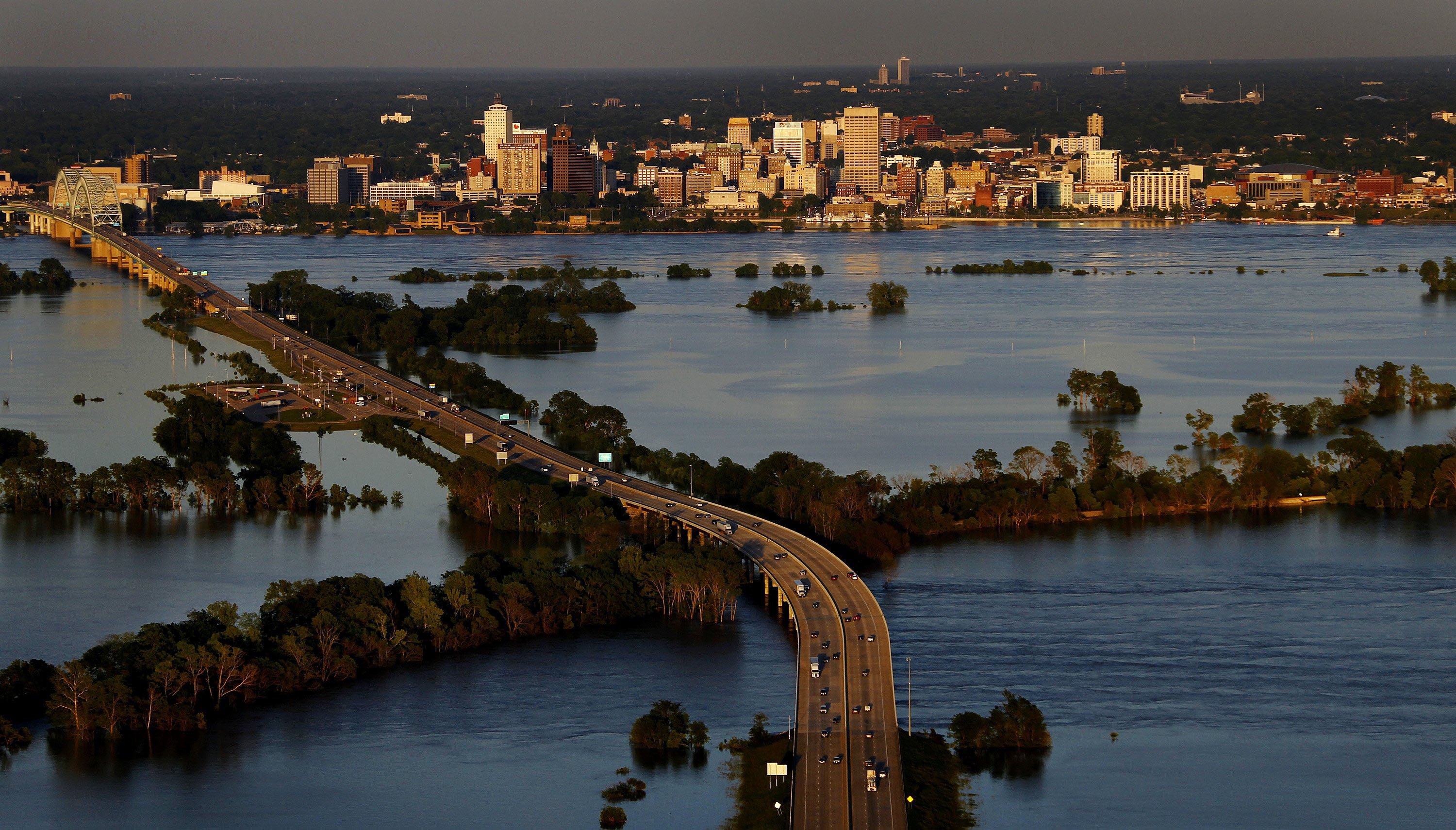
Motorists on Interstate 40 pass over the rising Mississippi River as the sun set over downtown Memphis on Thursday. Flood waters are expect edto reach record levels by next week.
(AP Photo/The Commercial Appeal, Mark Weber)Even as residents of Southeast Tennessee, Northwest Georgia, Northeast Alabama continue the effort to assess their losses and to regain a sense of normalcy in the wake of a record-breaking string of tornadoes on April 27, those who reside in Memphis and in other communities along the Mississippi River are struggling to cope with another natural disaster. Water at near or above record levels continues to menace that city, and is expected to threaten communities downriver for days and perhaps weeks to come. The effort to save life and protect property in the flood-ravaged and flood-threatened region continues.
The battle against the high water has been marked by both success and failure. Few lives have been lost, thank goodness, but property loss is immense, and growing. Land inundated currently is measured in the hundreds of thousands - or more - of acres. That total is sure to increase as the surge of water heads toward the Gulf Of Mexico. The Amy Corps of Engineers and other agencies are doing what can be done to mitigate harm, but there's little way to know for sure if those efforts will be fruitful.
The current floods are caused, in large part, by heavy snowmelt and rainfall during the last few weeks along the Mississippi and its tributaries. During one two-week period, meteorologists say that about 600 percent more precipitation fell in the region than normal. Consequently, a bulge of water is now moving down the Mississippi. The river is so high that many of its tributaries are overflowing because there is not enough room in the Mississippi for them to drain. The current flooding is the result.
Water in the river, according to a Corps of Engineers officer, was moving by Memphis at about 2 million cubic feet per second. That's enough, he said, to fill up a football field 44 feet deep in one second. By Monday afternoon, the river at Memphis was at or near 48 feet and expected to crest late in the day or early Tuesday just below the record 48.7 foot mark set in 1937. And while levees and floodwalls in and around the city seemed to be doing their job, high water still has crippled large parts of the community and threatens even more. Water had reached one end of world-famous Beale Street by Monday and threatened to advance. The situation was more dire elsewhere in the city.
Many homes in low-lying areas were under water, their residents living in shelters or with friends and relatives. The possibility of additional evacuations remains high. The crisis in and around Memphis will ameliorate somewhat in coming days as the wall of water moves downstream. Federal and Mississippi and Louisiana officials are preparing for the onslaught.
Monday afternoon, for example, authorities opened floodgates north of New Orleans to divert water and to reduce pressure on levees in populated areas. That's part of preparedness procedures that include moving some people to higher ground and to safeguard infrastructure, including water treatment, sewage and power plants. Officials believe those steps will help avert catastrophe, but given the capriciousness of the river no one can be certain that will be the case.
The truth is that the levees and other flood management structures and policies along the Mississippi River have been in place since the great floods of the 1920s and 1930s. In many instances, they've proved useful in averting disaster. In a few, they have not. The current flooding along the Mississippi and its tributaries is another test that pits man's engineering expertise against topography and the powerful forces of nature. In those confrontations, the outcome is never certain.