

Read moreSnow brings fun, inconvenience and a chance for added hospitality
Most recent Chattanooga snowfalls of more than 7 inches:• Jan. 10, 2011: 8.4 inches• March 13, 1993: 18.5 inches• Jan. 7, 1988: 10.2 inches• Jan 29, 1966: 8.4 inches- Source: Morristown, Tenn., office of the National Weather ServiceSnowfall totals for Feb. 12-13Tennessee• Chattanooga: 7.2 inches• Athens: 6 inches• Soddy-Daisy: 8 inches• Ooltewah: 7 inches• Newfound Gap, a 5,048-foot-elevation mountain pass near the center of the Great Smoky Mountains National Park: 16 inchesGeorgia• Lookout Mountain: 10 inches• Trenton: 5 inches• LaFayette: 7 inches• Summerville: 6.8 inches• Dalton: N/A• Ringgold: 10 inchesAlabama•Scottsboro: 2 inches• Rainsville: 5.5 inchesSources: National Weather Service offices in Morristown, Tenn., Peachtree City, Ga., and Huntsville, Ala.
FRIDAY SCHOOL DELAYS AND CLOSINGS
Athens City Schools will be closed.Bachmann Academy will be on a 1-hour delay.Berean Academy will be on a 2-hour delay.Bledsoe County Schools will be closed.Bradley County Schools will be closed.Catoosa County Schools will be closed.Chattanooga Girls Leadership Academy will be on a 2-hour delay.Chattooga County Schools will be on a 2-hour delay.Cleveland Christian School will be closed.Cleveland City Schools will be closed.Cornerstone Christian will be on a 3-hour delay.Dade County Schools will be closed.Dayton City School will be on a 2-hour delay.DeKalb County Schools will be on a 3-hour delay.Etowah City School will be closed.Fannin County Schools will be closed.Georgia Northwestern Technical College (all campuses) will open at 9 a.m.Gordon County Schools will be closed.Greater Collegedale School System will be on a 1-hour delay.Hamilton County Schools will be closed.Jackson County Schools will be on a 3-hour delay.Marion County Schools will be closed.McMinn County Schools will be closed.Meigs County Schools will be closed.Murray County Schools will be closed.Oakwood Christian Academy will be on a 2-hour delay.Rhea County Schools will be closed.Sequatchie County Schools will be closed.Sweetwater City Schools will be closed.Union County Schools will be on a 2-hour delay.Walker County Schools will be closed.Whitfield County Schools will be closed. (staff should report by 10 a.m. if it is safe for them to do so)
OpeningsNorth Georgia Health District Office and all county health departments open at 9 A.M. on Friday.Georgia Department of Labor offices to reopen Friday following.
Meteorologists don't like to call weather "weird" - but the rest of us can.
Chattanooga and the rest of the South have had a winter full of fits and starts.
January and February were about 7 degrees and 4 degrees colder than average, respectively, for the Scenic City area, and even saw single-digit midweek lows on Jan. 6-7. But that weekend, residents shed their coats and welcomed temperatures in the 60s.
Last month, a 1-inch snow snarled cities across the South and paralyzed Chattanooga. Nearly 8 inches of fluffy snow this week left roads slushy but passable. By midday Thursday, it was nearly all gone. Highs are predicted to reach the 50s Sunday and the 60s early next week.
What do the experts say?
"It's weather," said Derek Eisentrout, of the National Weather Service's Morristown, Tenn., office. "Normal" in the weather world is based on 30-year averages of data, he said.
"You have a lot of ups and downs and ebbs and flows in 30 years," Eisentrout said.
Meteorologist George Wetzel, of the weather service's Peachtree City, Ga., station had similar sentiments. Two recent snow storms - this week's and the one on Jan. 28 - that covered the Southeast were "strange, but not uncommon," he said.
"It's not typical," Wetzel said. "I'll definitely say that."
The bottom line is: February is a month of change, meteorologically speaking.
Paul Barys, chief forecaster for WRCB-TV, said February is when the jet stream, the prevailing wind in the upper atmosphere, is just starting to move north for spring and summer. That change in pattern shakes things up, creating warm and cold fronts in close succession, he said.
"There are little waves in the upper atmosphere, and February is usually an active month," Barys said.
In this week's case, that follows.
Chattanooga got 7.2 inches of snow overnight on Wednesday and Thursday.
That's way above the average annual snowfall of 3.9 inches since record-keeping began in 1879, according to the weather service.
Yet, Thursday afternoon temperatures soared to near 50 - closer to the average high of 54, Barys said.
Nevertheless, Hamilton County and other area schools were closed again today. Hamilton County has now used up its allocated seven snow days.
Barys' forecast of 3 to 5 inches was close to what actually fell. But the extra flakes were caused by an unexpected atmospheric event that started over Birmingham, Ala. It was a "mesolow," or what Barys described as a storm within a storm in the lower atmosphere, and it produced some extra precipitation.
That system moved gradually toward Chattanooga and added to the inch count, Barys said.
One traffic fatality
Governments handled Wednesday's storm much more proficiently than the one in late January.
Although a woman died in a car crash and a deputy was injured in separate accidents Wednesday, Sheriff Jim Hammond said overall the deep snow didn't wreak much havoc in Hamilton County compared to the 1 inch the area saw late last month.
"It went very well," he said. "Most people stayed off the roads [due to] all the advance warning and what folks saw happen last time."
Hammond said the fatal two-vehicle accident in the 11300 block of Highway 58, which also left three people injured, is under investigation. Police haven't determined what role the weather played.
"What we know is an SUV crossed the center line and hit a pickup truck. We don't know for sure if the weather was a cause," Hammond said.
The deputy lost control of his patrol car on Dayton Boulevard near Pine Forest Lane and struck a light pole, Hammond said. The officer suffered lacerations to his face and other injuries, but he was expected to recover, Hammond said.
The city of Chattanooga had just as much work to do this time as in January, but this time it wasn't playing catch up, according to Public Works Director Lee Norris. Overall, the event went much more smoothly, he said.
"At least we knew this one was coming. We had no idea the last one was coming. The other factor was the low temperatures we had at the end of January. It made that layer of ice [under the snow]," Norris said.
Crews in plow trucks worked through the night Wednesday to keep city roads clear, he said.
"We had our hands full keeping up with the snow," Norris said. "As soon as we cleared one road, we'd get a call that another one needed to be plowed."
Eventually, the city had to close some roads on Lookout Mountain, mainly because plows couldn't get past abandoned cars, he said.
And despite mass melting Thursday, the city isn't dropping its guard.
"We are going to leave the trucks set up and ready to go. I just got advance notice there's an outside chance of snow [tonight]," Norris said.
Much like in Chattanooga, road crews in unincorporated Hamilton County kept tabs on roads Wednesday night and much of Thursday morning.
"Our crews have been out and about. All our men are OK but tired," said county spokesman Mike Dunne. "We've been responding to some situations where there are trees down and removing trees where we can."
The county will continue to have all hands on deck through Friday, he said.
Some 25,000 EPB customers were left without heat because the heavy snow weighed down trees that took out power lines and - in some cases - knocked down utility poles.
"About 17,000 homes remain without power," EPB spokesman John Pless said around 5 p.m. Thursday.
EPB hoped to restore power to half of those 17,000 homes Thursday night and the remaining half today.
"Our goal is to have all the areas restored by Saturday," Pless said.
About 100 EPB and contract crews have been working throughout the day, and EPB is bringing in 90 more crews from nearby, including Georgia and Alabama, to help with the restoration.
That's still a fraction of the 1,900 out-of-the-area crews that EPB brought in to help restore power after the April 2011 tornadoes, Pless said.
He said 106 EPB fiber optic customers were left without service due to the snow storm.
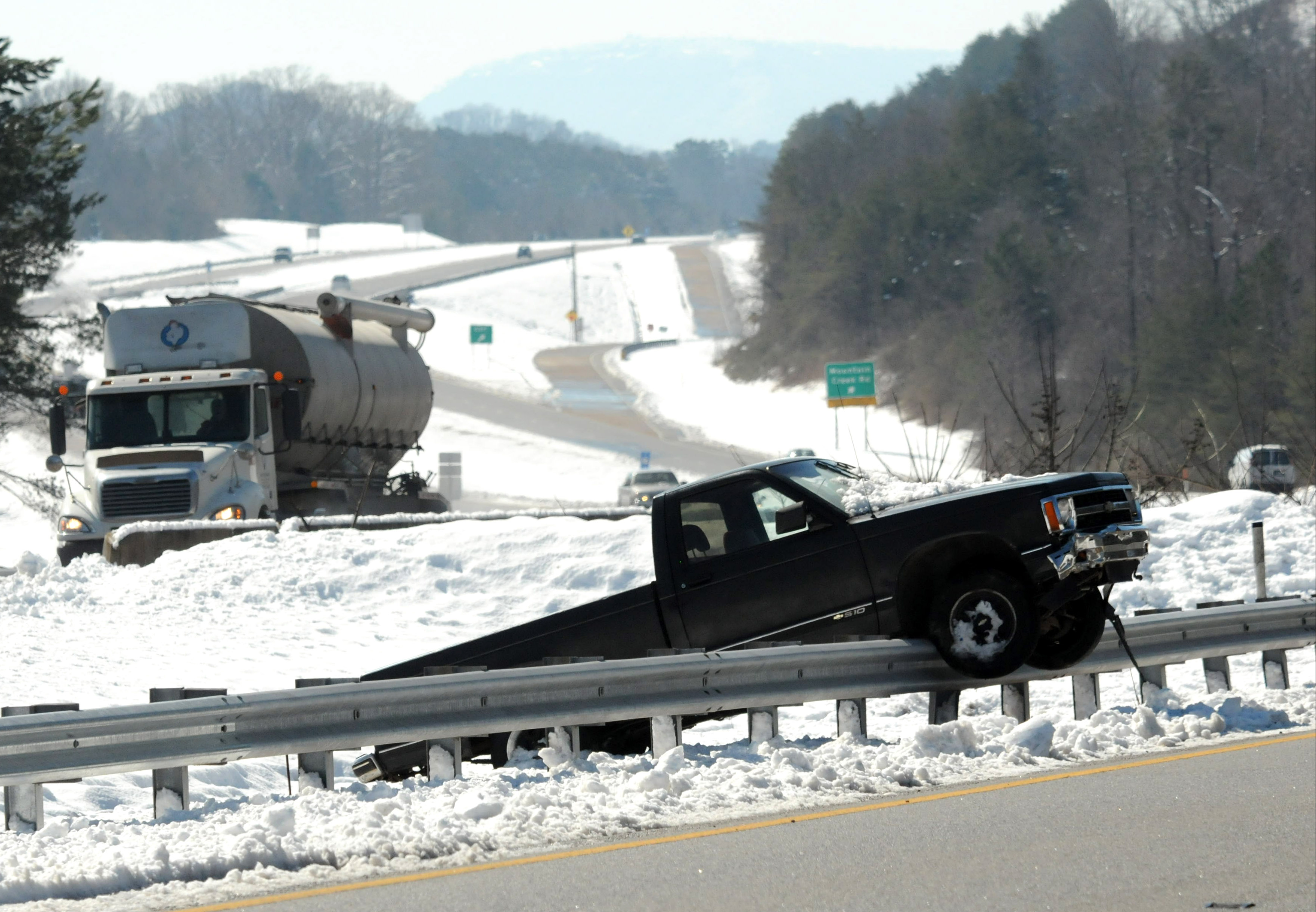 A Chevrolet pickup truck rests atop a guardrail Thursday morning on U.S. Highway 27, nine miles north of downtown Chattanooga. Lookout Mountain can been seen, above, in the distance.
Enough for a 'snurfew'
Whitfield County, Ga., residents were instructed to stay home during the storm under a "snow curfew." County Commission Chairman Mike Babb called the curfew.
"I've had more questions about that," Babb said Thursday afternoon. "We just put the curfew out there to emphasize that people don't need to be on the road."
Babb didn't think anyone had been cited or arrested due to the curfew.
"Not that I'm aware of," he said
Dalton snowstorm totals weren't immediately available Thursday afternoon, but Babb said county emergency management personnel said 6 to 9 inches fell on and around Whitfield County.
"I measured 9 inches on my picnic table," he said.
Historically, Chattanooga has only one day a year, on average, with more than 1 inch of snow.
But the Wednesday night storm did not bring record-breaking snowfall.
The most snow measured in one day at Lovell Field was 18.5 inches that fell on March 13, 1993. That season had 22.7 inches of snow - well above the 8.4 inches we've logged this winter.
During the 135 years records have been kept, snowfalls of more than 7 inches have occurred 16 times - or about 11 percent of the time, said Eisentrout.
"Sixteen times we've had occasions where it has [snowed 7 inches in a day] since 1879, Eisentrout said.
This storm's snowfall only reaches 7.2 inches in Chattanooga when Wednesday's and Thursday's totals are combined.
On Thursday, 100 percent of the Southern Appalachian region was covered with snow, with an average depth of 8.4 inches and a maximum of 19.1 inches, according to what bills itself as "the ultimate source for snow information" - the National Weather Service's National Operational Hydrologic Remote Sensing Center in Chanhassen, Minn. It gathers "daily ground-based, airborne, and satellite snow observations from all available electronic sources," according to its website.
The Southern Appalachian region includes the Chattanooga area. It consists of parts of North Georgia, East Tennessee and West Virginia, and western North Carolina and Virginia. Last month, less than 1 percent of the region was snow-covered, according to the remote sensing center.
Contact staff writer Louie Brogdon at lbrogdon@timesfreepress.com or at 423-757-6481.
Contact staff writer Tim Omarzu at tomarzu@timesfreepress.com or 423-757-6651.