A group of neighbors may not be able to stop a new development near Hixson Pike's S-curves. But they will get one more chance to limit what they say could add danger to an already hazardous stretch of road.
And their words are bolstered by a new, city-paid traffic study that confirms some of their fears.
Residents of the Stuart Heights, Olde Towne and River Knolls neighborhoods have been concerned since December when the Regional Planning Agency approved a preliminary plat for a 35-lot, 14.76 acre development called River Oaks that would sit between the three neighborhoods.
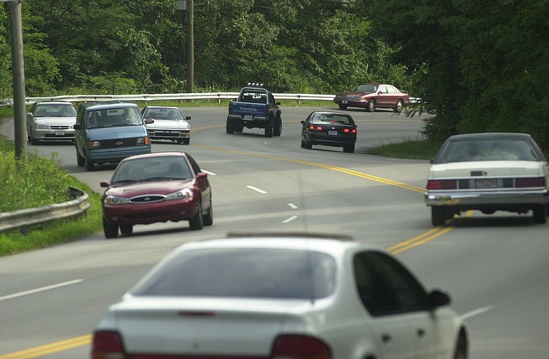
Their concern is the new development will add problems to an area of road that already is plagued by poor visibility and heavy traffic.
The neighbors commissioned a traffic study that found the developer's plans to connect a new road, River Summit Drive, to Hixson Pike from Braly Place and near Olde Towne Lane would create traffic hazards.
Get involved
Planning officials are holding a meeting to address concerns at 6 p.m. Thursday at Cross of Christ Lutheran Church, 3204 Hixson Pike.
The developer, Lamay Development Co., then paid for its own traffic study that said the development was totally safe.
To settle the dispute, the city contracted a third, independent study. And it seems to agree with the neighbors.
The study by WMB Engineering says the existing intersection at Braly Place and Hixson Pike, which Lamay wanted to use, already is dangerous because of lack of visibility and limited road shoulders. A proposed intersection Lamay hopes to build is dangerous for the same reasons and would be too close to other intersections, the WMB study says.
The study recommended that Lamay avoid Braly Place and use Olde Towne Lane to access the subdivision.
The company that did Lamay's study, Meyer Transportation Consultants, responded by suggesting using Olde Towne Lane to access the subdivision. It also asked for a radio-controlled gate for emergency vehicles to enter from Braly Place.
But Joe Cofer, who lives on Braly Place and has been a spokesman for the neighborhoods, said even using Olde Towne is infeasible, because Lamay Development doesn't own a critical piece of property that would allow access.
The WMB report also found that the city shouldn't have competing traffic studies in the future.
"I doubt that 'battling' TIS reports is typical for development in the City, but it would be helpful if the City could standardize the process by providing Traffic Impact Study guidelines for future developments in the City so the process could be more uniform in the future," according to the report.
Chattanooga spokeswoman Lacie Stone said Thursday that city transportation officials are still reviewing the new traffic study, including the suggestion to standardize traffic study guidelines.
Contact staff writer Louie Brogdon at lbrogdon@timesfreepress.com, @glbrogdoniv on Twitter or at 423-757-6481.