
Rainfall in Chattanooga Monday set a new record, and some parts of North Georgia saw more than 5 inches as a rainy weather system hovered over the region. Rain was expected to soak the area again this morning.
Urban intersections were turned into ponds and low-lying rural areas became lakes as torrential downpours fell across the region over the past two days.
Lingering heavy rain at the Chattanooga airport between midnight Sunday and midnight Monday set a new record at 3.41 inches for the date, WRCB-TV Channel 3 meteorologist David Karnes said Tuesday. Heavy rain that fell after midnight early Tuesday only added to that amount.
 Caution tape lies across a puddle in the parking lot across from Ridgedale Baptist Church along Hickory Valley Road Tuesday, September 25, 2018 in East Brainerd, Tennessee. Rain is expected to loom in the Chattanooga area until Friday.
FIVE-DAY FORECAST
WednesdayThunderstorms, 87 percent chance of precipitationHigh: 67 | Low: 65ThursdayThunderstorms, 84 percent chance of precipitationHigh: 76 | Low: 67FridayScattered thunderstorms, 80 percent chance of precipitationHigh: 80 | Low: 65SaturdayScattered thunderstorms, 77 percent chance of precipitationHigh: 81 | Low: 65SundayShowers late, 75 percent chance of precipitationHigh: 82 | Low: 66Sources: WRCB-TV Channel 3, the National Weather Service
"It was pretty much record-shattering rainfall," Karnes said. "The old record was 1.7 inches back in 1991."
Eastern Hamilton County and Western Bradley County had 2.5 to 3.5 inches of rain, and the same was true in North Georgia from Ringgold down to LaFayette, he said.
But south of Chattanooga, where Georgia's Whitfield, Gordon and Murray counties meet, more than 5 inches of rain fell Monday, Karnes said. Portions of Walker County also got 5 inches or more.
And in the hours leading up to today's rush hour, "we're looking at 1 to 2 more inches of rain that's going to potentially create some more flooding issues," Karnes said. "I'd say it's going to be a pretty nasty commute."
The drenching bumps rainfall tallies to above average.
"That gets us into a nice surplus for the month," Karnes said, "and now a big surplus for the year."
He said rain for the month so far stands at 4.78 inches, about 1.6 inches above average for September.
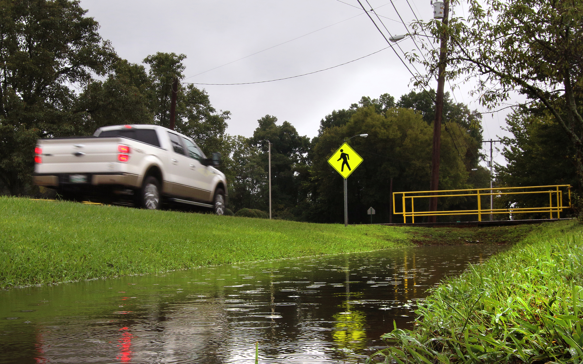 The drainage ditch along Hickory Valley Road at Ridgedale Baptist Church fills with rainwater Tuesday, September 25, 2018 in East Brainerd, Tennessee. Heavy rains Wednesday are expected to bring one to two inches more rain.
 "We have also seen 44.51 inches for the year, which is 6.07 [inches] above average for the year," he said.
When record rains in late February caused widespread flooding in the tri-state region, the Tennessee Valley Authority had to manage the flow to offer relief to some areas.
Likewise, the heavy rainfall has caused the Tennessee Valley Authority to begin spilling water over Nickajack, Guntersville, Pickwick and Kentucky dams downstream from Chattanooga, while the Chickamauga dam is running at full-generation capacity to keep the water moving without spilling it and raising water levels, TVA spokeswoman Malinda Hunter said Tuesday.
"Right now, they don't have any plans for spilling at Chickamauga," Hunter said.
TVA officials are keeping in close contact with Ironman officials on the potential impact for this weekend's Ironman triathlon event, she said. The swimming portion of the event is held downstream of the Chickamauga Dam in front of the Tennessee Riverwalk downtown.
"We work with the TVA every year to control water flow and will continue to monitor throughout the week," reads a Tuesday evening statement from Ironman spokesperson Tayva Sammet. "At this time all events are scheduled as planned."
Despite the standing water around Chattanooga, the rains will help some drier areas of the tri-state area.
In Tennessee, the U.S. Drought Monitor reported last week no problems in the Chattanooga region counties of Bledsoe, Bradley, Grundy, Hamilton, Meigs, Polk, Rhea or Sequatchie counties. But Marion, Franklin and other Middle Tennessee counties were abnormally dry. Decatur, Hardin, McNairy and Wayne counties are experiencing moderate drought.
The monitor report was issued Sept. 20 and considered rainfall occurring up to Sept. 18.
In Alabama, almost all of Jackson County is experiencing moderate drought, and the rest of the northern half of the state is abnormally dry as far south as Birmingham. A sliver of moderate drought also cuts across Lauderdale and Colbert counties in the northwestern corner of the state.
In Georgia, Dade County is shown as abnormally dry, with a small area of moderate drought shown in the middle of the county. Abnormally dry conditions also are shown in Chattooga, western Walker, Floyd, Bartow, Polk and a couple of other Northwest Georgia counties. Other areas of central Georgia had moderate drought and abnormal dryness and some coastal counties also were abnormally dry.
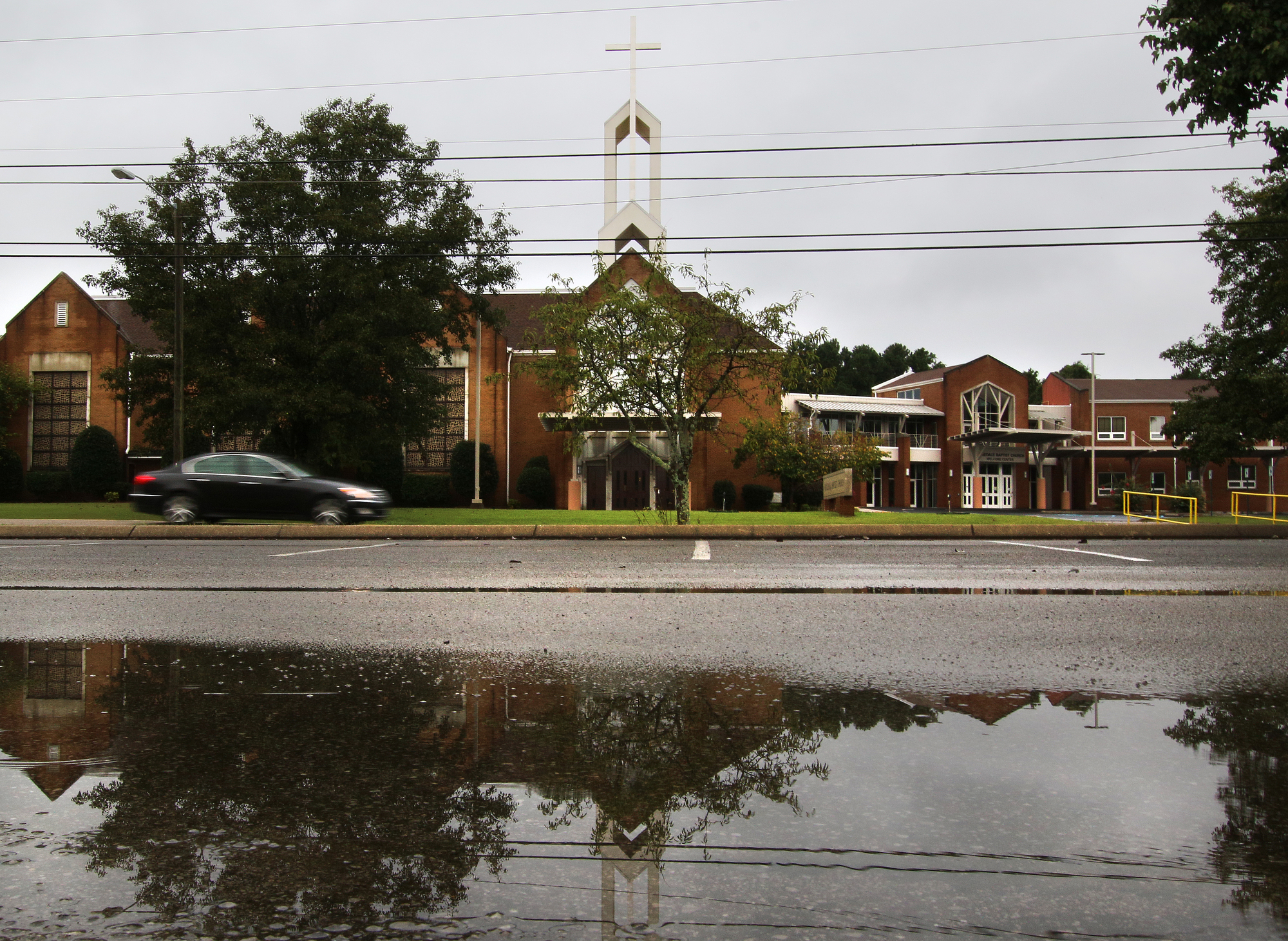 The parking lot across from Ridgedale Baptist Church has several large puddles Tuesday, September 25, 2018 in East Brainerd, Tennessee. Rainfall in Chattanooga area Monday set a new record.
As September ushers in autumn, people start making plans to see fall colors across the region.
Karnes said rainfall doesn't have the impact some might think.
"Wet weather doesn't really help or hurt with the foliage colors," he said.
"During September and October, when the leaves are changing naturally, the foliage colors can be enhanced by sunny days and cool nights," Karnes said. "Rain at this time can actually hurt, as it may knock leaves off of trees before they have a chance to turn."
Contact staff writer Ben Benton at bbenton@timesfreepress.com or 423-757-6569. Follow him on Twitter @BenBenton or at www.facebook.com/benbenton1.