YEAR-TO-DATE RAINFALL CHATTANOOGA
August: 1.72 inches (normal 3.48 inches)July: 4.86 inches (normal 4.91 inches)June: 4.46 inches (normal 4.05 inches)May: 5.94 inches (normal 4.1 inches)April: 4.35 inches (normal 3.99 inches)March: 5.97 inches (normal 4.98 inches)February: 11.3 inches (normal 4.84 inches)January: 7.0 inches (normal 4.91 inches)Source: National Weather Service
When the mercury under a cloudless sky rises above 93 or so, the Chattanooga region feels like a bright, sweltering sauna where even the slightest breeze brings desperately sought relief.
A record high of 103 degrees was set Friday as most of the city lost its water supply with a water main break Thursday night that caused problems that lingered through the weekend. People were warned to boil drinking water and not to water lawns or plants.
The first day of fall is still just a week away, but the sweat machine in the Chattanooga region won't relent anytime soon with daily highs expected to be above 90 until Thursday and a drier-than-normal trend across the region.
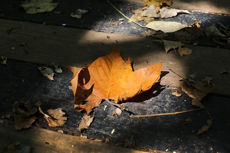
That means fall's leaf colors are still up in the air depending on the weather, according to forecasters and city officials.
WRCB-TV Channel 3 Chief Meteorologist Paul Barys said dry weather in September has the Chattanooga region more than 1.5 inches below normal rainfall for the month and each day without significant rain increases that deficit.
"It's about as dry as it can be," Barys said. "October is usually the driest month of the year."
5-DAY FORECAST
MondayMostly sunnyH 95L 67TuesdayMostly sunny with 10% chance of rainH 96L 70WednesdayMostly sunny with 10% chance of rainH 91L 72ThursdayMostly sunny with 10% chance of rainH 86L 69FridayPartly cloudyH 87L 64Source: WRCB-TV Channel 3
The impact on leaf color could depend on that trend, Barys said, noting the dry weather has been tough for trees.
"What I tell people is if the sky is blue, the leaves pop, if it's cloudy, no matter how pretty the leaves are they don't look as good," Barys said last week.
Weekend meteorologist Alison Pryor said Sunday that those afternoon and evening showers popping up recently are just helping a few people over the short term. The trend for the region is still dry with little improvement on the horizon, she said.
"We're going to be looking at temperatures Monday and Tuesday that I'm forecasting in the mid-90s, so it's going to be 10 degrees above normal or more," Pryor said.
By Thursday, "it'll dip down to the mid-80s," she said. "Closer to normal, but the average is 84 and we're going to be at 86 Thursday."
Last Friday's record high was also the second-highest recorded temperature for the month since Sept. 5 and 7, 1925, when the mercury marked 104 degrees for those two days. Climate records for Chattanooga go back to 1879, Pryor said.
Gene Hyde, Chattanooga Public Works city forester, said the level of leaf color across the Chattanooga region will largely depend on what happens going into fall, but the hot, dry weather over the summer has hurt some trees.
"It's been very, very dry and I'm seeing a lot of trees going to early dormancy currently; some are dropping a fair amount of leaves and they could have an impact on the color," Hyde said. "It's kind of hard to predict sometimes from the standpoint that there's so many factors that play into fall color."
Spring's leaves already have pigments that produce orange, yellow and brown colors but those are overshadowed most of the season by the green of chlorophyll until fall and the chlorophyll is used up, revealing the other colors, Hyde said.
Leaves that turn to shades of red and purple have pigments that don't form those colors until fall in the presence of cool temperatures and bright sunlight, he said. Fall weather will dictate how vivid the color is.
"A lot of the colors, particularly the reds and the purples, those are dependent on the kind of weather we're going to have from now on into October," Hyde said.
"If it's very overcast and warm and wet, then the fall color's predominantly yellow, brown and orange," he said. "If we have some nice, cool weather where we have cool but not freezing nights, electric blue skies during the day, that facilitates the reds and the purples."
Predictions?
"I can describe what goes into this, but Mother Nature has the final say," Hyde said. "Typically, the peak time is around the last week of October, the first week of November."
According to the U.S. Drought Monitor issued Sept. 12, the Chattanooga region and a few counties in extreme northeast and central Tennessee are experiencing dry conditions. Moderate drought is indicated in Tennessee in a wide swath across Hamilton County and the north end of Bradley County, with abnormally dry conditions extending in all directions into Marion and parts of Franklin, Meigs, Polk, Rhea and Sequatchie counties.
In the Georgia portion of the Chattanooga region, only the north end of Dade County was indicated in the abnormally dry category, while a number of central and eastern Georgia counties are experiencing moderate and/or severe drought, according to the drought monitor. In Alabama near Chattanooga, both DeKalb and Jackson counties are abnormally dry, with a large portion of Jackson in moderate drought. Alabama counties farther south are dry, too.
For those considering a fall color trip to the Great Smoky Mountains National Park, Cherokee National Forest and other fall color targets in the Appalachians, the National Weather Service says most of East Tennessee will remain warm and dry for the next couple of weeks or more, so nothing's certain yet.
"Generally speaking for the year, most of the region is above normal in terms of rainfall but the last couple of months have been drier, for sure," weather service meteorologist Charles Dalton said of the eastern end of the state. Dalton works in the Morristown office.
"There's really no relief in sight in terms of the heat," he said.
The National Weather Service Climate Prediction Center "has a pretty high chance of continued above-normal-high temperatures and below-normal rainfall for the next three or four weeks' time frame," he said.
Barys and Dalton said forecasters are watching a tropical weather system east of the Bahamas that could potentially bring rain, but it's too far away to know for sure which direction it'll end up going.
Contact Ben Benton at bbenton@timesfreepress.com or 423-757-6569. Follow him on Twitter @BenBenton or www.facebook.com/benbenton1.