A flash flood watch continues for southeast Tennessee and north Georgia Tuesday, but the area will see a slight break in the rain this morning and through the afternoon, according to our news partners at WRCB.
Although, the risk of flooding continues throughout the day and more showers will start this evening and be lighter than we have experienced in the past week.
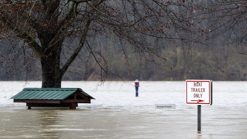
In Tennessee, Hamilton, Bradley, Sequatchie, Bledsoe, Rhea, Meigs, McMinn and Marion counties are in a flood watch until Tuesday evening. In Georgia, Dade, Walker, Catoosa, Whitfield, Murray, Chattooga and Gordon counties are in a flood watch beginning Monday at 1 p.m. until Tuesday evening, according to the National Weather Service.
A flash flood watch means that conditions may develop that lead to flash flooding.
A flood warning continues until Thursday night for Lookout Creek affecting Dade and Hamilton counties, South Chickamauga Creek affecting Catoosa and Hamilton counties and Sequatchie River affecting Bledsoe, Marion and Sequatchie counties.
Several area school districts are closed Tuesday, including Hamilton County, Whitfield County and Bradley County schools. Hamilton County school-aged childcare locations will be open tomorrow from 8 a.m. to 6 p.m. at Barger Academy, Battle Elementary, Daisy Elementary, East Brainerd Elementary, East Ridge Elementary, McConnell Elementary, Harrison Elementary, and Red Bank Elementary.
Wednesday will be a little drier with some scattered showers, but late Wednesday night and into the early morning hours of Thursday the Chattanooga area will see heavier rain with about one to two more inches of rain expected, WRCB reports.
The biggest threats for the Chattanooga area currently are damaging winds of 50-60 mph, localized flooding and low risk for tornadoes.
Thursday, Friday and Saturday will be sunnier and drier but cooler with temperatures in the low 20s and high 50s.
The heavy rains - and nearly 3 inches of snow Saturday in Chattanooga - have raised river levels and currents so much that most barge navigation along the Tennessee River is shut down and is likely to remain idled for at least another week.