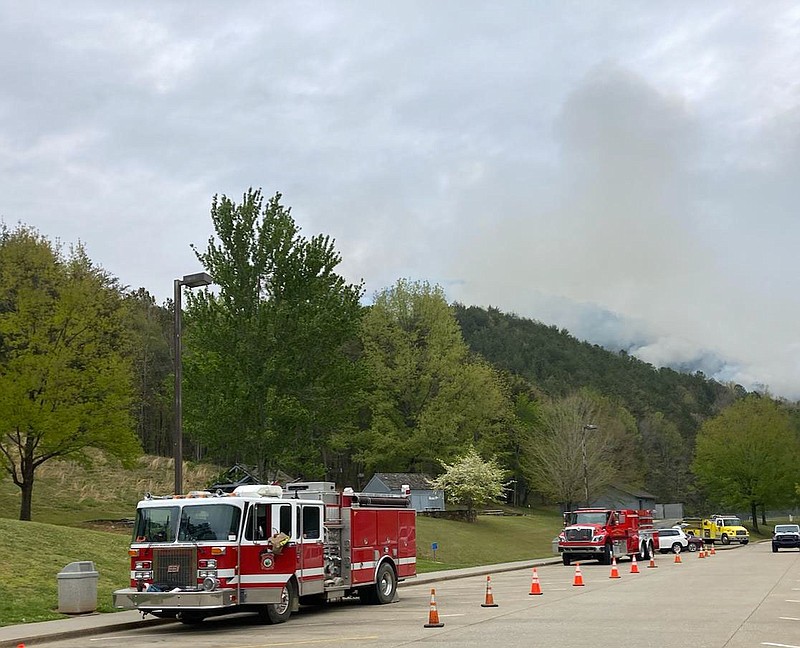
The rain poured on Saturday but the wildfires burning in large areas of the Cherokee National Forest in East Tennessee since last week are continuing to devour acreage.
The fires together have consumed at least 1,400 acres in the Cherokee National Forest, including a fire dubbed the "Long Branch Fire" southeast of Tellico Plains in Monroe County, the "Meadow Creek Fire" near Del Rio in Cocke County and the "Mill Creek Fire," also in Cocke County along the westbound lanes of Interstate 40, where it threatened multiple structures, U.S. Forest Service spokesperson Mary Miller said Monday.
The fire in Monroe County is human-caused, according to officials. Fire crews started fighting the Long Branch and Meadow Creek wildfires last week as officials attacked the blaze from the ground and air.
The Meadow Creek fire was contained over the weekend and is no longer significantly active, Miller said, but the other two continue to burn even after heavy rains on Saturday. The Meadow Creek blaze claimed about 120 acres near the Tennessee Visitor Center at the Tennessee/North Carolina state line.
"While the rain did help with control efforts, we are concerned about areas that may not have gotten rain and will continue to install containment lines," forest fire management officer Trent Girard said in a statement. Fire crews from the Tennessee Division of Forestry on Friday and Saturday established containment lines around endangered structures as they waited to see how much help came from the rain, officials said.
On Sunday, about 1,000 acres were continuing to burn in the Long Branch and Mill Creek blazes combined, officials said, with an estimated 700 acres consumed in Monroe County's Long Branch fire. Miller said that fire was about 75% contained late Sunday.
Crews and equipment as well as smoke may still be in the Cherohala Skyway area and could cause traffic delays, Miller said. The Long Branch Trail, trail #103 and the Hemlock Trail, trail #101, remain closed until they are considered safe for visitors, she said.
Affected communities should remain aware of smoke advisories and conditions, she said. Find the current air quality nearby at airnow.gov.
It's been less than 5 years since wildfires burned almost 18,000 acres in the Gatlinburg area of the Great Smoky Mountains National Park in 2016, claiming 14 lives and injuring at least 200 people.
In 2020, more than 10.1 million acres burned across the U.S., setting a record for acres burned since accurate recording and data gathering began, according to officials. Between 1983 and 1992 wildfires burned an average of 2.7 million acres per year. The 10-year average for the number of acres burned is about 6.8 million acres per year and the trend is increasing, officials said.
Contact Ben Benton at bbenton@timesfreepress.com or 423-757-6569. Follow him on Twitter @BenBenton or at www.facebook.com/benbenton1.