The Hamilton County Commission last week approved new district boundaries based on 2020 census data, adding two districts to the county's current nine - but there is more that residents need to know about how their districts will be changed.
Pending final approval of the maps by the state, the new District 10 will sprawl along the eastern border of the county, including Collegedale and Georgetown. It will also include the areas surrounding Ooltewah's elementary, middle and high schools.
The new district is carved from existing districts of Commissioner Steve Highlander and Commission Chair Sabrena Smedley, both Ooltewah Republicans.
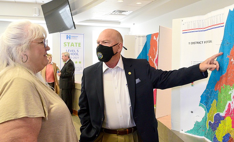
The new District 11 will sit in the southwestern corner of the county. It will include Lookout Valley and Lookout Mountain. Further east, it will also include the area surrounding Chattanooga's Asbury Park Street.
District 11 is being formed from the existing districts of Commissioners David Sharpe, D-Chattanooga, and Warren Mackey, D-Lake Vista.
County Mayor Jim Coppinger and the county's mapping department referred the Times Free Press to individual commissioners for details of how the mapping played out for their areas. According to them, here's how the nine existing districts are being realigned to make way for the two new ones:
District 1 (Randy Fairbanks, R-Soddy Daisy)
The current lines of District 1 include portions of areas such as Sale Creek, Soddy-Daisy and the northern tip of Chattanooga. The district will shed Mowbray Mountain, Flat Top Mountain and North Woods, which will join District 2, Fairbanks said.
"I didn't have any gains," Fairbanks said. "All I did was lose."
(READ MORE: Hamilton County commissioners approve adding two new districts to county map)
District 2 (Chip Baker, R-Signal Mountain)
District 2 includes portions of Falling Water, Signal Mountain and Red Bank. It also includes eastern Chattanooga. The main change with the new map is that the district as a whole shifted further north.
The more northern areas of the district include what Baker took from District 1 such as Northwoods and Flat Top Mountain. At the very northern tip of the district, communities along Highway 111 near Heiss Mountain Road, Reed Lane and Jones Gap Road will also be included in the new district.
Baker will lose a portion of northern Chattanooga, which houses communities near Route 27. He will also lose voters who live around McCahill Road, Oakland Terrace and Martin Road. Those areas will move to the new District 6, he said.
"[My district] changed significantly," Baker said.
District 3 (Greg Martin, R-Hixson)
District 3 includes portions of areas such as northern Chattanooga, Middle Valley, Lakesite and Hixson.
Martin said under the new map he also will lose voters in Hixson around Daisy Dallas Road, which is in the southern part of his district. That area will move into District 1.
In the northern part of his district, he will lose voters in the Northgate 1 and Northgate 2 precincts near Ely Road, which will be broken up into the new District 2 and District 6.
Martin described the changes as mild; he did not gain any new territory and the portion he lost accounted for 7,000 voters.
District 4 (Warren Mackey, D-Lake Vista)
District 4 includes areas such as Riverside, Highland Park and East Lake in Chattanooga.
In Mackey's district, he will split Glenwood with Katherlyn Geter, D-Ridgeside. Geter will get the east side, and Mackey will get the west side. The dividing line between the two areas will be Glenwood Drive.
The district was one of the trickiest to draw because the commission wanted to keep the majority of the population made up of minorities. If approved by the state, the new district will be comprised of 52% minority residents, Mackey said.
He added that it alsowill disenfranchise voters by breaking off Alton Park, Piney Woods and Oak Hill and moving them to District 5 - leaving many residents to question if their interests are being represented.
Smedley, the main point of contact for redistricting matters, said that District 4 and District 5 were confusing because of constant changes and she was therefore unaware how neighborhoods were broken up.
District 5 (Katherlyn Geter, D-Ridgeside)
District 5 includes all of Ridgeside and a portion of Chattanooga.
The district also was difficult for commissioners to map out, Smedley has said, with commissioners wanting to keep it a majority-minority district.
Geter did not respond to multiple requests for comment on Thursday and Friday, but during Tuesday's meeting, Geter said she will lose the area around Harrison Elementary School to District 9, leaving the district with only one elementary school.
She will also lose the western side of Wilcox Boulevard in Dalewood.
The district will now have a roughly 51% minority population under the new map.
District 6 (David Sharpe, D-Chattanooga)
District 6 includes municipalities such as Red Bank, Lookout Mountain and a chunk of southwestern Chattanooga.
The district will lose the entirety of Lookout Mountain and Lookout Valley with the new map, moving those areas into District 11.
Sharpe also will lose his Southside-area neighborhoods in Chattanooga, with voters north of Market Street moving to District 4. Everything south of Main Street will move to District 11.
On the other hand, Sharpe's district will also include the entirety of Red Bank rather than just a portion of it.
Sharpe said his district lines were drawn well, but he chalked many of the other aspects of the overall county map to racial gerrymandering that breaks up communities.
"I think it's a terrible map," he said.
District 7 (Sabrena Smedley, R-Ooltewah)
District 7 includes municipalities such as Apison, Collegedale and eastern Chattanooga.
Due to its large growth of about 28% over the past decade, the district will lose Collegedale, which includes voters near the areas of Ooltewah-Ringold Roads, University Drive, College Drive and Apison Pike. Those areas will be moved to District 10.
"At the end of the day, we came out with the best option," Smedley said, adding she will also lose the areas of the Cambridge Estates, Yorktown Estates and Yorktown Woods.
District 8 (Tim Boyd, R-Chattanooga)
District 8, which saw about 8% growth, includes all of East Ridge and a southern portion of Chattanooga.
Boyd will lose a portion of East Brainard with the new map, specifically the area surrounding East Brainerd Elementary School and the school itself. Those areas will move to District 7.
District 9 (Steve Highlander, R-Ooltewah)
District 9 includes Harrison and Ooltewah, as well as a portion of Collegedale.
With of growth of about 30%, the district will be split along Snow Hill Road and Highway 58 in the new map, moving the portion of the district east of Highway 58 into District 10 and leaving a significant chunk carved out of the current district, Highlander said.
A PDF file of the current map can be found at bit.ly/HamiltonCountyDistricts. The new map can be found at bit.ly/NewDistricts.
Contact Logan Hullinger by phone at 814-319-5158 or via email at lhullinger@timesfreepress.com. Follow him on Twitter @LoganHullinger.
Brought to you by gis.hamiltontn.gov/