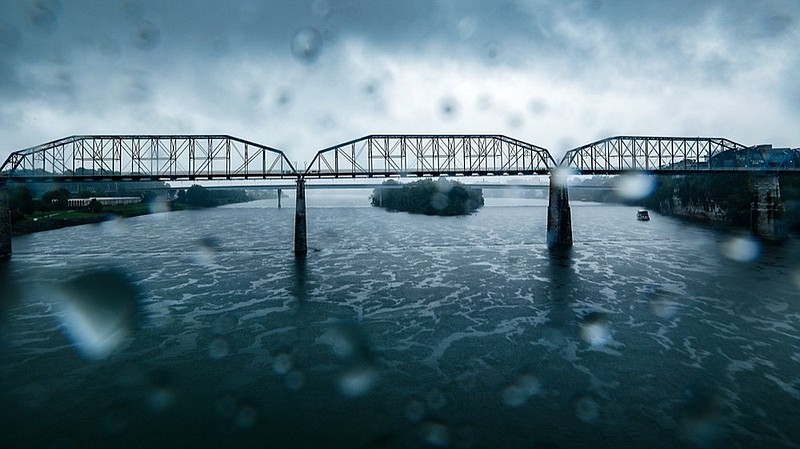
The remnants of Tropical Storm Fred and Hurricane Ida helped more than double the normal rainfall in August this year in Chattanooga, raising water levels in area streams and rivers and causing some localized flooding.
Chattanooga received nearly 11.5 inches of rain last month, including nearly 3 inches this week, as storms related to the Category 4 storm Ida that hit the Louisiana coast Sunday came through the area on the same date Hurricane Katrina ravaged Louisiana and Mississippi 16 years earlier.
Last month's rainfall total in Chattanooga was nearly triple the average of 3.67 inches for the month, making the month the second wettest August on record in Chattanooga. Only the 12.3 inches of rain that fell on Chattanooga in August 1920 was wetter for the month, National Weather Service records indicate.
"The two major tropical storm systems that came through this area last month caused this to be a very wet month," said Allan Diegan, a meteorologist at the National Weather Service office in Morristown, Tennessee. "It does look like after some drizzles and minor rain today [Wednesday] it should be fairly dry until Sunday."
The National Weather Service issued a flash flood watch for Chattanooga for Tuesday and Wednesday, but drier weather through the remainder of this week should relieve such flooding problems, officials said.
Despite roads being flooded in some low-lying areas, major rivers remained below flood stages this week.
The Tennessee Valley Authority, which manages the 652-mile Tennessee River to help limit flood damage, began drawing down reservoirs and preparing for heavy rains last week in anticipation of Hurricane Ida.
"We try to be ready for these storms by managing the reservoir system to push a lot of water out of the system ahead of all of this rain," said James Everett, manager of TVA's River Forecast Center in Knoxville. "Having lake levels lowered ahead of the storm is a key part of that."
In the western part of the TVA service territory, rainfall measurements totaled up to 5 inches this week in some places from the remnants of Hurricane Ida, Everett said.
TVA opened spillways to release more water through its dams, but the water flow was still well below levels that limit navigation on the river.
Across the Tennessee Valley, about 8 inches of rain fell during August, compared with a normal rainfall for the month of 3.9 inches, Everett said.
"It's been a very, very wet August," he said.
Although Chattanooga's overall rainfall so far in 2021 is about normal, across the entire Tennessee Valley rainfall is running about 9 inches above normal, according to TVA.
The extra rain last month created major flooding problems in Waverly, Tennessee, where at least 22 people died from flooding caused by more than 17 inches of rain. But across TVA's seven-state region, the extra rain this year has also boosted hydroelectric generation by about 20% more than normal, helping out the cheapest source of energy for the federal utility.
Last month was a typically hot August in Chattanooga with 15 days where the high temperature topped 90 degrees, according to the National Weather Service. The overall average high of 88.9 degrees was still slightly below the long-term August average of 89.8 degrees, however, Diegan said.
Contact Dave Flessner at dflessner@timesfreepress.com or 423-757-6340.