Bundle up Chattanooga.
Forecasters are predicting rain, sleet and snow across the Chattanooga region Thursday and some of the coldest weather in the past five years Thursday night, but the dividing line for rainy or snowy conditions will determine which areas will have the most travel problems.
Hamilton County Schools will be closed Thursday, the system said in a written statement Wednesday afternoon. System officials said they made the decision after consulting with the National Weather Service and local emergency management officials. All 12-month employees (those who work during the summer, as well as the academic year) will work remotely, the statement said, and school-aged child care locations will be closed.
"A wintry mix of rain, sleet and snow likely will be from late morning into the afternoon hours," WRCB-TV Channel 3 meteorologist Cedric Haynes wrote in his Wednesday afternoon weather blog. "This will still be a tricky forecast, as a degree or two difference above our heads will make the difference on [whether] you will see snow, sleet, or rain [or freezing] rain."
Areas north of Chattanooga stand the best chance of getting "a few inches of snow," Haynes said. "From Chattanooga and southward, it looks like we could see a little snow or sleet to start, with a mix of rain, sleet and maybe snow during the afternoon hours. The [precipitation] should end as a burst of light snow across valley locations Thursday afternoon.
"Because this will be a mixed bag of [precipitation], accumulation amounts will depend on exactly what falls," he said, noting the current projection is less than an inch of snow and possibly a glaze of ice for some valley locations.
(READ MORE: Weather service: Tennessee flood set rainfall record)
"Behind the wintry weather, a bitterly cold air mass quickly follows, leading to the potential for a flash freeze, meaning black ice on bridges and elevated roads and surfaces," he said. "Temps will drop down into the teens by Friday morning with wind chills in the single-digits at times."
The city of Chattanooga's Public Works Department is staying put and won't be pretreating any roads because of the way precipitation is expected to transition, city spokesperson Mary Beth Ikard said Wednesday in an email.

"Forecasts currently show this event beginning as rain, then possibly turning to snow," Ikard said. "Rain starting first would wash away any pretreatment."
The Alabama Department of Transportation echoed that concern in a news release Wednesday afternoon, stating expected early rainfall could wash planned brine treatment off roads.
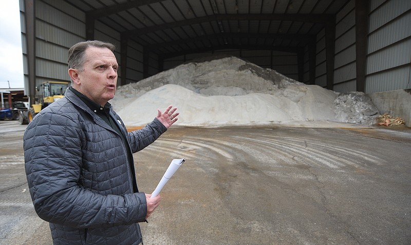
Meanwhile, the Tennessee Department of Transportation, with more potentially snowy and icy territory to cover, is well-prepared for Thursday's expected winter blast with plenty of salt and sand supplies, and snow plows and brine trucks standing ready, according to a news release issued Wednesday.
"We prepare for winter weather months in advance," TDOT Commissioner Joe Galbato said in the release. "Our salt bins and our brine are fully stocked, and our employees are ready to mobilize in the event of inclement weather. Clearing our roadways as soon as we can is vital to keeping motorists safe and traffic moving in Tennessee."
(READ MORE: Winter preparedness: 10 things to know as the temperatures drop)
FIVE-DAY FORECAST
ThursdayThe chance of a wintry mix rain, sleet, snow is 90%High 38 | Low 32FridayMostly sunnyHigh 34 | Low 19SaturdayPartly sunnyHigh 48 | Low 22SundayCloudy with a 70% chance of rainHigh 53 | Low 39MondayMostly sunnyHigh 46 | Low 34Source: WRCB-TV Channel 3 as of 4:15 p.m. Jan. 5, 2022
TDOT's statewide 2021-22 winter weather budget is $25.6 million and includes salt, salt brine, employee overtime and equipment maintenance. The state's salt vendors refill salt bins as needed in all of Tennessee's 95 counties.
The state nearly has 200,000 tons of salt and more than 1.5 million gallons of salt brine ready for use, TDOT officials said. TDOT describes salt brine as a mixture of water and salt that is used for pretreating roads before a winter storm or to melt snow on roads when temperatures are hovering around the freezing mark, officials said in the release.
Salt is applied to roads once snow has started to accumulate, according to TDOT. In snowy or icy weather, TDOT's teams focus first on clearing interstates and heavily-traveled state routes. Officials said snow and ice teams specifically target areas vulnerable to freezing, such as hills, curves, ramps, bridges and interchanges. During prolonged weather events, crews may have to clear roadways repeatedly.
The National Weather Service issued a winter weather advisory about 3 p.m. Wednesday for East Tennessee and its valleys, calling for up to a couple inches of snow and hazardous travel.
"We're looking at snow moving into the southern Cumberland Plateau/Southeast Tennessee area tomorrow morning," weather service meteorologist David Hotz said Wednesday in a telephone interview. "There could be a little mixture initially, but overall most of it's going to be snow."
As far as accumulations go, Hotz said downtown Chattanooga might get up to a half-inch of snow while higher elevations such as Lookout Mountain and Signal Mountain could get an inch or 2.
"This winter mix will start in the morning, but it will be pretty much done by 5 or 6 in the evening," he said.
The wintry mix will be followed by plunging temperatures into Friday morning, when Hotz said coats, gloves and hats are the best gear for children at school bus stops.
(READ MORE: Cooper: Week holds two inauspicious weather records in city history)
"The temperature is going to drop down to the mid- to upper-teens in Chattanooga, and if you go to outlying areas, it'll be closer to the 10- to 15-degree range," he said. Hotz said lows are not expected to set any records, but he said it would be a good idea to bring outside pets indoors.
The Chattanooga area's lower elevations haven't seen an appreciable amount of snow in a couple of years, though outlying areas and mountain residents have seen more, weather service records show.
In the six-plus years since the winter of 2015-16, a combined 4.7 inches of snow has fallen in the Chattanooga area, excepting totals in higher elevations.
The largest snowfall event during the period was in February 2020, when 2.7 inches of snow fell. The year before that, in February 2015, 8.8 inches of snow hit the Chattanooga area.
Temperatures in the Chattanooga area follow the same trend. The last time the mercury went below 20 degrees was December 2020, when it dropped to a low of 19. Prior to that, the lowest temp was in January 2019, when the cold marked another 19-degree low, according to weather service data.
Weather service records for the Chattanooga area over the last five years show temperatures have only been in the teens or lower five times; 16 degrees in January 2016, 14 degrees in January 2017, 8 degrees (a five-year low) in January 2018, 19 degrees in January 2019 and 19 degrees again in December 2020.
The lowest temp recorded by the weather service in the Chattanooga area since 2011 stands at 5 degrees in January 2014, records show.
For those who must travel, the American Red Cross recommends three items motorists should keep in their vehicle in the winter - sand, a red signal cloth and a flashlight. Other recommended items for a winter driving kit include an emergency supply of warm clothing, a windshield scraper and broom and matches in a waterproof container.
Contact Ben Benton at bbenton@timesfreepress.com or 423-757-6569. Follow him on Twitter @BenBenton.