
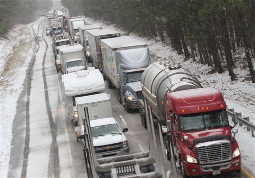
 Motorists are at a standstill as emergency responders cleaned up a tractor-trailer wreck on Interstate 85 southbound near the Dinwiddie, Va., exit Monday, March 3, 2014. Winter kept its icy hold on much of the country Monday, with snow falling and temperatures dropping as schools and offices closed and people from the South and Mid-Atlantic to Northeast reluctantly waited out another storm indoors.
WASHINGTON – On the latest snow day in a winter full of them, residents of parts of the South, Mid-Atlantic and Northeast were coping with several inches of snow on top of a layer of slush.
With accumulations of 4-to-6 inches in Washington, Monday’s storm would have been the largest in the nation’s capital in all of last year. But in the seemingly endless winter of 2013-2014, it came 2 ½ weeks after a much bigger storm, and the region settled into a familiar routine of hunkering down.
Schools and government offices were closed. Federal workers stayed home. Young adults gathered on the sloppy, slushy National Mall for a semi-organized, afternoon snowball fight.
By early afternoon, the snow had stopped. But the region will face yet another challenge: another blast of bitterly cold arctic air. Temperatures were expected to dip into the single digits along the Eastern Seaboard on Monday night. That doesn’t usually happen after March 1, which is sometimes referred to as the start of “meteorological spring.”
If the forecast holds, it would be only the third single-digit day after March 1 in the recorded history of the nation’s capital – and the previous two were in 1872 and 1873, according to the National Weather Service.