
Friday, November 13, 2026Nov 13

Area hit hard by Indonesia quake was seen as high-risk zone

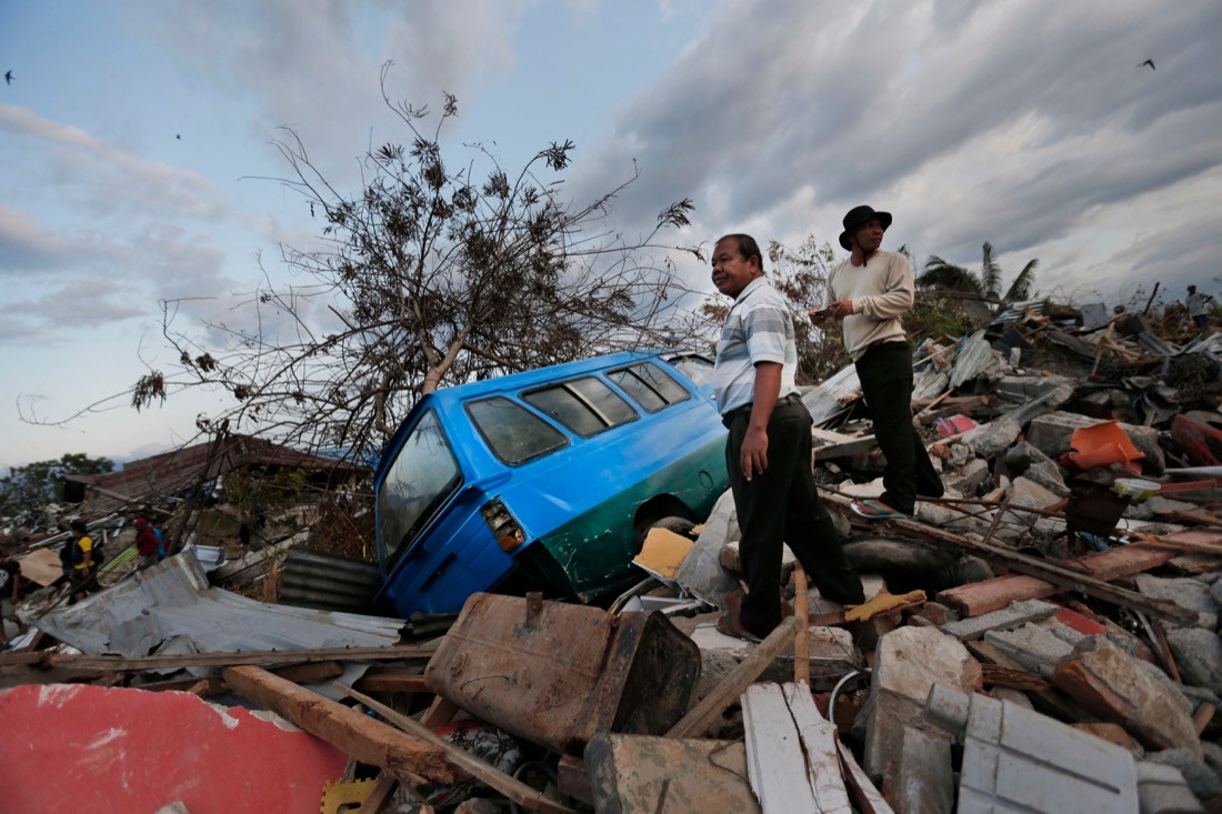
In this Friday, Oct. 5, 2018, photo, men survey the damage in the Petobo neighborhood which was wiped out by liquefaction during a massive earthquake in Palu, Central Sulawesi, Indonesia. Many in the decimated village had no idea they were in an area already identified as a high-risk zone for this apocalyptic phenomenon that causes soft ground to liquefy during temblors. The area around Sulawesi island's Palu Bay had been slammed before and was due for another potential perfect storm, capable of unleashing earthquakes, landslides, tsunami waves, and soil liquefaction. (AP Photo/Dita Alangkara)
In this Friday, Oct. 5, 2018, photo, men survey the damage in the Petobo neighborhood which was wiped out by liquefaction during a massive earthquake in Palu, Central Sulawesi, Indonesia. Many in the decimated village had no idea they were in an area already identified as a high-risk zone for this apocalyptic phenomenon that causes soft ground to liquefy during temblors. The area around Sulawesi island's Palu Bay had been slammed before and was due for another potential perfect storm, capable of unleashing earthquakes, landslides, tsunami waves, and soil liquefaction. (AP Photo/Dita Alangkara) In this Friday, Oct. 5, 2018, photo, men survey the damage in the Petobo neighborhood which was wiped out by liquefaction during a massive earthquake in Palu, Central Sulawesi, Indonesia. Many in the decimated village had no idea they were in an area already identified as a high-risk zone for this apocalyptic phenomenon that causes soft ground to liquefy during temblors. The area around Sulawesi island's Palu Bay had been slammed before and was due for another potential perfect storm, capable of unleashing earthquakes, landslides, tsunami waves, and soil liquefaction. (AP Photo/Dita Alangkara)

PETOBO, Indonesia (AP) – When the violent shaking from a massive magnitude 7.5 earthquake finally stopped, Selvi Susanti stood up and realized something strange was happening. First, she saw the ground suddenly begin to sink. Then the pavement split beneath her feet like a broken dinner plate and started to rise.

Terrified, she clung to a small sliver of asphalt and surfed a river of fast-moving mud as it swallowed entire neighborhoods, carrying her higher than coconut trees for a quarter of a mile.

“What I saw – oh my God! Houses were tumbling. They started to roll like waves. It’s like a tsunami, but the difference was they were waves of soil,” said Susanti, 38, weeping at the memory of seeing so many people simply disappear into the earth as they screamed for help. “It felt like I was in a boat, moving around. But the difference is I was not in water, but in the mud.”

Many, like Susanti in the devastated village of Petobo, had no idea they were in an area already identified by the government as a high-risk zone for the devastating geological phenomenon that causes soft ground to liquefy during earthquakes.

But Indonesian scientist Gegar Prasetya wasn’t surprised by any of the events that occurred at dusk on Sept. 28, killing nearly 2,000 people and leaving possibly thousands more missing. He had warned people for years that the area around Sulawesi island’s Palu Bay had been struck before and was due for another potential combination of factors to create a perfect storm capable of unleashing earthquakes, landslides, tsunami waves and soil liquefaction.