
Read more
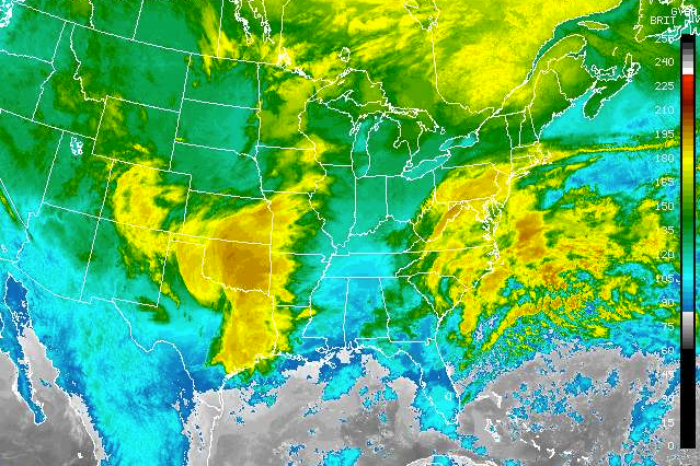
* At least 3 dead as storms, tornadoes rip through Gulf states * Fierce storms move into Deep South
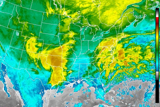 The National Weather Service has issued a flash flood watch ahead of a line of storms coming out of the Deep South.
Thunderstorms capable of producing immense amounts of rain are moving into Tennessee from Alabama and Mississippi, causing the National Weather Service to issue flash flood watches through Wednesday afternoon in Hamilton, Bradley, Polk and Marion counties. Hamilton is also under a flood warning.
The storms are capable of very heavy rain of one to two inches in short periods of time. Because of recent rain, some areas will already be semi-saturated, causing flooding in low lying areas, according to the National Weather Service.
“People who live along creeks and streams should monitor levels and be prepared to take action,” the service said.
The National Weather Service has also called for “strong and gusty” winds for mountains and foothills Tuesday night and Wednesday morning.
Polk and McMinn counties are under a wind advisory.
Localized damaging winds are possible, and there is a low chance of an isolated tornado in the region.
Forecasters have also issued flash flood watches in Alabama and Georgia ahead of a storm system that’s expected to drop 1 to 2 inches of rain, with higher amounts possible in some areas.
In Georgia, Catoosa, Dade, Murray, Walker and Whitfield counties are under a flash flood watch. Catoosa, Dade, Murray and Whitfield counties are also under a flood warning.
The warnings, which cover large parts of both states, are expected to be in effect through Wednesday afternoon.
The National Weather Service says new rain on already saturated soil in those states could cause roads to flood, as well as low-lying areas and small streams.
The weather service projects that some of the heaviest rain will fall in metro Atlanta and in parts of the north Georgia mountains, where up to 3 inches is expected.
More than a dozen public school systems in south Georgia are closing as forecasters predict severe storms could threaten the region overnight.
Schools in Valdosta and surrounding Lowndes County will be closed Wednesday, as well as 12 other school systems in rural south Georgia counties.
Public school officials in another seven districts – including Albany and surrounding Dougherty County – say they will open late Wednesday morning.
The National Weather Service says southwest and south Georgia are at a moderate to enhanced risk of violent storms that could produce damaging winds and isolated tornadoes. Forecasters say the main threat appears to be from Tuesday night until Wednesday morning.
The same storm system caused early school closures Tuesday in districts from Louisiana to Alabama.
Alabama Gov. Robert Bentley issued a state of emergency because of severe weather approaching his state.
The declaration released Tuesday means schools won’t have to make up any days lost because of the storms. It also directs emergency management officials to offer any assistance needed because of severe weather.
Bentley’s action came after the National Weather Service placed southwest Alabama under a tornado watch. Storms moving toward the state already have caused damage near New Orleans, where a possible tornado touched down.
A flash flood watch covered central Alabama, where forecasters said as much as 2 inches of rain was possible. The weather service issued an advisory saying winds up to 40 mph were possible in the Tennessee Valley region of north Alabama.
The meteorologist in charge for the National Weather Service’s southeast Louisiana office says at least seven tornadoes have hit southeast Louisiana and southwest Mississippi.
Ken Graham says that number includes the one that slammed into a trailer park in Convent, Louisiana, Tuesday and one that killed a person near Purvis, Mississippi.
Graham said teams will be sent out in the morning to document the damage and rate the tornadoes.
Severe weather has been moving through southern Louisiana and Mississippi. At least three people have been killed – two in Louisiana and one in Mississippi.
Graham said a lightning strike hit the building where the weather service is located in Slidell, knocking out their radar systems and forcing them to go to backup systems.
WEDNESDAY CLOSINGS AND DELAYS
Polk County Schools will be delayed two hours