
Saturday, October 31, 2026Oct 31

This story is free to read.

Strong storms a possibility for Chattanooga area through the weekend

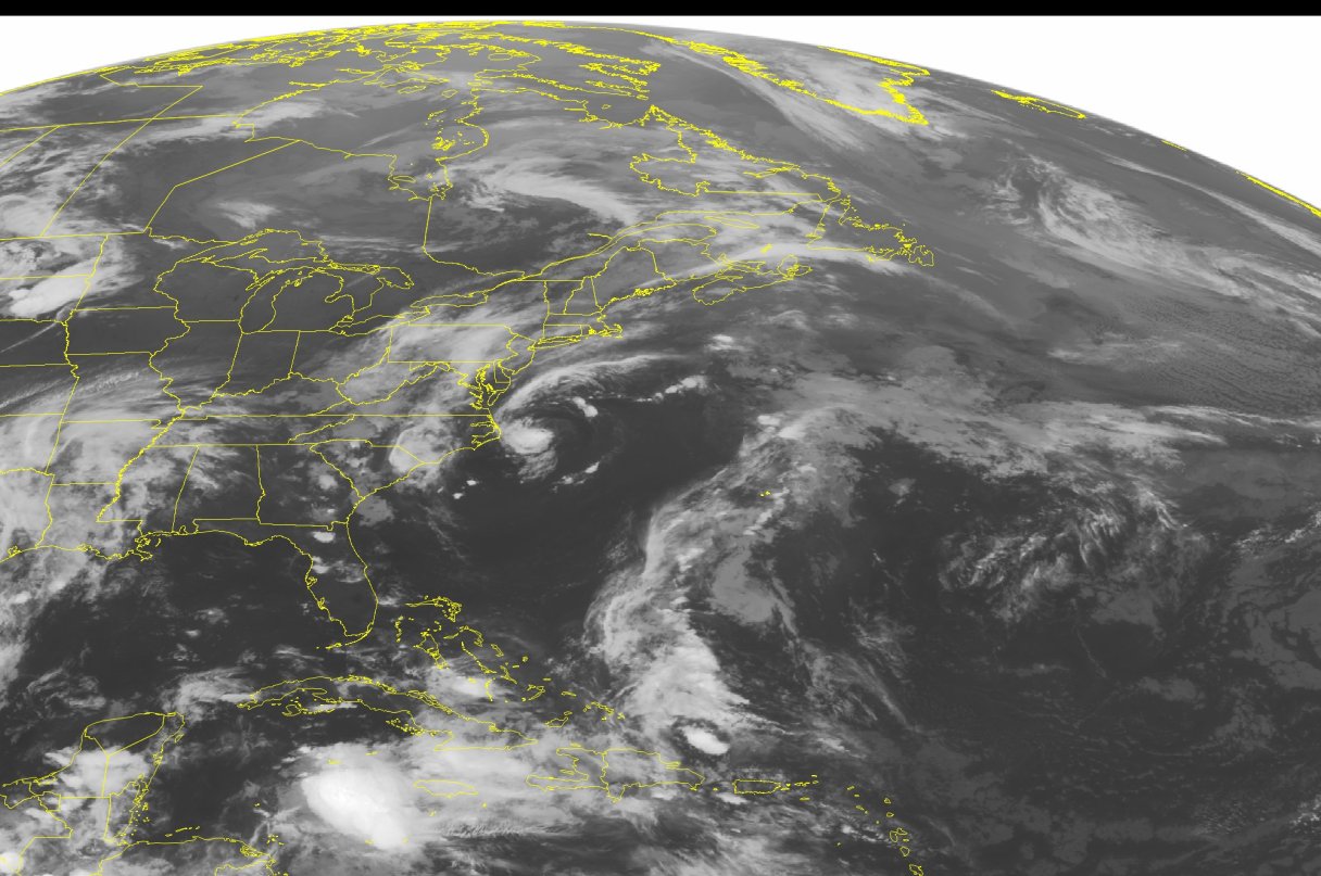
This NOAA satellite image taken Friday, June 3, 201,6 at 12:45 AM EDT shows Tropical Depression Bonnie just east of the Outer Banks of North Carolina. Tropical Depression Bonnie is forecasted to strengthen into a Tropical Storm as it moves to the east and out to sea. A slow moving cold front extends from western New England south into the southern Mississippi River Valley where it becomes a stationary front. Showers and thunderstorms will break out over the Mid-Atlantic along the cold front. Showers and thunderstorms will also develop over the Deep South. The heaviest rain will be seen across eastern Texas where an area of low pressure has developed. Flash flooding is possible in Texas due to this slow moving area of low pressure. High pressure over the Great Lakes is bringing sunny and dry weather.
This NOAA satellite image taken Friday, June 3, 201,6 at 12:45 AM EDT shows Tropical Depression Bonnie just east of the Outer Banks of North Carolina. Tropical Depression Bonnie is forecasted to strengthen into a Tropical Storm as it moves to the east and out to sea. A slow moving cold front extends from western New England south into the southern Mississippi River Valley where it becomes a stationary front. Showers and thunderstorms will break out over the Mid-Atlantic along the cold front. Showers and thunderstorms will also develop over the Deep South. The heaviest rain will be seen across eastern Texas where an area of low pressure has developed. Flash flooding is possible in Texas due to this slow moving area of low pressure. High pressure over the Great Lakes is bringing sunny and dry weather. This NOAA satellite image taken Friday, June 3, 201,6 at 12:45 AM EDT shows Tropical Depression Bonnie just east of the Outer Banks of North Carolina. Tropical Depression Bonnie is forecasted to strengthen into a Tropical Storm as it moves to the east and out to sea. A slow moving cold front extends from western New England south into the southern Mississippi River Valley where it becomes a stationary front. Showers and thunderstorms will break out over the Mid-Atlantic along the cold front. Showers and thunderstorms will also develop over the Deep South. The heaviest rain will be seen across eastern Texas where an area of low pressure has developed. Flash flooding is possible in Texas due to this slow moving area of low pressure. High pressure over the Great Lakes is bringing sunny and dry weather.

The greater Chattanooga area could see a round of showers and thunderstorms this evening, with gusty winds and locally heavy rainfall being the primary risks, according to the National Weather Service.

Several scattered thunderstorms are expected in the area Saturday during the afternoon and evening. Some of these storms could become severe with damaging winds and heavy rainfall.

A cold front will pass through Sunday and there will be the possibility of strong to severe thunderstorms with hail, locally damaging winds and heavy rainfall.

Localized flooding could be a threat Saturday and Sunday especially in areas of poor drainage.