
There’s nothing quite like the unassuming majesty of a waterfall. You can usually hear its roar before you can see it, before you can appreciate the sight of its churning, winding ways as water cascades down to meet the land below. Some are a mere five minutes from the hiking trail. Others make you work to find and experience them, buried deep within the woods. But with as many as the Chattanooga area has to offer – in particular the 10 highlighted here in our guide – there’s no excuse to miss the magic they each offer.
So whatever you do, don’t listen to ’90’s girl group TLC’s cliche advice: Go chase waterfalls.
* Author’s note: Obviously, there are too many favorite falls nearby to list them all. This list aims to represent a wide variety of vistas with hikes ranging from easy to tricky and everything in between. So go out and explore – and remember to wear your slip-resistant water shoes.
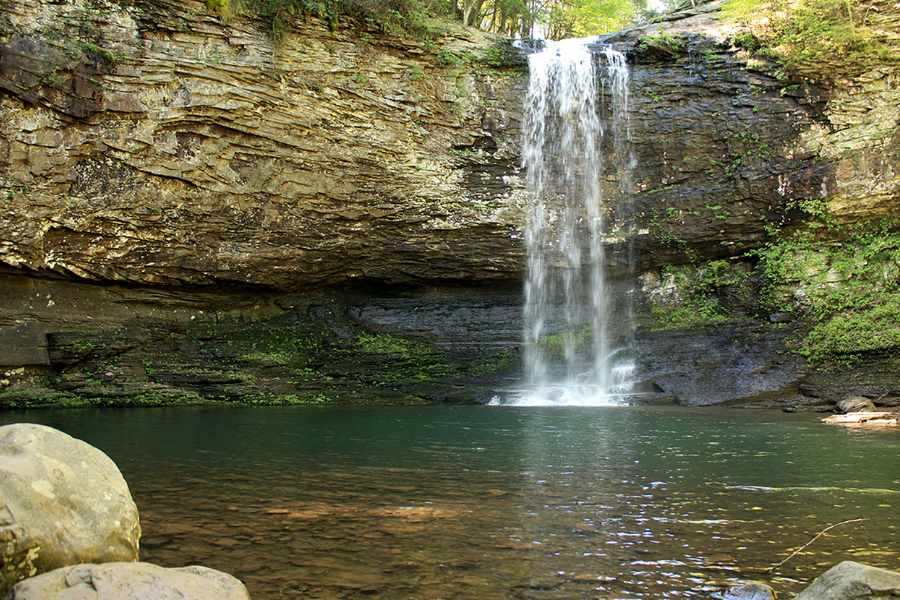
Cloudland Canyon Falls
Located in the heart of Georgia’s Cloudland Canyon, Cherokee and Hemlock falls are known for the leg workout required to find the view. Although the trail length is fairly short overall, in order to see the falls you will descend more than 400 feet downward from the elevation of the initial trailhead.
To return to the trail after seeing the falls in all of their glory, be prepared to climb the canyon’s intimidating 600 stairs. If you start to lose your momentum, just picture the gorgeous view of the canyon awaiting you at the top.
Height:
Cherokee – 60′
Hemlock – 90′
Drive time: 35 minutes from Chattanooga
GPS coordinates: 34.8402630, -85.4828810
Hike distance: 2 miles total
Level of difficulty: Hard
Amenities: Everything – even overnight options ranging from camping areas to “yurts” and cabins
Fast facts: When the Cloudland Canyon trail returns to the trailhead and starting elevation at the end of your waterfall experience, you will have dropped and gained over 1,000 feet of elevation during the hike.
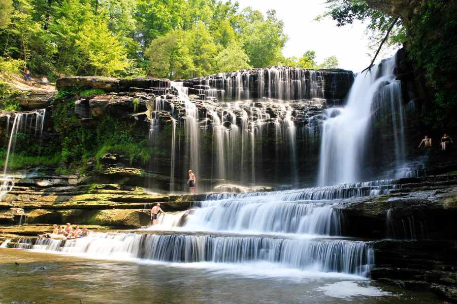
Cummins Falls
It’s only fitting that a waterfall with one of the top 10 best swimming holes in the United States (according to both Travel + Leisure and Condé Nast magazines) would make you work hard to trek to it. But the view and opportunity to swim in the gorgeous, clear waters make the hike through moving water and the climb up a ridge well worth it to witness the beauty of the idyllic falls and large swimming area located just north of Cookeville.
Height: 75′
Drive time: 2 hours from Chattanooga
GPS coordinates: 36.24949, -85.5717
Hike distance: 2.5 miles
Level of difficulty: Hard
Amenities: Shaded picnic area – though no grills or trash cans, so be sure to pick up before leaving!
Fast facts: Located on Blackburn Fork State Scenic River just north of Cookeville, Cummins Falls is Tennessee’s eighth largest waterfall.
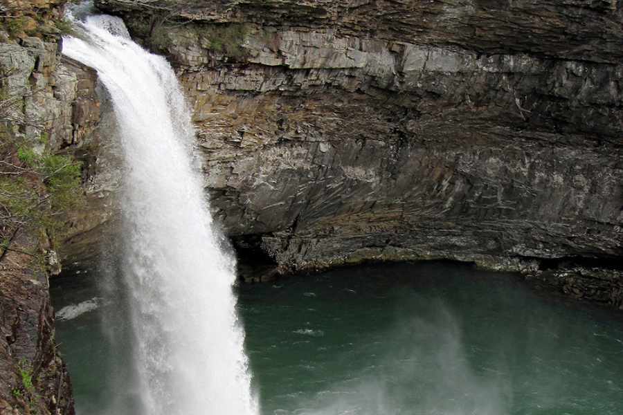
DeSoto Falls
Named for Spanish explorer Hernando de Soto (the first documented European to discover the Mississippi River), this enormous waterfall is one of the tallest in Alabama. Nestled on Lookout Mountain, the waterfall pathway is paved and is known for its ease of access for people of all abilities.
For those looking for more activity and another view, descend down the concrete stairs for a look from the bottom of the falls.
Height: 107′
Drive time: 55 minutes
GPS coordinates: 34.706596, -83.915254
Hike distance: Approximately 350 yards from the parking lot
Level of difficulty: Very easy
Amenities: Picnic shelter areas with grills, campground and more
Fast facts: It is believed that the falls’ namesake explorer never actually visited himself, but rather sent men to what is now De Soto National Park to explore.
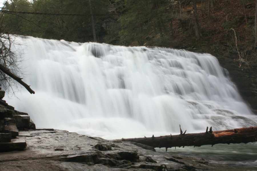
Fall Creek Falls
For a spectacular view of one of the tallest waterfalls in the Eastern United States – and the tallest east of the Mississippi River – look to Fall Creek Falls, located in the state park that shares its name. And, to make the hour-long drive to Spencer, Tennessee, even more worthwhile, you can visit the five other falls at the park: Cane Creek Falls, Cane Creek Cascades, Coon Creek Falls, Rockhouse Falls and Piney Creek Falls.
Height: 256′
Drive time: 1 hour
GPS coordinates: 35.66583, -85.35583
Hike distance: A short hike trail and long hike trail are both available to get you to the falls with the experience you want.
Level of difficulty: Low
Amenities: On-site campground, nearby inn, and more
Fast facts: Fall Creek Falls State Park is the most visited (and largest) state park in Tennessee. Made up of more than 34 miles of trails, the state park even offers overnight trails for those chasing a more intense experience.
Watch out: Be sure to look for the 80-foot, 120-year-old steel fire tower jutting out of the forest. The tower is currently in the submission process to be added to the National Register of Historic Places, and many hope the tower will eventually be reinforced and become an observation deck for visitors to the state park.

Falling Water Falls
Just minutes away from Chattanooga’s downtown is a view from the top of a waterfall that isn’t for the faint of heart. But for those comfortable looking down more than 100 feet at the free-falling water, a quick drive up to the town of Walden on Signal Mountain and a five-minute hike are all you need for a peaceful view that will take your breath away.
Height: 110′
Drive time: 10-15 minutes
GPS coordinates: 35.18969, -85.2826
Hike distance: Approximately 300 yards
Level of difficulty: Very easy
Amenities: Small parking lot at the top of the falls
Fast facts: For a view from the valley and a longer hike, the base of the falls can be viewed off of Levi Road in Soddy-Daisy.
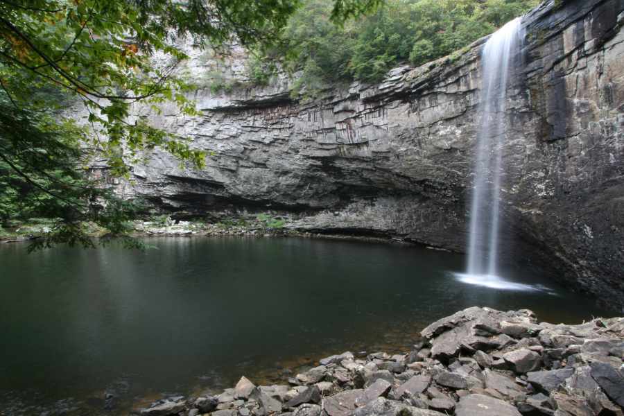
Foster Falls
Made popular as one of the premiere climbing destinations in the South, Foster Falls is home to a variety of beautiful plant species. Operated by the Tennessee Valley Authority in Sequatchie near Tracy, Tennessee, the area remains less-visited by guests outside of the climbing community, so it’s ideal for a calm afternoon with an easy hike through the woods. And, the end of the trail to the falls will take you over the river on a suspension bridge for the best view from the bottom of the falls.
Height: 60′
Drive time: 45 minutes
GPS coordinates: 35.18177, -85.676
Hike distance: Under 2 miles (including rope bridge)
Level of difficulty: Easy to moderate
Amenities: Restroom, picnic area and grills available
Fast facts: A top overlook to the falls is handicap accessible and near the parking lot.
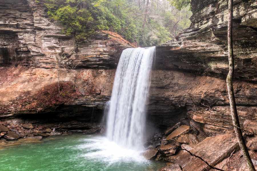
Greeter Falls
Although there are several routes you can take to find Altamont, Tennessee’s Greeter Falls, the quickest takes you only about half a mile from the trailhead, down a winding staircase and straight to a glorious view and great swimming opportunities at the lower falls. And for those in an adventurous mood, several other marked trails nearby mean you can continue exploring to see more of what South Cumberland State Park has to offer (which is a lot).
Height: 50′
Drive time: 1 hour 20 minutes
GPS coordinates: 35.4343, -85.69624
Hike distance: Under 1 mile
Level of difficulty: Moderate
Amenities: Picnic area
Fast facts: The Savage Gulf State Natural Area where Greeter Falls is located is the largest unit of the South Cumberland Trail.
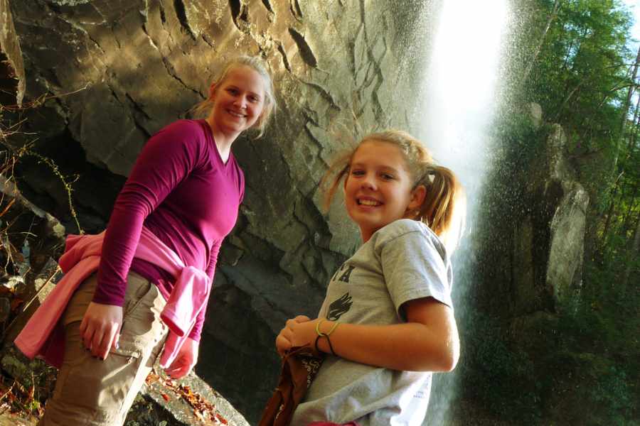
Laurel Falls
Found just outside of the Chattanooga area near Dayton, Tennessee, Laurel Falls offers a combination of paved walkways and steeper, wildlife filled trailways. To find the beautiful blooms on the shrubs which inspired the name of the falls, be sure to take a trip in May.
Height: 80′
Drive time: 1 hour, 15 minutes
GPS coordinates: 35.54719, -85.02396
Hike distance: Under 2 miles
Level of difficulty: Moderate
Amenities: Ample paved parking, nearby visitor’s center
Fast facts: The Laurel Snow Trail where the falls is found was the first national recreation trail in Tennessee.
Watch out: Bears are common on this part of the trail, so protect both the hikers and bears and be especially cautious not to leave food remnants which tempt the animals to come out and become less fearful of people.
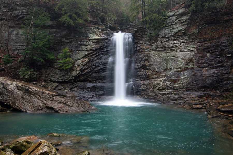
Rainbow Falls
Neither the hike to the bottom of the falls nor merely getting to the overlook to Rainbow Lake is for novice hikers, but those up for the adventure will not be disappointed. From an overlook with a view of the Tennessee River to the challenging hike down to the falls (ropes along the way have been installed to keep hikers from falling down the steep, rocky incline), there is much to see and appreciate at this secluded Signal Mountain spot.
Height: 40′
Drive time: 15 minutes
GPS coordinates: 35.12701, -85.3655
Hike distance: 1.5 miles
Level of difficulty: Hard
Amenities: None
Fast facts: Rainbow Lake also features a smaller “falls” created by the dam in place. For those tempted to jump off the dam – which we cannot endorse or condone – please check the water levels before doing so, as they fluctuate greatly.
QUICK TIPS FOR PHOTOGRAPHING WATERFALLS
North Carolina photographer Kevin Adams, a naturalist and photographer for more than 30 years, has become well known for his photographic portrayal of waterfalls. Dubbed “The Waterfall Guy,” Adams provides a few tips for amateur photographers interested in upping their waterfall photo game. » First and foremost, get out of the sun. Cloudy and rainy days provide not only a more interesting waterfall photo, but also provide better contrast and saturate the color of the surrounding foliage. » Identify what you are trying to showcase most before shooting – then make sure the resulting image highlights that. » “Sometimes it’s as simple as asking yourself, ‘What about that waterfall made you want to stop and take the picture in the first place? What is most appealing?'” » Simplify! Use just enough surroundings to give people place: “Don’t overwhelm people with too much information.” » Take advantage of photos that are out of the ordinary or find an interesting angle. Maybe the trees surrounding the falls are a vibrant, fall-festive red, or maybe there’s an ice formation in winter worth capturing. Either way, try to stay away from the popular and often seen straightforward shot.