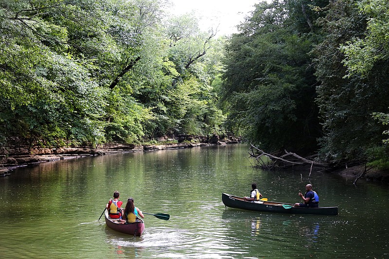
With its vast network of rivers and creeks, the Tennessee Valley is a mecca for paddlers. Options abound. In fact, it can be a little overwhelming. Where does one begin? How does one find the put-ins, or check the gauge to ensure the river is navigable?
For the past decade, local paddler Eric Fleming has been collecting data on local flatwater runs. Now, with the help of fellow Tennessee Valley Canoe Club member BG Smith, he has created the region's first comprehensive map of water trails.
Inspired by the number of hiking trails located within a 15-minute drive of downtown, Fleming says, "That got me thinking about how many navigable miles of rivers and creeks there are that have [boat] access within an hour's drive of downtown."
The answer, he discovered, is about 380 miles, comprising 18 different rivers and lakes with a total of 270 access points.
The map features only waterways that are maintained, meaning they are less likely to have downed trees or log jams. Each put-in and takeout listed on the interactive map includes GPS coordinates, information on whether bathrooms are available, and whether or not powerboats are permitted.
Additionally, it features points of interest along the way, including outfitters, campgrounds, restaurants, sightseeing opportunities and river gauge information.
So, where does one begin? Here are a few of Fleming's recommendations to get you started. Explore all the rest at tvccpaddler.com/tennessee-river-valley-access-points.
___________
Best Beginner Paddle: North Chickamauga Creek
Minutes from Chattanooga: 20
Put-in/Takeout: Upper Greenway Farm
GPS coordinates: 35.127, -85.215
Length: 2 miles downstream, and return to the ramp
Bathrooms: Yes
Powerboats: No
___________
Best Family Paddle: Harrison Bay
Minutes from Chattanooga: 34
Put-in/Takeout: Harrison Bay Beach and Picnic Area
GPS coordinates: 35.167, -85.126
Length: Because it's a bay, paddlers can cover as much or as little flatwater as they'd like.
Bathrooms: Yes
Powerboats: No
___________
Best Scenic River: Sequatchie River
Minutes from Chattanooga: 39
Put-in: "Canoe the Sequatchie" boat ramp
GPS coordinates: 35.332, -85.392
Takeout: Frank Tate Road ramp
GPS coordinates: 35.274, -85.430
Length: 6 miles
Bathrooms: No
Powerboats: No
Need to know: There is a $3 ramp fee at the put-in. At the takeout, there is an unlocked gate. Access is permitted.