
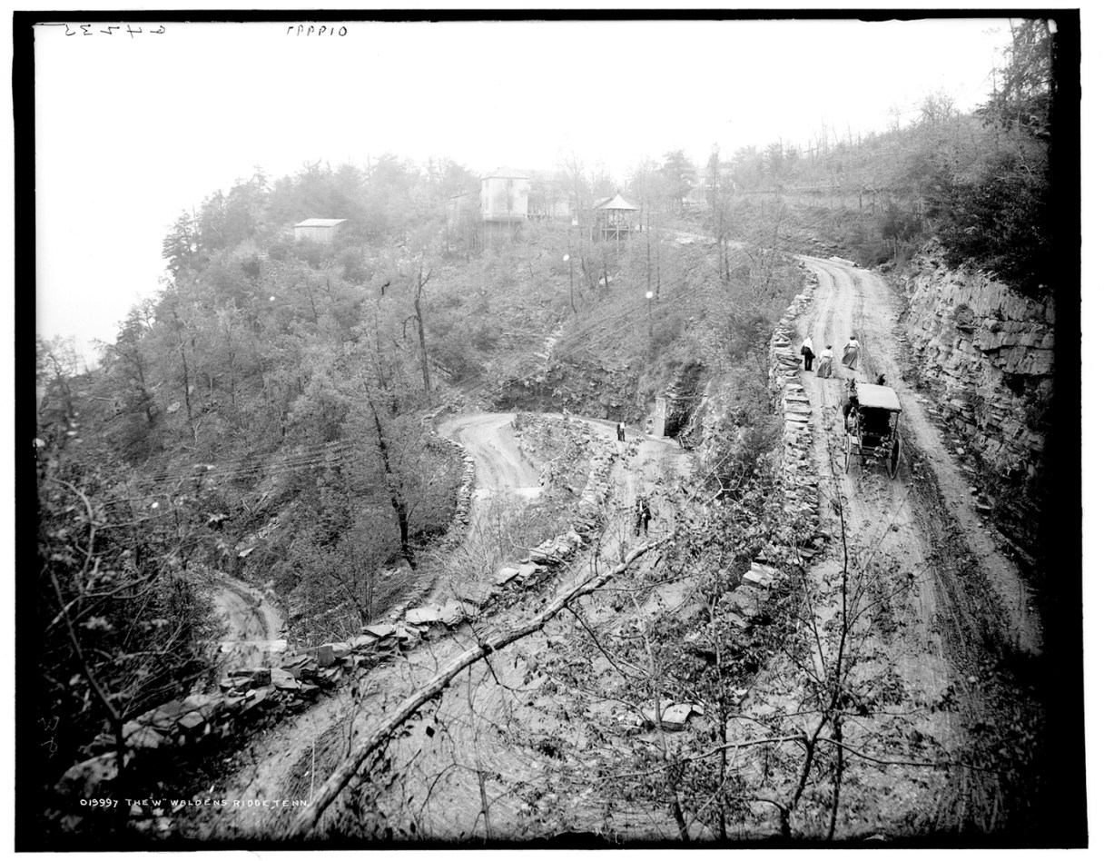
The “W” Road has a rich and colorful history. It began centuries ago when American Indians hunted deer, turkey, bear and grouse on Walden’s Ridge. Tribes lived in the valley and used a system of trails to climb the ridge, including one at a natural pass at Roger’s Gap, later the “W” Road.
After the Cherokee Removal, white settlers streamed into Ross’s Landing. To serve this new market and reach the Western Atlantic railhead, prosperous farmers in the Sequatchie Valley sought a direct route to transport their produce and livestock. In 1840, the Tennessee legislature authorized construction of a turnpike road, which was to begin at Josiah Anderson’s farm in Sequatchie Valley, cross Walden’s Ridge and descend at Roger’s Gap.
In 1863, Anderson Pike and Roger’s Gap Road played a brief but important role in the Siege of Chattanooga. After a major defeat at the Battle of Chickamauga, Union troops retreated into Chattanooga. The federal supply depot in Bridgeport, Alabama, was only 30 miles downstream on the Tennessee River, but Confederate artillerists, sharpshooters and pickets blocked all direct routes. The only route the rebels did not control was a 60-mile wagon road northward to Jasper, up Walden’s Ridge on Anderson Pike and down Roger’s Gap Road into Chattanooga.
During October, storms reached near hurricane proportions. Horses and mules foundered in the mud as they struggled to bring their loads along the difficult road. Things came to a flashpoint on Oct. 3, when General Joe Wheeler led his Confederate cavalry to catch a train of 800 Union supply wagons at the foot of Anderson’s Gap. Warned that Union General Rosecrans was despondent and on the verge of retreating, President Abraham Lincoln ordered Gen. Ulysses Grant to take command in Chattanooga. On Oct. 22, Grant with his small party set forth on horseback up Sequatchie Valley and over Walden’s Ridge on mountain roads described in his memoirs as “almost impassable from mud, knee deep in places, and from washouts on the mountain sides.” Grant’s party passed by what later became the McCoy Farm and Gardens, where the federal Army had a large store house.
Gen. Grant and his party started down Rogers Gap Road, which then had just one steep hairpin curve, or “V” at the top. One Union officer described this most treacherous part “as composed of logs, one end of which rests on the side of the mountain, the other end supported in a horizontal position by props, thus forming a sort of corduroy road [N]ear the summit, a stream of water ran down the mountain’s side through the interstices [small openings] of the logs. It was a rickety, insecure, makeshift of a road.” Several wagon drivers and mules plunged to their death down the mountainside during their journey. Grant’s horse slipped and fell on his leg during his trek, most likely at or near the “V.”