
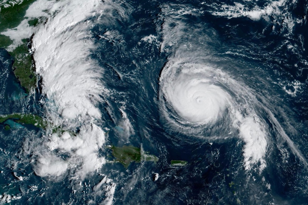
Tropical Storm Imelda formed Sunday and is expected to become a hurricane on a forecast track curving away from the U.S. East Coast early this week. The storm dumped rain and churned up seas near the Bahamas and Cuba and even briefly prompted a tropical storm watch on a stretch of Florida’s Atlantic coast.
Meanwhile, Hurricane Humberto weakened slightly but remained a powerful Category 4 storm further out in the Atlantic, potentially threatening Bermuda. The Bermuda Weather Service issued a tropical storm watch, meaning tropical storm conditions were possible on the island within 48 hours.
At about 8 p.m. EDT, Imelda was about 30 miles (45 kilometers) southeast of the northwest Bahamas and about 355 miles (570 km) southeast of Cape Canaveral in Brevard County, Florida, the National Hurricane Center in Miami said.
Imelda was headed north at 9 mph (15 kph), bearing top sustained winds of 40 mph (65 kph). The hurricane center said the storm was expected to move across the central and northwestern Bahamas through Sunday night and then spin east-northeast away from the southeastern U.S. by midweek.
A tropical storm watch for the east coast of Florida from the Palm Beach-Martin County Line to the Flagler-Volusia County Line was discontinued Sunday afternoon. But the hurricane center urged people on the southeast U.S. coast to monitor Imelda’s progress.