
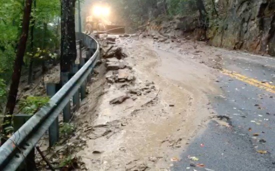
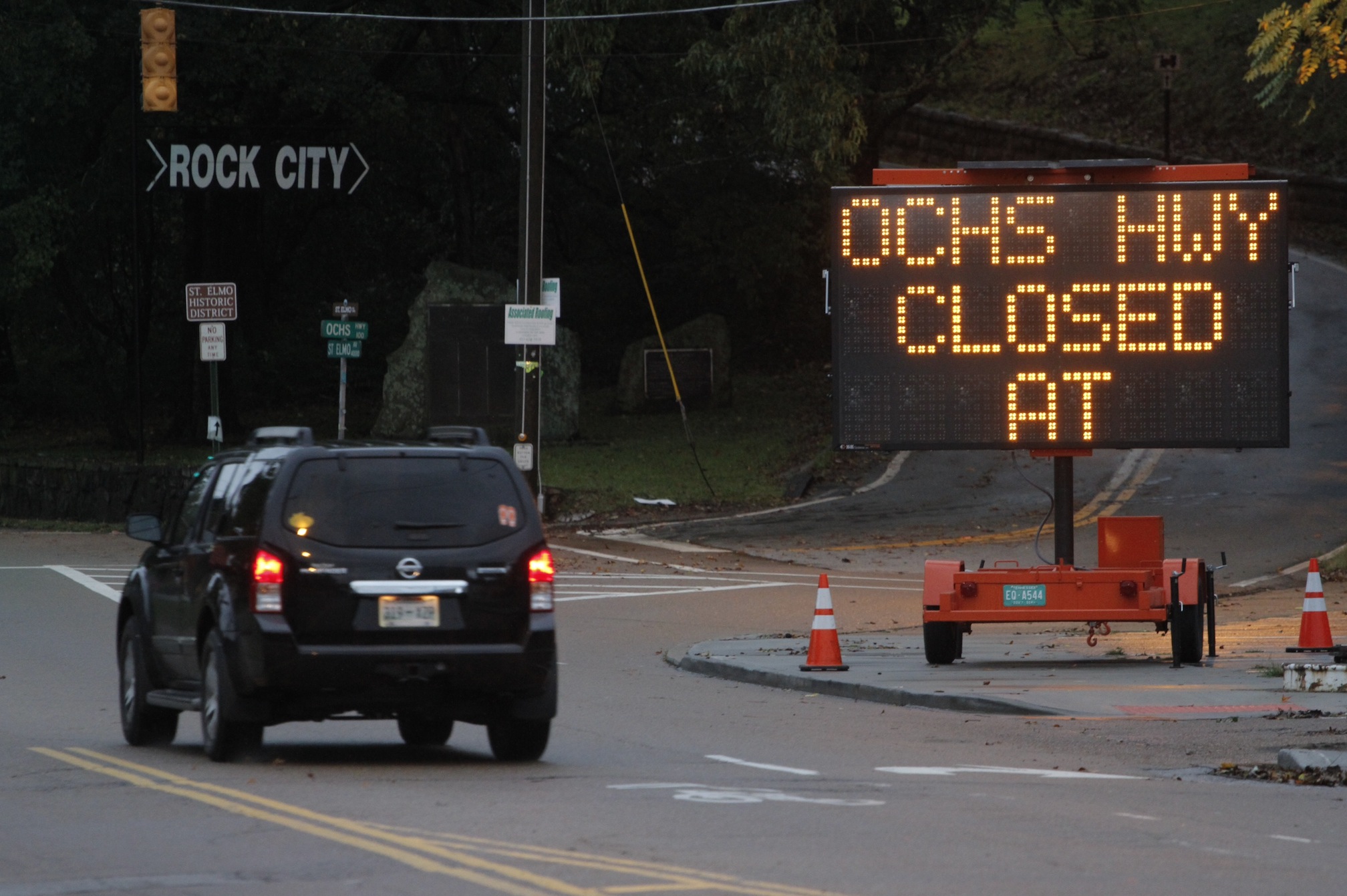
 Ochs Highway is closed near the intersection of Sanders road after heavy rains caused a mudslide near the top of Lookout Mountain.
POWER OUTAGES
As of 9:07 a.m.:• 100-200 without power in North Chattanooga• 100-200 without power in Shallowford area
ROAD CONDITIONS
• Hamilton County:100 block of Roberts Mill Road closed due to water over the roadway.12000 block of Birchwood Pike has trees down.
SCHOOL DELAYS, CLOSINGS
Closed:• Dade County SchoolsTwo-hour delay:Hamilton County Schools• Bradley County Schools• Bowman Hills School• Cleveland City Schools• Chattanooga Girls Leadership Academy• Chattanooga Charter School of Excellence• Chickamauga City Schools (9:30)• Notre Dame High School (10:00)• Our Lady of Perpetual Help (10:00)• Polk County Schools• St. Jude School (10:00)• Walker County Schools• Skyuka Hall
MORE STORM COVERAGE
• Tornado watch issued for Chattanooga area counties• Storm system causes damage across Mississippi• Woman killed as storms cross Alabama
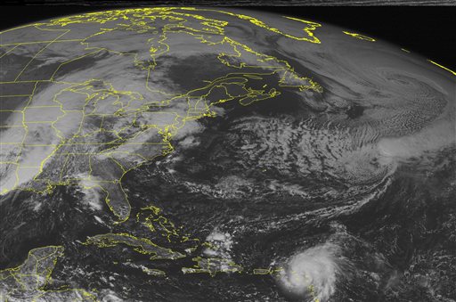 This NOAA satellite image taken Monday, Oct. 13, 2014 at 01:45 PM EDT shows a very strong area of low pressure over eastern Oklahoma and Arkansas. The associated warm front is moving into the Ohio Valley and Mid Atlantic with heavy rain and thunderstorms. The trailing cold front moves across Tennessee, Alabama and Louisiana with strong thunderstorms, including the threat for tornadoes.(AP Photo/Weather Underground)
A squall line that was anticipated to cause widespread damage and led to school delays and cancellations in the Chattanooga region lost steam before it hit the Scenic City, though a continuous barrage of rain and wind storms caused minor damage around the Tennessee Valley.
Crew are working to clean up a mudslide on Ochs Highway near Sanders Road and Signal Mountain, the result of rain-soaked soil that has not had a chance to dry.
Derek Eisentrout, a meteorologist with the National Weather Service in Morristown, Tenn., reported that there are a number of trees down in Marion County, near Jasper.
Overnight, photos and eyewitness accounts emerged of water across roads and flooded yards, though the physical damage has been minimal thus far, especially compared to storm damage reported in Louisiana, Mississippi, Alabama and Kentucky.
The city experienced about two inches of rain overnight, Eisentrout said.
He said the Signal Mountain area received 2.9 inches of rain, Red Bank had 2.8 inches, and the Brainerd area saw 1.76 inches total overnight. High winds were seen as well, ranging between 45 and 60 mph.
Today, as much as another inch is expected, although Eisentrout said that will vary based on how the day heats up.
North Georgia saw less rain than was expected. Carly Kovacik, a meteorologist for the National Weather Service in Peachtree City, Ga., said Dade County saw 3/4 of an inch overnight, Walker County saw just over an inch, and counties further east, such as Murray and Whitfield Counties, saw closer to two inches. Kovacik said northeast Murray County experienced as much as 2.85 inches overnight. She said no real damage was reported overnight.
Today, counties in north Georgia should see about a tenth of an inch of rain, Kovacik said, although that number too is flexible. She did note Walker County may see some heavier showers this morning.
Stay with the Times Free Press for updates to this story.
Previous story:
Heavy rainfall and damaging winds could continue to lash the Tennessee Valley today, according to warnings from the National Weather Service in Morristown, Tenn.
The threat posed by a slow-moving storm system, a so-called “squall line,” has led Hamilton County school officials to delay the beginning of school on today for two hours, as they wait out a storm that experts predict could continue throughout much of today.
Dade County Schools will be closed for the day, and Bradley, Cleveland, Polk and Walker county schools are operating on a two-hour delay, officials report. A smattering of other school systems and day cares throughout the region are also operating on a two-hour delay.
The strong storm system pummeled the region Monday night into this morning, including damaging winds, according to the NWS. An isolated tornado cannot be ruled out, officials said.
Rain and storms will continue today, as a cold front with a “strong wind field” will slowly move into the area, bringing a deluge of showers and thunderstorms with heavy rainfall.
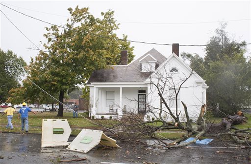 Paducah Power System employees respond to damaged lines on Monday, Oct. 13, 2014 due to a fallen tree on the 900 block of Martin Luther King Jr. Drive in Paducah. The debris of a children’s playhouse were blown into the street as well. (AP Photo/The Paducah Sun, John Paul Henry)
Because of the front’s slow movement, flooding will remain a threat on today and into tonight, officials report.
In addition, because of the strength of what the service is calling “damaging” winds, “an isolated tornado or two also will be possible,” according to a hazardous weather bulletin.
The NWS has advised that it may activate its network of spotters today and tonight night to assist with storm tracking.
The powerful storm system has already swept across Arkansas, Texas, Oklahoma, Missouri and Louisiana on Monday, killing at least one person and injuring four others, emergency officials said.
A tornado that touched down near Ashdown, about 150 miles southwest of Little Rock, killed a man and injured his wife when their home was destroyed early Monday, according to meteorologist Joe Goudsward with the weather service in Little Rock.
Goudsward said that tornado was an EF2 on a scale that rates twisters from EF0 to EF5, Goudsward said. A second one, near England, about 30 miles southeast of Little Rock, was rated an EF1, meaning it was less powerful than the other one.
Two tornadoes also touched down in Missouri on Monday morning, causing some roof damage and toppling trees, according to the National Weather Service.
In Louisiana, Gov. Bobby Jindal declared a state of emergency Monday as the severe weather moved across his state, downing trees and power lines and leaving thousands without electricity.
 A University of Mississippi student uses a newspaper to shield her head from rain while walking across campus in Oxford, Miss., Monday, Oct. 13, 2014. Trees tumbled and some buildings were damaged Monday, but few injuries were reported as a strong cold front pushed a line of thunderstorms across Mississippi. (AP Photo/The Daily Mississippian, Thomas Graning)
In Texas, lightning was suspected in a fire that set ablaze an oil well site near Longview, while downed trees were reported in parts of northern Louisiana.
University of Louisiana at Monroe spokeswoman Kiwana Sutton says several downed trees prompted officials to cancel all classes and shutter the campus until Tuesday morning.
The Storm Prediction Center estimated that more than 36 million people were in the path of damaging winds, possible tornadoes and heavy rainfall Monday, with the greatest risk for severe weather along the Mississippi River from extreme southern Illinois to northern Louisiana. Cities at risk for the nasty weather included Memphis and Nashville, Tennessee; Houston; Indianapolis; New Orleans and St. Louis. Widespread flash flooding was also expected in many areas as the storms dump heavy rainfall in a short period of time.
The soggy weather led to the postponement of Game 3 of the American League Championship Series in Kansas City, between the Royals and the Baltimore Orioles. It also delayed Monday’s opening time of the Arkansas State Fair in Little Rock, which has seen dismal attendance numbers in its first three days because of the rain.
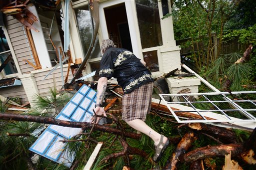 John Brooks climbs into his house that was hit by a tree during the storm Monday Oct. 13, 2014, in Monroe, La. (AP Photo/The Shreveport Times, Henrietta Wildsmith)
Late Sunday, damaging winds knocked out electricity and overturned trucks on Interstate 40 in western Oklahoma as powerful thunderstorms came through the state. A portion of the interstate in Oklahoma was shut down briefly on Monday morning so crews could clear a downed power line, but it was reopened by midday.
Mike Bettes, a reporter for The Weather Channel, said today that Little Rock, Ark., experienced rain of “almost Biblical proportions” when the storm passed through.
Updated at 6:56 p.m. to add storm-spotter information.
Updated at 7:06 p.m. to add information from The Weather Channel.
Updated at 8:15 p.m. to include school closings and delays.
Updated at 12:15 a.m. to include tornado warning link.