
(Editor’s note: First in a series)
The Cherokee people were forced out of their ancestral homeland by the federal government in 1838, a tragedy to forever be known as the Trail of Tears.
The early departing detachments, traveling under military escort, suffered many hardships and deaths. Cherokee leaders appealed to President Van Buren to allow the Cherokees to oversee the removal of their people. This request was granted, and the remaining 15,000-plus Cherokees were divided into 13 detachments and headed west under the supervision of Chief John Ross and his brother Lewis.
Of the 13 detachments, nine crossed the Tennessee River at Blythe’s Ferry (from Meigs County into Rhea County), then crossed the Cumberland Mountains to begin what is known as the Northern Route. Two detachments went by water, and the other two led by prominent Cherokees James Brown and Richard Taylor departed from camps in the area of Hamilton County now known as Harrison. They crossed the river, camped near present day Chester Frost Park, traveled Daisy-Dallas Road to Daisy, and camped, climbed and crossed Walden’s Ridge (Daisy/Mowbray Mountain), descended into and crossed the Sequatchie Valley, and traveled Hill’s Turnpike to a location near McMinnville, where they connected with the Northern Route.
In 1987, Congress designated the Northern (land) Route and the Water Route as National Historic Trails. The route taken by Brown and Taylor through Hamilton County, commonly referred to as “The Richard Taylor Detachment Route,” is part of the Northern Route and is thus a National Historic Trail.
The James Brown detachment departed on Sept. 10, 1838, with 850 people, mostly Cherokees. The Richard Taylor detachment, with 1,029 people, left 10 days after the Brown detachment. Traveling with the Taylor detachment was missionary Daniel S. Butrick. Butrick was serving at Brainerd Mission at the time of the removal and chose to go west with his beloved Cherokees. Butrick kept a journal during this ordeal. Matching clues given by Butrick to towns and roads that existed in 1838 show that about 1,900 Cherokees left the camps around Ross’ Landing and Brainerd Mission and went eastward to begin their journey west.
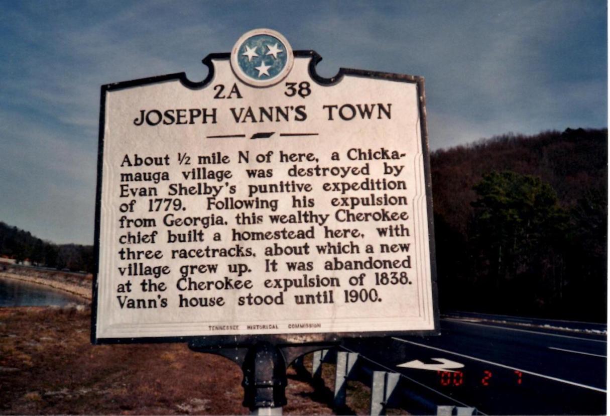
On Thursday, Oct. 4, Butrick wrote, “Left Brainerd for the Cherokee camps, near Mister Vann’s. Thus, we leave this place, perhaps never to return.” He logged the distance as 12 miles. Mr. Vann was Joseph Vann, a wealthy Cherokee leader who had a large estate near the confluence of Wolftever Creek and the Tennessee River at present day Harrison. The settlement that sprang up around Vann’s place was known as Vann’s Town. The main road used, connecting Vann’s Town with Ross’s Landing, later became known as Harrison Pike. Early maps show it as Chattanooga-Harrison Road, Harrison Road and the original Highway 58. Some of it still exists, though much of it is under TVA’s Chickamauga Lake. For several weeks, people, supplies and equipment were gathered at this camp, and this became the departure point from the Cherokee Nation. This campsite is now under water.
On Thursday, Nov. 1, Butrick entered in his journal, “About 9 o’clock, we started with the detachment to cross the river, to go this week to the foot of Walden’s Ridge, 10 miles. We were among the first who crossed. One waggon [sic] with five horses, came within a hairs breadth, almost, of sinking, the water coming within about an inch of the top of the gunnels at one corner.”
Although Joseph Vann owned and operated a ferry just south of Wolftever Creek, this description indicates that the river was forded. Vann himself was forced to leave, and in 1840, Vann’s Ferry became the Harrison Ferry. Ten miles to the west, at the foot of Walden’s Ridge, was the little town of Poe’s Crossroads. Named for early white settler Hasten Poe, this town later became known as Daisy, and in 1969 was incorporated as part of the city of Soddy-Daisy.
After fording the river, the party traversed through a farmer’s cornfield. The farmer refused to let the detachment pass through, forcing it to use a narrow, dangerous road he had roughed out on the nearby “side hill,” now known as Big Ridge. Butrick told of wagons turning over, one onto an elderly Cherokee woman, killing her. They made it through this dangerous stretch, traveled four miles and camped, “having a quarter of a mile to go for water.” The rest of their journey through Hamilton County will be covered in next week’s Part Two.
Carlos Wilson, a retired Hamilton County engineer, has Cherokee ancestors and is a Trail of Tears researcher. For more, visit Chattahistoricalassoc.org.