
Monday, November 2, 2026Nov 2

This story is free to read.

Surprising Ana becomes tropical storm menacing the Carolinas

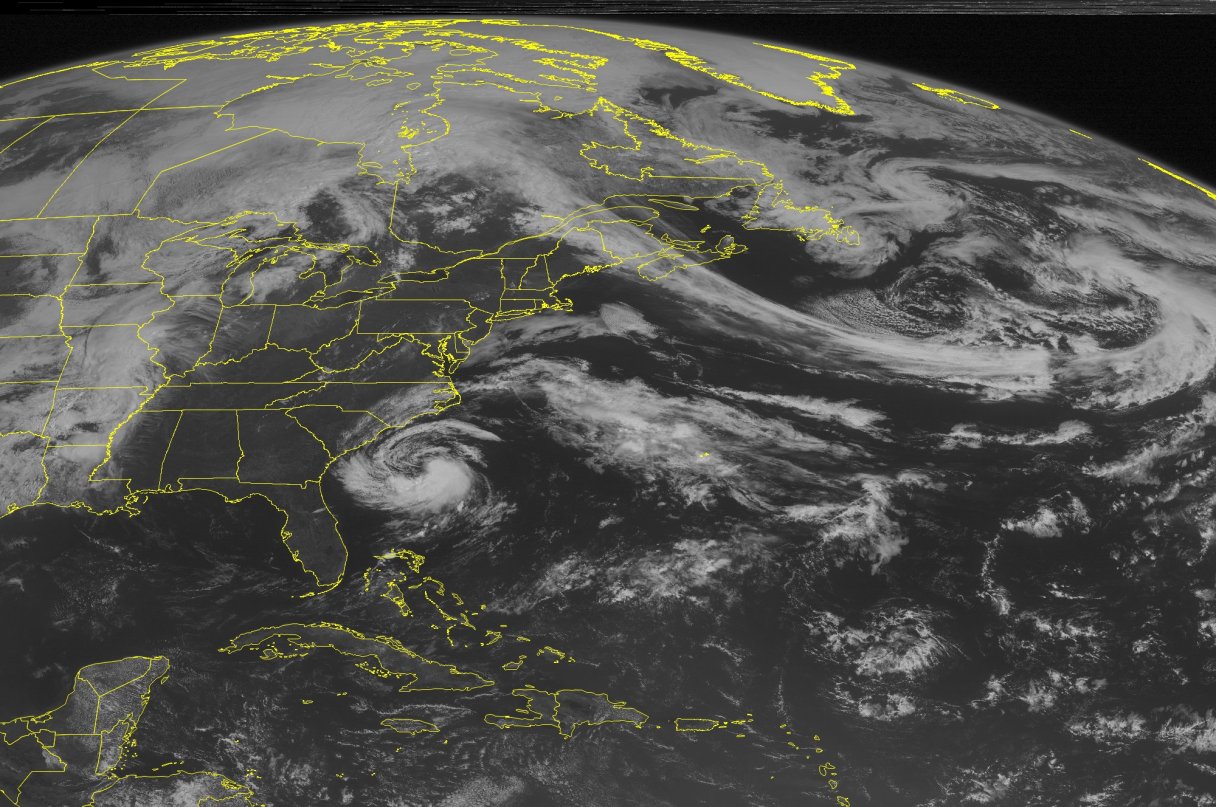
This NOAA satellite image taken Friday, May 8, 2015 at 09:45 AM EDT shows a ridge of high pressure building over the East. Underneath the ridge is a  development of a Sub Tropical Storm named Ana. The storm is slowing moving to the Northwest and expected to effect North and South Carolina coastline. The biggest effect from the storm will be heavy rains with winds up to 45 MPH. To the northeast is a cold front with a streak of clouds that extends from Canada to Maine and offshore. This is creating cooler conditions for Eastern New England. Most active weather remains in the Mid-West where thunderstorms are firing up a long a large cold front. (Weather Underground via AP)
This NOAA satellite image taken Friday, May 8, 2015 at 09:45 AM EDT shows a ridge of high pressure building over the East. Underneath the ridge is a development of a Sub Tropical Storm named Ana. The storm is slowing moving to the Northwest and expected to effect North and South Carolina coastline. The biggest effect from the storm will be heavy rains with winds up to 45 MPH. To the northeast is a cold front with a streak of clouds that extends from Canada to Maine and offshore. This is creating cooler conditions for Eastern New England. Most active weather remains in the Mid-West where thunderstorms are firing up a long a large cold front. (Weather Underground via AP) This NOAA satellite image taken Friday, May 8, 2015 at 09:45 AM EDT shows a ridge of high pressure building over the East. Underneath the ridge is a development of a Sub Tropical Storm named Ana. The storm is slowing moving to the Northwest and expected to effect North and South Carolina coastline. The biggest effect from the storm will be heavy rains with winds up to 45 MPH. To the northeast is a cold front with a streak of clouds that extends from Canada to Maine and offshore. This is creating cooler conditions for Eastern New England. Most active weather remains in the Mid-West where thunderstorms are firing up a long a large cold front. (Weather Underground via AP)

MIAMI (AP) – Early surprise Ana muscled up to a tropical storm as it plodded toward the Southeast coast early Saturday, threatening to bring the Carolinas drenching rains and dangerous surf after forming weeks ahead of the formal June 1 start of the Atlantic hurricane season.

The U.S. National Hurricane Center in Miami said Ana was centered at 5 a.m. EDT Saturday about 115 miles (170 kilometers) south-southeast of Myrtle Beach, South Carolina. Ana has sustained top winds of 60 mph (95 kph) while moving north-northwest at 3 mph (6 kph).

Forecasters say a tropical storm warning extends from south Santee River in South Carolina to Cape Lookout, North Carolina. Ana is forecast to deliver 1 to 3 inches of rain, up to 5 inches in scattered spots, and drive potentially life-threatening surf.