
Sunday, November 15, 2026Nov 15

The Latest: Florida’s Gulf coast braces for tropical storm

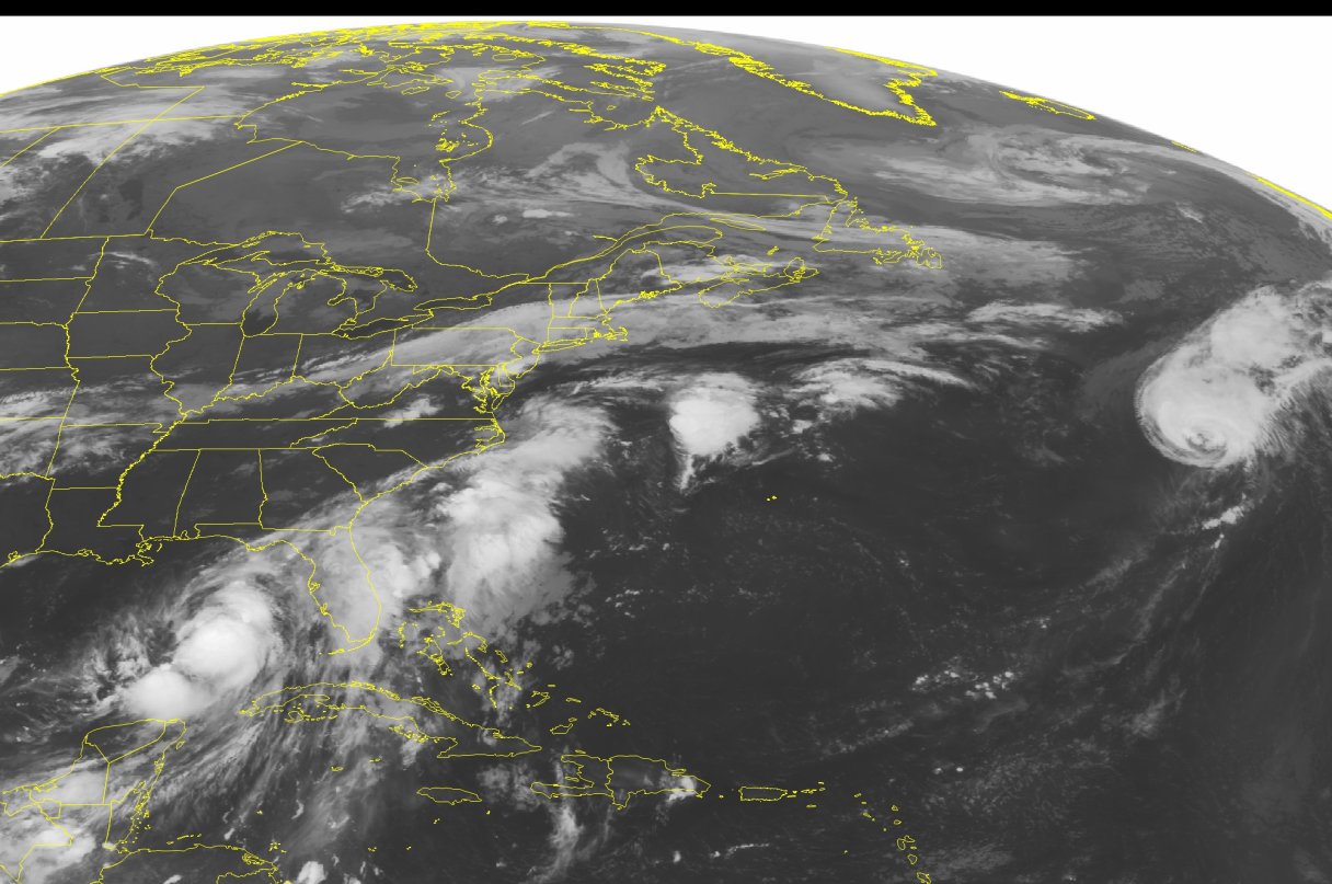
This NOAA satellite image taken Thursday, September 01, 2016 at 12:45 AM EDT shows large amounts of thunderstorm activity occurring offshore of the southeastern United States, extending offshore of the Mid-Atlantic. Tropical Storm Hermine is also observed in the southeastern Gulf of Mexico, slowly marching northward towards the Gulf shore. Some isolated rain showers are also moving ahead of a cold front draped across New England and into the Mid-west. (NOAA/Weather Underground via AP)

MIAMI (AP) – The Latest on Tropical Storm Hermine, which forecasters say could make landfall as a hurricane in Florida: (all times local):

8 a.m.:

Residents in some low-lying communities of Florida are being asked to evacuate as Tropical Storm Hermine takes aim at the state.

The Tallahassee Democrat (http://on.tdo.com/2c2jFxe) reports emergency management officials in Franklin County have issued a mandatory evacuation notice for people living on St. George Island, Dog Island, Alligator Point and Bald Point. Residents in other low-lying areas prone to flooding area also being asked to evacuate.

A hurricane warning is in effect for Florida’s Big Bend from the Suwannee River to Mexico Beach. On the East Coast, a tropical storm warning has been issued for an area that extends from Marineland, Florida, northward to the South Santee River in South Carolina.