

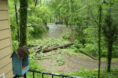
 3416 Pinewood Terrace, Chattanooga – corner of Montview and Pinewood.
Contributed Photo by Jennifer Milsaps
An intense storm battered southeast Tennessee and northwest Georgia this morning, knocking down trees, cutting power and lifting the roof off Dade Elementary School.
But National Weather Service officials say the worst may still be to come.
The main source of the storm is still to the west and should move through the Chattanooga area by mid- to late afternoon, according to NWS meteorologist Matt Sena in Atlanta.
“The next round has every potential to be just as strong, if not stronger,” he said.
The storm should have passed through the area by the early evening, but Sena said those in the path of the storm should stay alert for any danger.