
About midway through the school year, fifth and eighth grade teachers do a lesson on how Tennessee became a state. If they aren’t careful, this lesson might be boring, and the events might seem inevitable.
But that era was anything but boring.
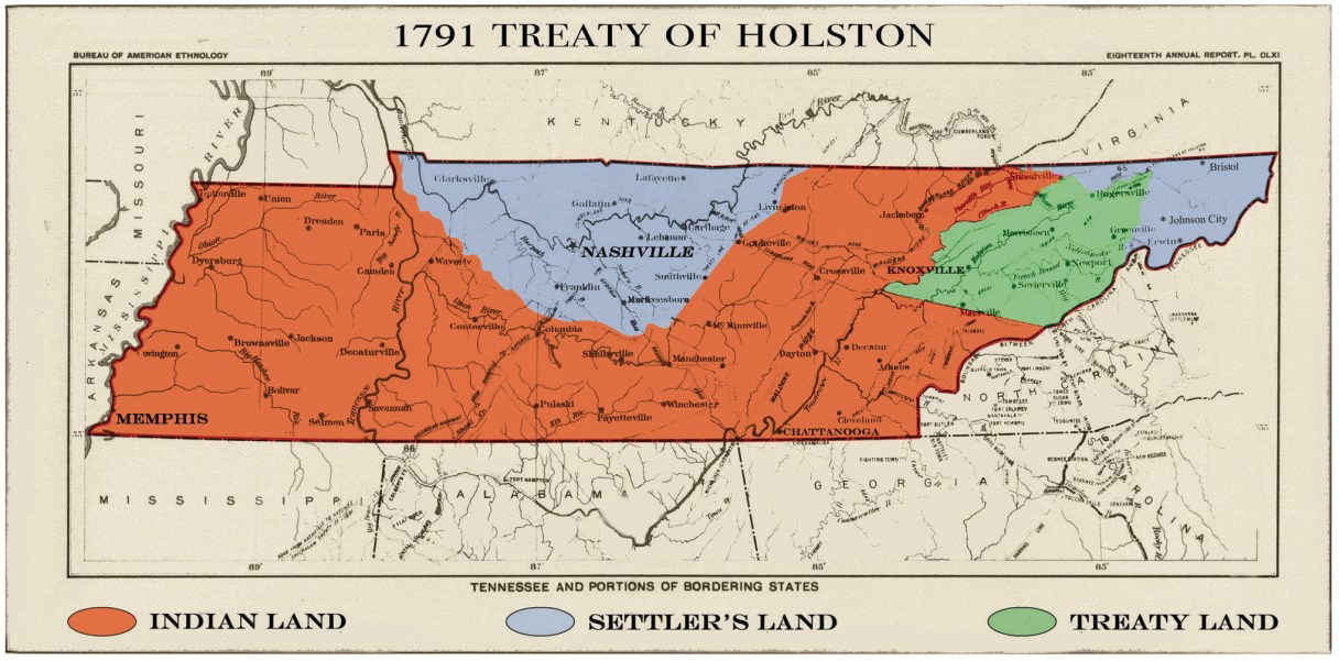
From 1790 until 1796, present-day Tennessee was known as the Southwest Territory, and about five-sixths of it was owned by Native American tribes. The Cherokee Nation still owned and controlled all of present-day East Tennessee south and east of Kingston. The Chickasaw Nation owned all of present-day West Tennessee.
As far as white settlers were concerned, Tennessee consisted of two separate pieces of land divided by the “vast wilderness” of the Cumberland Plateau.
Under the terms of the Treaty of Holston, settlers were supposed to have unlimited access to a road that connected the two areas and crossed the plateau. But there were so many acts of violence along the road that most people only traveled it with military escort. Every few months, those military escorts left Fort Southwest Point (in present-day Roane County) heading west and Fort Blount (present-day Jackson County) heading east.