LATEST UPDATE: All severe weather alerts for the greater Chattanooga region have expired.
Power outages have been reported in areas served by EPB, North Georgia E.M.C. and Sequatchie Valley Electric Coop.
___
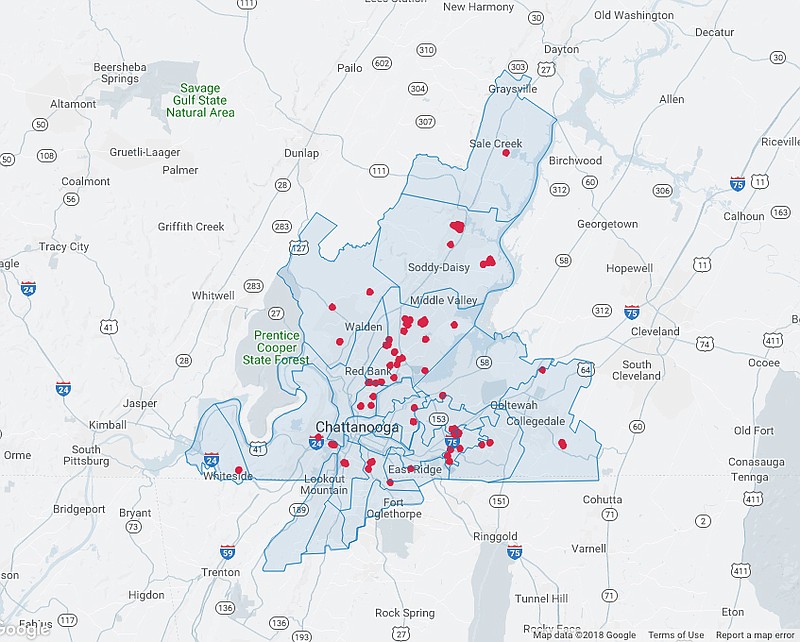
 Chattanooga area power outages reported by EPB as of 3:30 a.m. on Wednesday, April 4, 2018. (Screenshot: epb.com/outage-map)
UPDATE: Downed trees and power outages have been reported after a line of strong thunderstorms swept through the greater Chattanooga area overnight Tuesday into Wednesday morning.
A significant weather advisory has been issued until 2:45 a.m. EDT for Bradley and Polk counties in Tennessee. Half inch hail and wind gusts up to 50 mph are possible with these storms.
A severe thunderstorm warning is in effect for Bradley, McMinn and Polk counties in Tennessee until 2:30 a.m.
A severe thunderstorm watch remains in effect until 3 a.m. EDT for Bledsoe, Bradley, Hamilton, Marion, McMinn, Meigs, Polk, Rhea and Sequatchie counties in Tennessee and Catoosa, Chattooga, Dade, Gordon, Murray, Walker, Whitfield counties in Georgia.
___
ORIGINAL STORY: A severe thunderstorm watch is in effect for the Chattanooga area, according to the National Weather Service.
The watch is until 3 a.m. EDT for Bledsoe, Bradley, Grundy (2 a.m. EDT), Hamilton, Marion, McMinn, Meigs, Polk, Rhea and Sequatchie counties in Tennessee; until 3 a.m. EDT for Catoosa, Chattooga, Dade, Gordon, Murray, Walker, Whitfield counties in Georgia; and until 2 a.m. EDT for DeKalb and Jackson counties in Alabama.
A severe thunderstorm by definition is a thunderstorm that produces one inch hail or larger in diameter and/or winds equal or exceeding 58 miles an hour.