
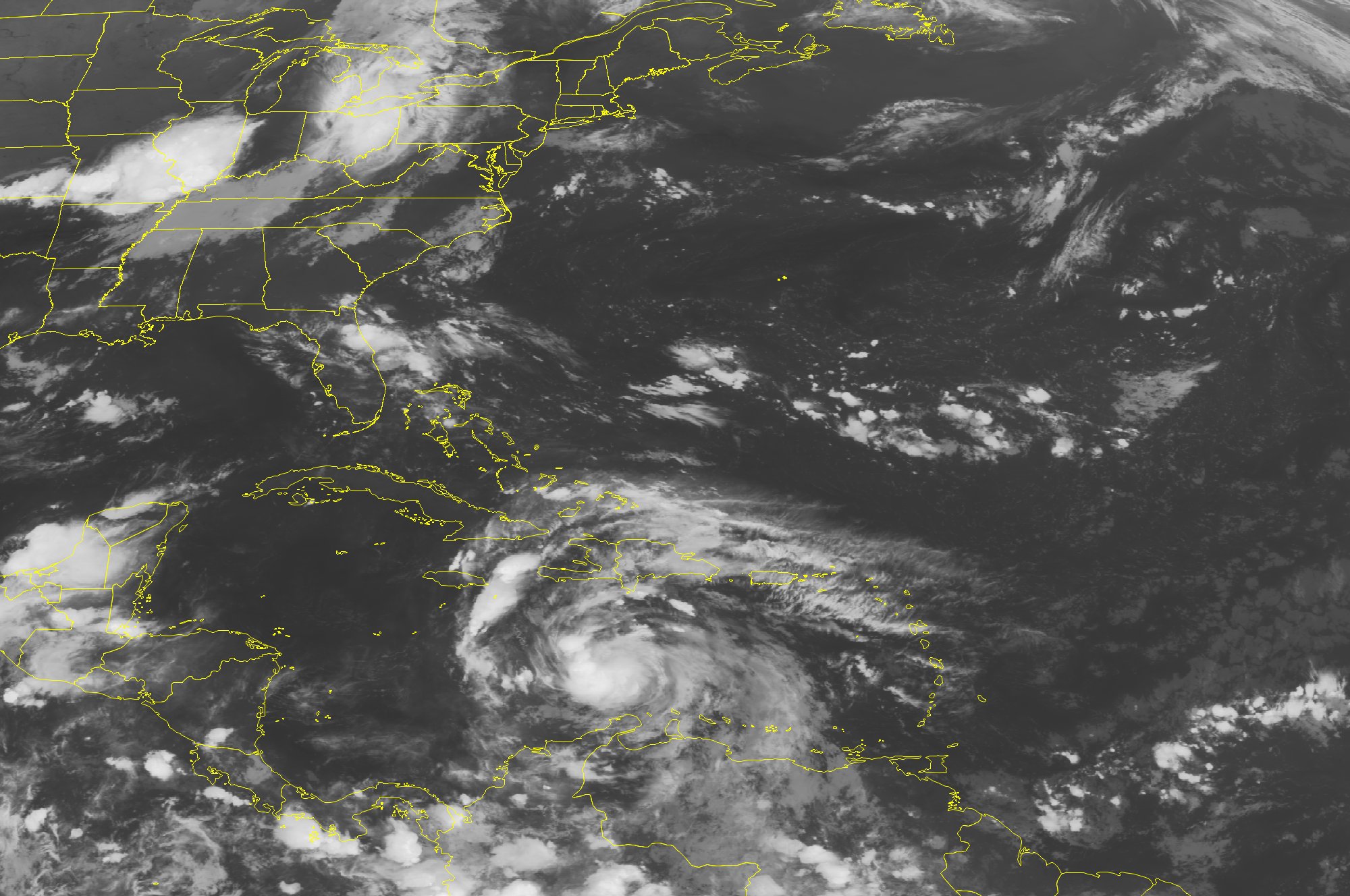
 This NOAA satellite image taken Sunday, Aug. 05, 2012 at 01:45 AM EDT shows Tropical Storm Ernesto continues moving through the Caribbean Sea. This system is now located about 290 miles southeast of Kingston, Jamaica, with maximum winds up to 60 mph. To the north, thunderstorms activity continues for the Bahamas, Florida and into the Carolinas. An area of low pressure over the region has a low chance of tropical cyclone development, but continues producing widespread showers and thunderstorms.
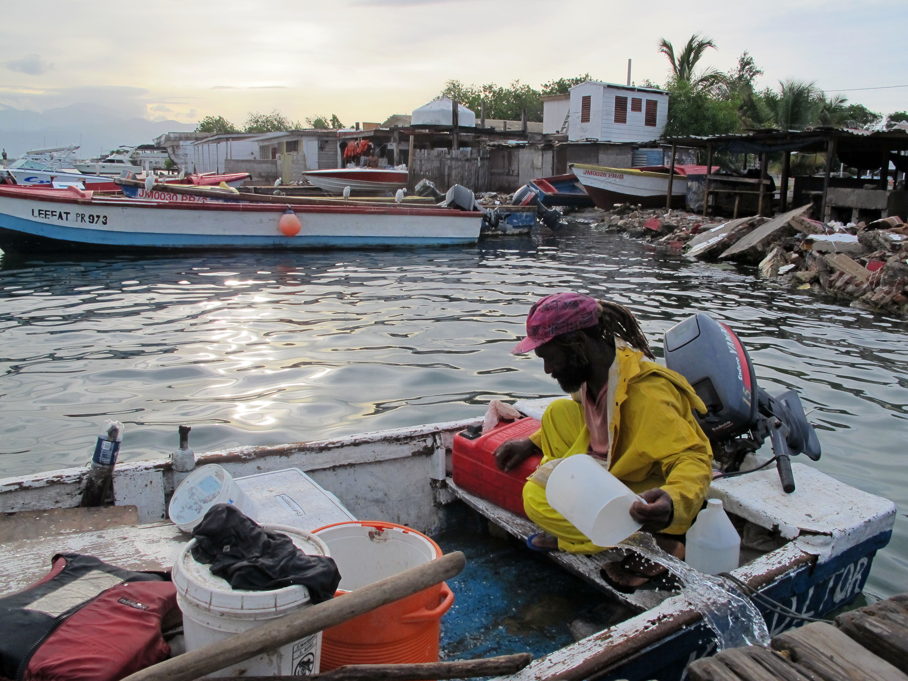 Fisherman Daniel Edwards bails his small wooden skiff out in Port Royal, a fishing village just outside of Kingston, Jamaica, Sunday Aug. 5, 2012. Tropical Storm Ernesto is pushing for a brush with Jamaica on Sunday.
PORT ROYAL, Jamaica - Tropical Storm Ernesto brushed past the Caribbean country's southern coast Sunday, causing heavy rains but few problems, as it took a path expected to carry it by Honduras and across the Yucatan Peninsula into the Gulf of Mexico.
Forecasters at Jamaica's Meteorological Service said late in the day that the rain was tapering off but light to moderate showers from squalls were still present over most of the island, especially eastern areas.
In Jamaica's southern capital of Kingston, Ernesto dumped some rain but left no noticeable damage.
Island authorities urged people in flood-prone areas to be on alert and urged fishermen on outlying cays and banks to remain in safe harbors on the main island.
As the storm's outer bands approached, Prime Minister Portia Simpson Miller called on all Jamaicans to make the necessary preparations to ensure their safety.
"I urge you to especially consider the children, the sick, persons with disabilities, the elderly, and the most vulnerable in the society," she said.
Daniel Edwards, a dreadlocked fisherman in Port Royal, a small fishing village at the tip of a spit of land near Kingston's airport, said vigorous lightning lit up the sky over the sea late Saturday and early Sunday.
Bailing out his small wooden fishing boat next to a dilapidated wooden dock, Edwards said he wasn't overly concerned by the storm.
"It's not much of a muchness," said the veteran fisherman, decked out in rain gear.
Forecasters said Ernesto could begin drenching the coast of Honduras late Monday. It is then expected to move ashore near the Belize-Mexico border Tuesday night and pass into the Gulf of Mexico.
The U.S. National Hurricane Center in Miami said Ernesto could possibly become a hurricane by late in the week while heading toward the Mexican mainland.
A tropical storm watch was in effect for the coast of Honduras, from the border with Nicaragua westward to Punta Castilla, and the main island of Grand Cayman in the Cayman Islands.
A Cayman government statement urged Grand Cayman residents to monitor the storm but said the storm was not likely to have serious effects on the British Caribbean territory.
The U.S. hurricane center said Ernesto was centered about 220 miles south-southwest of Kingston, Jamaica, late Sunday afternoon. It had maximum sustained winds near 50 mph and was moving swiftly westward at 20 mph.
Elsewhere, Tropical Storm Florence, which formed far out in the Atlantic, stopped strengthening by early Sunday and was no longer expected to gain strength, the hurricane center said.
Florence's top sustained winds had slowed to 50 mph (85 kph) by Sunday afternoon and it was 845 miles west of the Cape Verde Islands. Forecasters said a gradual weakening of the storm was expected over the next couple of days.