Arctic temperatures combined with a wintry mix that passed through the region Monday will make traveling tough Tuesday and Wednesday with little chance for improvement as a deep freeze sets in until mid-week.
As the snowfall began just before 10 a.m. in downtown Chattanooga on Monday, Southeast Tennessee officials and residents started bracing for an arctic plunge before another system bringing a mix is expected before the weekend, according to forecasters.
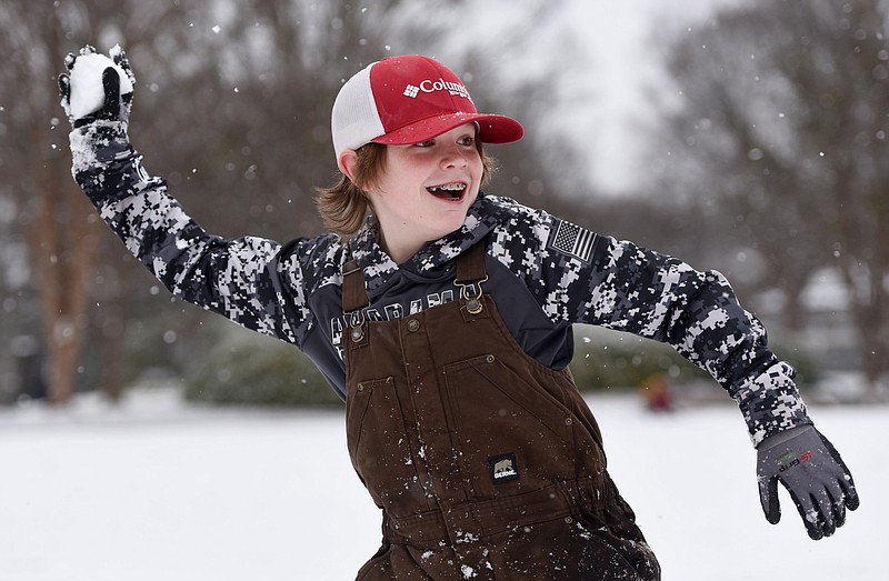
(Send us your Chattanooga area snow pictures)
"A winter storm warning is in effect for most of the Tennessee Valley, with a winter weather advisory for our far southeastern counties through Tuesday morning," Local 3 News meteorologist Cedric Haynes said Monday in his weather blog. "A winter storm warning means dangerous winter weather conditions are likely, and this will impact travel, power and could be potentially life-threatening."
Heavier precipitation throughout the day Monday, mixed with sleet and freezing rain, was widespread in Southeast Tennessee and North Georgia and was expected to accumulate between 1-3 inches with some light ice, Haynes said. Up to 5 inches accumulated Monday north and west of Chattanooga — and 1-3 inches near Chattanooga and Cleveland — and it will linger.
(READ MORE: TVA braces for coldest weather since Winter Storm Elliott forced power blackouts)
"Travel will become difficult around the region, so plan to stay home if possible," Haynes said.
"Tuesday, the snow and freezing drizzle ends early, but get ready for a brutally cold day with afternoon highs only in the 20s," he said. "This means anything that falls is not going anywhere anytime soon."
Wednesday will start with morning lows in the single digits to near zero degrees, Haynes said.
"Wind chills will be minus 10 degrees to zero degrees," he said.
Hypothermia — don't wait, take action
Warning signs of hypothermia:
— Adults: Shivering, exhaustion or feeling very tired, confusion, fumbling hands, memory loss, slurred speech, drowsiness.
— Babies: Bright red, cold skin and very low energy.
Hypothermia is a medical emergency. If you notice any of the above signs, take the person's temperature. If it is below 95 degrees, get medical attention immediately.
If you are not able to get medical help right away, try to warm the person up.
Get them into a warm room or shelter. Remove any wet clothing the person is wearing.
Warm the center of the person's body — chest, neck, head and groin — using an electric blanket if available. You can also use skin-to-skin contact under loose, dry layers of blankets, clothing, towels or sheets.
Warm drinks can help increase body temperature but do not give alcoholic drinks. Do not try to give beverages to an unconscious person.
After body temperature has increased, keep the person dry and wrap their body, including their head and neck, in a warm blanket.
Get the person proper medical attention as soon as possible.
A person with severe hypothermia may be unconscious and may not seem to have a pulse or to be breathing. In this case, handle the person gently and get emergency assistance immediately.
Perform CPR, even if the person appears dead. CPR should continue until the person responds or medical aid becomes available. Keep warming the person while performing CPR. In some cases, hypothermia victims who appear to be dead can be successfully resuscitated.
Source: Centers for Disease Control and Prevention
Schools around the region announced closures for Tuesday and Wednesday as road conditions worsened in some areas.
Hamilton County government offices and courts, the Hamilton County Health Department, Chattanooga City Courts, Chattanooga city facilities and local Social Security offices announced they'd be closed Tuesday.
Several medical offices and clinics also announced closures Tuesday, including Cempa Community Care, Signal Centers and multiple Erlanger Medical Group clinics and physician offices.
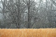
Snow along the southern Cumberland Plateau began early Monday as ice and sleet pelted downtown Chattanooga.
Fredonia Mountain west of Dunlap is about 2,200 feet above sea level, while the Sequatchie Valley floor in Dunlap is about 715 feet above sea level. One resident there said snow was falling and accumulating Monday morning, making conditions treacherous.
"We have 2-3 inches," Clinton Dixon, a Fredonia Mountain resident in Sequatchie County, said by phone Monday morning. "It's got ice under it. It's slick."
(READ MORE: 'Stay home': Chattanooga treating roads as area prepares for snow)
A video Dixon shot of Monday morning's snowfall showed it building quickly on the mountaintop's roads and trees.
The last time downtown Chattanooga got significant snow was in 2022, said Lyle Wilson, a meteorologist with the National Weather Service in Morristown, Tennessee.
"It looks like Chattanooga got an inch of snow back on March 12, 2022," Wilson said.
The remainder of the week could see small accumulations of snow, he said.
"Toward the end of the week on Thursday will be the first day it gets above freezing into the low 40s," Wilson said. "Then we will have another system coming in Thursday night, and Friday looks like there could be a little bit of light snow. Accumulations will be less than an inch if any at all."
Residents should keep up to date on the latest weather forecast in the days ahead because predictions could change, he said.
TVA prepared
Unlike the high winds that knocked out power Friday for more than 4,000 Chattanooga area EPB customers, Monday's snowfall created only a handful of power outages in the area.
But colder weather Tuesday and Wednesday will push up electricity use across the Tennessee Valley to the highest wintertime peaks since Winter Storm Elliott forced the Tennessee Valley Authority to impose rolling blackouts for most of its 10 million customers just before Christmas 2022.
TVA is projecting its peak power demand could top 32,000 megawatts both Tuesday and Wednesday for the highest winter power peak of the year. While that is still below the 33,427-megawatt peak reached during Winter Storm Elliott in December 2022, TVA officials said they are doing all they can to prepare for the cold weather and hope to avoid any power outages like those in late 2022.
Nick Austin, a TVA meteorologist who works in the utility's system operations center in downtown Chattanooga, said TVA has been tracking the Arctic storm and working to make sure the utility has adequate power resources to supply enough electricity as the cold weather pushes up power use by furnaces and other heating equipment.
"For the past 10 days or so, we've been in communication with all of our various facilities and groups across the agency to make sure that we do prepare for this cold snap and snow," Austin said in a video chat posted on TVA's webpage Monday. "We want to make sure we do all we can to keep everyone's lights on during this event."
The North American Electric Reliability Council, a nonprofit organization that works to coordinate power deliveries and limit outages, warned last year that power outages could occur this winter in Tennessee and other states because power generation is not keeping pace with the overall growth in power demand.
But TVA President Jeff Lyash said last year the utility is better positioned for the cold weather than it was during Winter Storm Elliott. TVA has added 1,500 megawatts of additional gas-fired generation in the past year at former coal plants in Alabama and Kentucky and has or will spend more than $200 million upgrading the reliability of other generators to avoid frozen lines and sensors that knocked out 6,700 megawatts of power for TVA during Winter Storm Elliott.
More than two-thirds of all households in Tennessee rely upon electricity for their primary household heating, according to the Energy Information Administration.
Visit bit.ly/EPBtips for some tips from EPB on preparing for winter weather.
Cold weather plumbing tips
— Identify freezing points: Check for pipes in areas prone to freezing, such as crawl spaces, unheated rooms, basements, garages and exterior walls.
— Know how to shut off your water: Label your water main valve so you can find it quickly in an emergency.
— Strengthen your defenses: Eliminate sources of cold air near water lines by closing off crawl spaces, fixing drafty windows, insulating walls and attics and plugging drafts around doors.
— Protect your pipes: Where pipes are exposed to cold, wrap them with insulation or heat tape — even fabric or newspaper can help.
— Give pipes a helping hand: If pipes run through cabinets or vanities, open the door to let warmer room temperatures flow in.
— Keep water working: Keep water moving through pipes by allowing a small trickle of water to run. The cost of the extra water is typically lower than the cost of repairing a broken pipe. Homeowners can capture water in a container for watering indoor plants and other uses.
— Shut off the water immediately: Don't attempt to thaw pipes without turning off the main shut-off valve.
— Thaw pipes with warm air: Melt the frozen water in the pipe by warming the air around it. Be sure not to leave space heaters unattended and avoid the use of kerosene heaters or open flames.
— Be careful turning the water back on: Once pipes are thawed, slowly turn the water back on and check pipes and joints for cracks or leaks that might have been caused by freezing.
Source: Tennessee American Water
Contact Ben Benton at bbenton@timesfreepress.com or 423-757-6569.
Staff writer Dave Flessner contributed to this story.