
After soaking rains deluged the Chattanooga region Thursday and Friday, forecasters are calling for a drying out period over the weekend leading into sunny skies next week.
(Heavy rains force road closings in the Chattanooga region)
Most of the Chattanooga area remained under a flash flood watch or warning Friday night as a series of rain storms moving through from the west pounded the region. Reports of road closures and power outages swelled and retreated across the Chattanooga area as heavy rains passed with the worst flooding appearing to have happened overnight Thursday into Friday, especially farther south and west.
WRCB TV Channel 3 meteorologist Brittany Beggs said Friday afternoon in her weather blog that flood warnings issued for Jackson County, Alabama, and Franklin County, Tennessee, on Friday came after 2 to 3 inches of rain had already fallen, with the continuing rain adding to swelling creeks, streams and rivers.
Rainfall amounts in Chattanooga had so far "been just over 2 [inches], and areas such as Scottsboro have picked up 3.8 [inches] over the last 48 hours," she said Friday.
Beggs said a river flood warning for Lookout Creek in the New England community of Dade County, Georgia, extends until 9 a.m. Saturday and the Sequatchie River near Whitwell, Tennessee, until 6 a.m. Sunday.
South Chickamauga Creek is expected to rise to minor flood stage by Saturday morning, flooding Mack Smith Road and other areas of East Ridge. Flooding also is expected in North Georgia around West Chickamauga Creek, Beggs said.
FIVE-DAY FORECAST
Saturday:40% chance of rain, some flurries at higher elevations, then clearing High: 54 | Low: 50 Sunday: Sunny High: 55 | Low: 32Monday: Sunny High: 55 | Low: 34 Tuesday: Some clouds, 30% chance of rainHigh: 53 | Low: 39Wednesday:Mostly sunny High: 51 | Low: 33 Source: WRCB TV Channel 3
U.S. Geological Survey stream data for Tennessee also showed Sewee Creek in Meigs County, Oostanaula Creek in McMinn County and the Tellico River in Monroe County nearing or at flood stage on Friday.
The Jackson County, Alabama, Emergency Management Agency by mid-afternoon Friday reported reopening a number of roads that had been temporarily closed with as much as 2 feet of water flowing over them Thursday night, particularly in the southern end of the county.
Last year was the second wettest year on record in the Tennessee Valley, following record rainfall in 2018.
TVA said Thursday that total precipitation in the Tennessee River basin was nearly 15.5 inches above normal during 2019, and included the wettest February on record when the rain-swollen river in Chattanooga rose 12 feet above its normal levels.
Darrell Guinn, manager of TVA's River Forecast center in Knoxville, told the Times Free Press earlier this week that 2020 is also starting out wetter than normal with 2-4 inches of rain expected to fall through Saturday across TVA's seven-state region.
Flood watches and warnings covered much of the South on Friday as torrential rains were flooding roads and highways and filling rivers and streams close to their banks, according to The Associated Press.
The National Weather Service said early Friday that most of the flooding advisories covered parts of Louisiana, Mississippi, Alabama, Tennessee and Georgia.
In Canton, Mississippi, at least 10 people were rescued from their homes before dawn in a neighborhood where heavy rains fell Thursday night, authorities said. Firefighters used a boat to reach people, WAPT-TV reported.
In Georgia, 3 inches of rain had fallen by early Friday in the state's northwest corner, with more expected through the evening. In metro Atlanta, standing water on freeways snarled traffic as cars and trucks slowed down to creep through it.
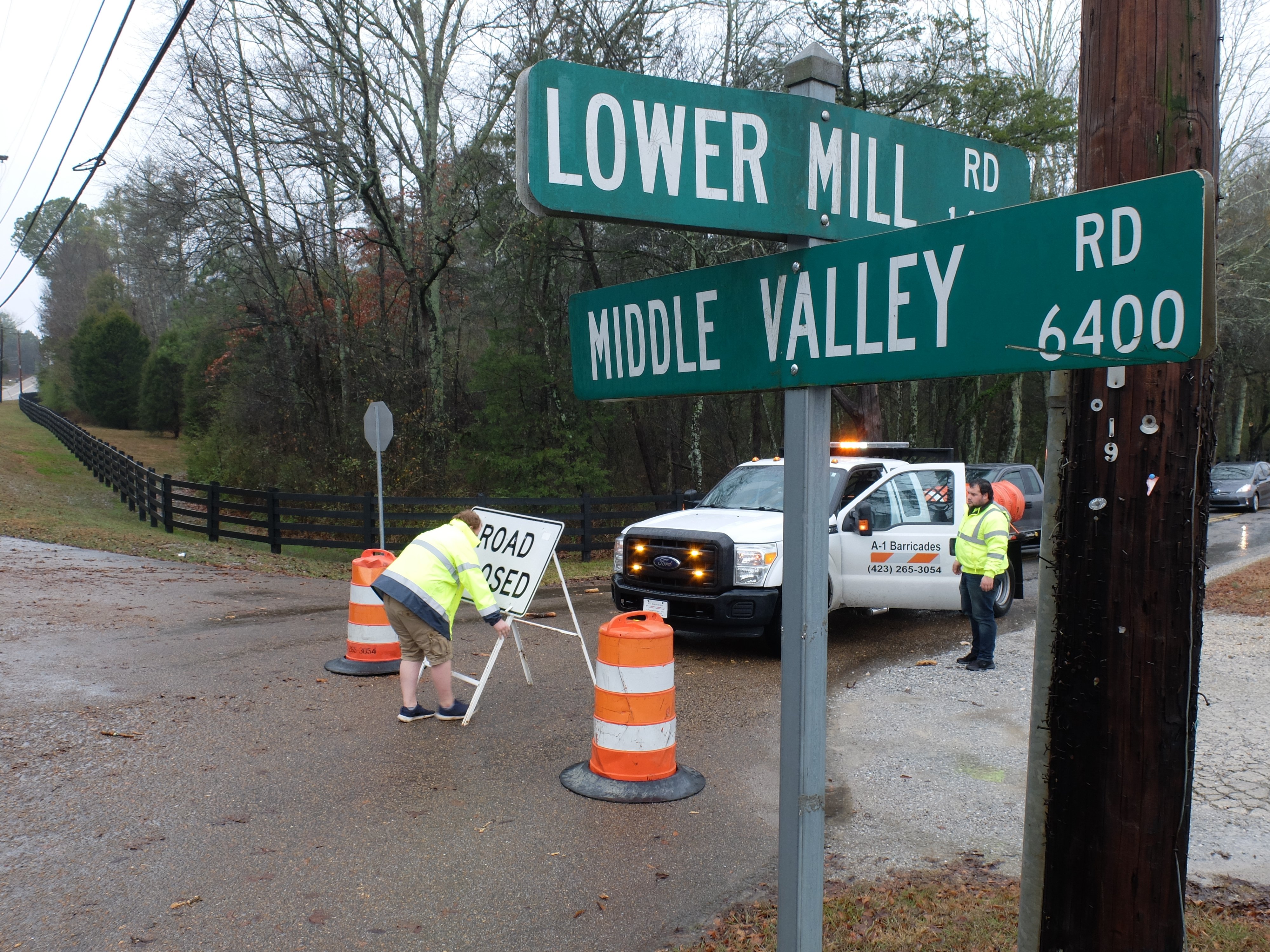 Staff photo by Tim Barber/ A rising North Chickamauga Creek dispatched James Burns, left, and Bradlee Ricketts, of A-1 Barricade in North Chattanooga, to close the 1400 block of Lower Mill Road art Middle Valley Road Friday morning, Jan. 3, 2020.
Around Chattanooga and the rest of the region, EPB through the day Friday reported scattered outages across the county, as did electric utilities in surrounding counties in Tennessee, Northeast Alabama and Northwest Georgia.
Saturday will bring a welcome change, according to WRCB chief meteorologist Paul Barys.
"The maximum temperature for Saturday will be in the early morning and in the mid 50s," Barys said in his evening weather blog.
"The temperatures will drop thoughout the day with an afternoon maximum near 50. Light showers could get mixed in with flurries especially in the higher elevations," he said. "Little if any accumulation is expected. Skies will clear off Saturday night and Sunday will be sunny with highs in the mid-50s."
Contact Ben Benton at bbenton@timesfreepress.com or 423-757-6569. Follow him on Twitter @BenBenton or at www.facebook.com/benbenton1.